Langdale Ferry Terminal
| Langdale Ferry Terminal | |||
|---|---|---|---|
| Data | |||
| Port type | Sea port / ferry port | ||
| Piers / quays | 3 | ||
| Geographic information | |||
| place | Horseshoe Bay | ||
| province | British Columbia | ||
| Country | Canada | ||
| Langdale ferry terminal | |||
| Coordinates | 49 ° 25 '59 " N , 123 ° 28' 23" W | ||
|
|||
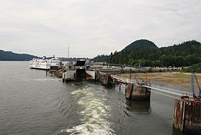
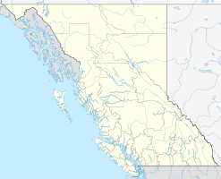
The Langdale Ferry Terminal is a ferry terminal near the small town of Gibsons in the Canadian province of British Columbia in the Sunshine Coast regional district on the west side of the Howe Sound . The tidal range here is usually between 1 and 5 meters. For the Sunshine Coast regional district, the ferry connection from here to Vancouver is the only connection to the mainland, although the district itself is on the mainland. The route of Highway 101 begins at the ferry port and leads north from here to Lund .
Of the three piers, two are for the vehicle ferries, while only the passenger ferries can moor at the third.
BC Ferries ( British Columbia Ferry Services Inc. ), as the main operator of the ferry connections on the west coast of British Columbia , operates various routes from here.
Routes
From here the following goals are approached:
- to West Vancouver via ( Horseshoe Bay )
- to Keats Island
- to Gambier Island
While vehicles are also transported on the connection to Vancouver, connections to Keats Island and Gambier Island are exclusively passenger ferries. The connections to Keats Island and Gambier Island are not operated by BC Ferries themselves, but by Kona Winds Yacht Charters Ltd.

