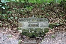
Langheim (district)
Langheim is a district in the Lichtenfels district . It lies entirely in the area of the city of Lichtenfels, is uninhabited, largely forested and consists of five non-contiguous parts of very different sizes in the south and east of the city center of Lichtenfels.
At the time of its dissolution on January 1, 1989, the former municipality-free area had an area of 1526.68 hectares . The vast majority with 1489.57 hectares was incorporated into the city of Lichtenfels , while the remaining 37.11 hectares came to the city of Bad Staffelstein . On October 1, 1966, the area of the community-free area was still 1660.23 hectares.
Territory parts
Langheim was originally divided into four disjointed parts of the area, which corresponded to the former forest districts, as can be seen from maps of the first survey. These forest districts were further subdivided into named forest departments.
District I Langheimer Wald
The "Langheimer Wald" part of the area is around eight square kilometers. In the south of this part of the area lies the FFH area "Südlicher Staatsforst Langheim" (185.50 hectares).
![]()
District II Book Ranges
The "Buchrangen" part of the area is about 3.4 square kilometers. This surface is almost completely a partial area of the FFH area "forest areas book Rangen and Spendweg" (651.11 hectare) and lies on her 42 hectares large protected area "Kitschentalrangen" .
![]()
Unnamed parcel
The smallest separate area of the district of Langheim is an east-west stretch of land stretching over 550 meters on a steep (30 meters difference in height over a distance of 100 meters) forest slope with an area of 3.3 hectares. It is completely surrounded by the Oberlangheim district. The land map of the first recording shows that this small area was originally spatially connected with District II Buchrangen and was specifically part of its forestry department 11 Probstleite . Later there was a spatial separation along the newly built road to LIF 22 by several small parcels that are now part of the Oberlangheim district.
![]()
District III donation path
The part of the area that was formerly known as (Forst-) District III Spendweg is about three square kilometers. It is located in the Franconian Switzerland - Veldensteiner Forest conservation area and is almost entirely part of the FFH area "Buchrangen and Spendweg forest areas". The neighboring markings are Lichtenfels, Mistelfeld , Roth , Oberlangheim , Grundfeld and Seubelsdorf . The Spendweg, a former road from Klosterlangheim to Vierzehnheiligen , runs through the "Spendweg" area and south along the "Prügel" area .
![]()
District IV beating
The area "Prügel" is about half a square kilometer. This is where the 366 meter high Prügelberg lies .
![]()
Individual evidence
- ↑ District. Office for Digitization, Broadband and Surveying Coburg, accessed on June 10, 2020 .
- ↑ RABl No. 17 v. December 28, 1988
- ^ Bavarian State Statistical Office: Official directory of the unincorporated areas of Bavaria. Issue 276 of the articles on Bavaria's statistics. Munich 1966, p. 27
- ↑ a b c d measured in BayernAtlas
- ↑ Untitled parcel in the BayernAtlas .
- ↑ Location and size in the BayernAtlas
- ↑ Location and size of District III Spendweg in the BayernAtlas
- ^ "Beatings" in the BayernAtlas
