Leach Nunatak
| Leach Nunatak | ||
|---|---|---|
| height | 740 m | |
| location | Marie Byrd Land , West Antarctica | |
| Mountains | Haines Mountains , Ford Ranges | |
| Coordinates | 77 ° 36 ′ 0 ″ S , 146 ° 25 ′ 0 ″ W | |
|
|
||
|
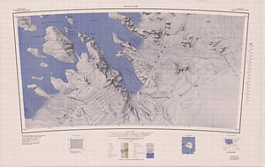
The Haines Mountains (southwest of the center of the map) with the Leach Nunatak |
||
The Leach Nunatak is a 740 m high nunatak in Marie Byrd Land in West Antarctica . In the Haines Mountains of the Ford Ranges, it rises 6 km west-southwest of Mount Ronne .
An initial mapping was made by scientists from the United States Antarctic Service Expedition (1939–1941). The United States Geological Survey mapped it based on its own measurements and aerial photographs of the United States Navy from 1959 to 1965. The Advisory Committee on Antarctic Names named it in 1970 after Edwin B. Leach, senior aircraft electronics engineer on Williams Field during Operation Deep Freeze 1967.
Web links
- Leach Nunatak in the Geographic Names Information System of the United States Geological Survey (English)
- Leach Nunatak on geographic.org (English)

