Leland (Michigan)
| Leland | ||
|---|---|---|
|
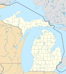
Location in Michigan
|
||
| Basic data | ||
| Foundation : | 1853 | |
| State : | United States | |
| State : | Michigan | |
| County : | Leelanau County | |
| Coordinates : | 45 ° 1 ′ N , 85 ° 46 ′ W | |
| Time zone : | Eastern ( UTC − 5 / −4 ) | |
| Residents : | 2,033 (as of: 2000) | |
| Height : | 177 m | |
| Postal code : | 49654 | |
| Area code : | +1 231 | |
| FIPS : | 26-26089 | |
| GNIS ID : | 630296 | |
| Website : | www.lelandmi.com | |
Leland is a small town ( unincorporate community ) in the US state of Michigan within the Leland Township in Leelanau County .
history
Leland was built on the area of one of the largest Ottawa villages on the Leelanau Peninsula. At the confluence of the Leland River with Lake Michigan there was a natural fishing route that was a traditional fishing spot for the Native American people.
The settlement was called Mishi-me-go-bing or Che-ma-go-bing and Chi-mak-a-ping .
The abundance of fish in the area was also beneficial to the white settlers who arrived from the 1830s. White settlement increased after Antoine Manseau built a dam and sawmill on the river in 1854 with his son Antoine Jr. and John Miller. The construction of the dam raised the water level by more than 3.5 m, and three natural lakes became a single lake, known today as Lake Leelanau (which is navigable as far as the municipality of Cedar, about 10 kilometers inland). The settlers built wooden docks that allowed steamers and schooners to carry new settlers and materials.
The city today
There are two fishing operations and a thriving charter fishing business.
Leland has three beaches, a small harbor from which ferries run daily to South and North Manitou Island , a small "Fishtown" where you can buy smoked salmon and other fresh fish products, a hotel, several restaurants, several small shops, family houses , a large sports complex, a sailing club and a golf course.
personality
- Alisha Glass (* 1988), volleyball player
