Lettenberg
| Lettenberg | ||
|---|---|---|
|
The Lettenberg with the four bunkers |
||
| height | 79 m above sea level NHN | |
| location | West Flanders , Belgium | |
| Mountains | Heuvelland | |
| Coordinates | 50 ° 46 '59 " N , 2 ° 48' 58" E | |
|
|
||
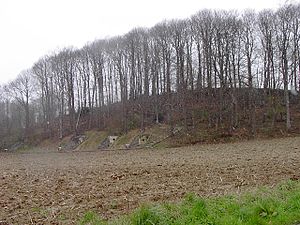
The Lettenberg or Kalvarienberg is a hill in the municipality of Heuvelland near Kemmel in the Belgian province of West Flanders . The summit is 79 m high.
geography
The Lettenberg is part of the central chain of hills, which also includes the Watenberg , Mont de Cassel , Wouwenberg , Katsberg , Boeschepeberg , Kokereelberg , Zwarteberg , Vidaigneberg , Baneberg , Rodeberg , Sulferberg , Goeberg , Monteberg and Kemmelberg . To the south of this ridge is the Leie basin , to the north the catchment area of the Yser .
bunker
On the flank you can see some restored bunkers of the British troops from the First World War . The hill was used by the British "175. Tunneling Company ”and from the beginning of April to the end of May 1917 it was equipped with underground bunkers (brigade staff, sleeping quarters and sickbay). The bunkers can be visited free of charge since 2004. An inauguration ceremony was held in 2005.
Individual evidence
- ↑ a b Omer Vandeputte: Gids Voor Vlaanderen, Lannoo Uitgeverij, 2007, p. 546 [1]
- ↑ Major Holt, Mrs. Valmai Holt: Major & Mrs Holt`s Battlefield Guide to Ypres Salient and Passchendaele, Pen and Sword, 2012, p. 220 [2]
- ↑ Peter Cuypers: Flandern, Lannoo Uitgeverij, 1989, p. 25 [3]
-
^ From bunker churches and concrete mules , welt.de , accessed on October 17, 2018
“During the same war, opposing troops erected bunkers on Lettenberg in southeastern Belgium. Here a protected military hospital of the British Army, not far from there were German bunkers from 1916. "
- ↑ Shelters Lettenberg , wo1.be
- ↑ Opening / inauguration Lettenberg bunkers - Kemmel , April 17, 2005

