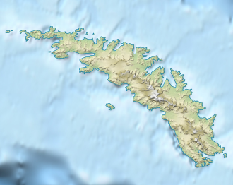
Lewis Pass (South Georgia)
| Lewis Pass | |||
|---|---|---|---|
| Compass direction | North-Northwest ( Maidalen ) |
South-Southeast ( Bore Valley ) |
|
| Pass height | 200 m | ||
| location | South Georgia , South Atlantic | ||
| map | |||
|
|
|||
| Coordinates | 54 ° 16 ′ 12 ″ S , 36 ° 30 ′ 13 ″ W | ||
The Lewis Pass is a mountain pass located about 200 m high on South Georgia . On the Thatcher Peninsula , it connects Maidalen with the Bore Valley to the south-southeast .
The UK Antarctic Place-Names Committee named it in 1991 after the British plant ecologist Ronald Ian Lewis Smith (* 1942) from the British Antarctic Survey , who carried out extensive botanical studies on South Georgia, the South Orkney Islands and the Antarctic Peninsula in numerous campaigns from the 1960s onwards performed.
Web links
- Lewis Pass in the Geographic Names Information System of the United States Geological Survey (English)
- Lewis Pass on geographic.org (English)
