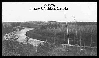
Limestone River
| Limestone River | ||
|
Lower Limestone River |
||
| Data | ||
| location | Manitoba (Canada) | |
| River system | Nelson River | |
| Drain over | Nelson River → Hudson Bay | |
| origin | Limestone Lake 56 ° 36 '33 " N , 95 ° 50' 53" W. |
|
| Source height | 188 m | |
| muzzle |
Nelson River below the Limestone Hydroelectric Power Station Coordinates: 56 ° 30 ′ 54 " N , 94 ° 7 ′ 11" W 56 ° 30 ′ 54 " N , 94 ° 7 ′ 11" W |
|
| Mouth height | 52 m | |
| Height difference | 136 m | |
| Bottom slope | approx. 0.72 ‰ | |
| length | approx. 190 km | |
| Catchment area | approx. 3330 km² | |
| Discharge at the Bird A Eo gauge : 3270 km² Location: 7 km above the mouth |
MQ 1971/2016 Mq 1971/2016 |
21.3 m³ / s 6.5 l / (s km²) |
| Left tributaries | Wasakamaw River | |
The Limestone River ( limestone English for limestone ) is an approximately 190 km long left tributary of the Nelson River in the north of the Canadian province of Manitoba .
River course
The Limestone River forms the drain of Limestone Lake . It leaves this on its north bank and flows mainly in an easterly direction. He forms numerous bends in the river and oxbow lakes . The Limestone River flows south past Little Limestone Lake . Bird station on the Hudson Bay Railway from The Pas to Churchill is on the lower reaches of the river. Shortly afterwards, 3.6 km above the estuary, the railway line crosses the Limestone River. The mouth of the Limestone River is located directly below the Limestone hydropower station on the Nelson River . Manitoba Provincial Road 290 crosses the river 900 m above the estuary .
Hydrology
The Limestone River drains an area of approximately 3,330 km². The mean discharge at the gauge 7 km above the mouth is 21.3 m³ / s. The highest monthly discharge occurs in May with an average of 63.9 m³ / s.
Web links
- Limestone River at Natural Resources Canada
Individual evidence
- ↑ a b Historical Hydrometric Data Search Results: Station 05UG001. Government of Canada
