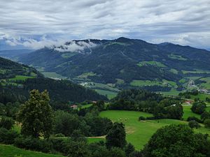
Lippekogel
| Lippekogel | ||
|---|---|---|
|
Lippekogel, seen from the northeast |
||
| height | 1079 m above sea level A. | |
| location | Carinthia , Austria | |
| Mountains | Lavanttal Alps | |
| Dominance | 5.3 km → Grabuschkopf | |
| Notch height | 553 m ↓ Launsdorf | |
| Coordinates | 46 ° 43 '55 " N , 14 ° 29' 55" E | |
|
|
||
| rock | tuff | |
The Lippekogel is 1079 m above sea level. A. high mountain near Brückl in Carinthia . The Carinthian Mariazellerweg (long-distance hiking trail 06) passes south of the summit . The Lippekogel is a popular take-off point for paragliders and hang-gliders.
Transmitter
On the Lippekogel there is an 83 meter high radio tower of the ORF for VHF and TV designed as a free-standing steel framework construction . The base of the transmission tower is at a height of 942 m above sea level. A.
Individual evidence
- ^ Fritz Peterka, Norische Region , Bergverlag Rother, 2002, page 94, ISBN 978-3-7633-4277-8 ( available online )
- ↑ Aviation Handbook Austria ( page no longer available , search in web archives ) Info: The link was automatically marked as defective. Please check the link according to the instructions and then remove this notice. . ENR 5.4 - Carinthia - 6, July 6, 2007, accessed on August 14, 2010.

