
Brueckl

|
market community Brueckl
|
||
|---|---|---|
| coat of arms | Austria map | |
 |
|
|
| Basic data | ||
| Country: | Austria | |
| State : | Carinthia | |
| Political District : | Sankt Veit an der Glan | |
| License plate : | SV | |
| Surface: | 46.68 km² | |
| Coordinates : | 46 ° 45 ' N , 14 ° 32' E | |
| Height : | 510 m above sea level A. | |
| Residents : | 2,739 (January 1, 2020) | |
| Population density : | 59 inhabitants per km² | |
| Postal code : | 9371 | |
| Area code : | 0 42 14 | |
| Community code : | 2 05 02 | |
| NUTS region | AT213 | |
| Address of the municipal administration: |
Marktplatz 1 9371 Brückl |
|
| Website: | ||
| politics | ||
| Mayor : | Burkhard Trummer ( SPÖ ) | |
|
Municipal Council : ( 2015 ) (19 members) |
||
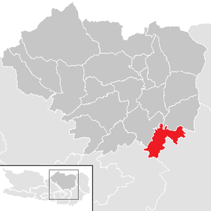
| Location of Brückl in the district of Sankt Veit an der Glan | ||
  |
||
 Brückl, seen from the Johannserberg |
||
| Source: Municipal data from Statistics Austria | ||


Brückl ( Slovenian Mostič ) is a market town with 2739 inhabitants (as of January 1, 2020) in the district of Sankt Veit an der Glan in Carinthia .
geography
The market Brückl is located at the mouth of Görtschitz in the Gurk , between Magdalensberg and Saualpe . The municipality extends to the east of the market on the Saualpe, in the south along the Gurk and on the hills of the Magdalensberg.
Community structure
The market community is divided into the five cadastral communities Brückl, Johannserberg, Labegg, Sankt Filippen and Schmieddorf. The municipality includes the following 20 localities (in brackets the traditional / historical Slovenian place names and the number of inhabitants as of January 1, 2020):
- Brückl ( Mostič ) (1554) including the Brückl hillside settlement and chlorine factory
- Christofberg ( Krištofova gora , dialectal Krištof ) (35)
- Eppersdorf (60)
- Hard ( Dobrava ) (23)
- Hausdorf (58)
- Johannserberg ( Šentjanška gora ) (46)
- Krainberg ( Strmec ) (10)
- Krobaths ( Hrovače ) (267)
- Labegg (17)
- Michaelerberg (18) including Wordianz
- Oberkrähwald ( Zgornje Hreble ) (2)
- Ox village ( Dešinje ) (108)
- Pirkach (32)
- Salchendorf ( Žalha vas ) (46)
- St. Filippen ( Šentlipš ) (302)
- St. Gregorn ( Baren ) (31)
- Ortisei am Johannserberg ( Šenturh na Šentjaški gori ) (58)
- Blacksmith Village ( Kovače ) (29)
- Selesen ( Železen ) (30)
- Tschutta ( Čuta ) (13)
Neighboring communities
| Sankt Georgen am Längsee | Eberstein | |
.svg)
|
Diex | |
| Magdalensberg | Völkermarkt |
history
Archaeological finds (weapons, statues, coins) in what is now the municipality indicate the existence of Romans, a late antique relief with four half-length portraits (double tombstone) is walled in in the rectory. The oldest written mention of the area around Brückl comes from the year 831, when Ludwig the German donated this area to the Archbishopric of Salzburg . The church of St. Lorenzen above Brückl was first mentioned in 927.
The place was called Görtschitz or Görtschach until the middle of the 16th century and was an enclave of the Diocese of Lavant and a toll station. In 1548 it was named St. Johann am Brückl after the patronage of the parish church and after a bridge over the Görtschitz , until the name was reduced to Brückl in 1915.
From the late Middle Ages, there was a hammer mill on the site of today's chain works, which processed iron ore from Hüttenberg and was converted into an iron casting works with a machine design office in 1838. The chain plant founded in 1869 was the main supplier of the k. u. k. Navy , while machine production was stopped in 1886. In the 20th century, the chemical industry also settled in Brückl.
In 1849 the political community was founded under the name St. Johann am Brückl and renamed Brückl in 1915. In 1963, Brückl was given the right to use the name Marktgemeinde .
Culture and sights

- Parish church hl. John the Baptist
- Parish Church St. Filippen Hll. Philip and James
- Parish church St. Ulrich am Johannserberg
- St. Lorenzen Church on Johannserberg
- Filial church of St. Andrew in Gretschitz am Johannserberg
- Branch church Christofberg
- Branch church "14 Nothelfer" in Selesen
- Eppersdorf Castle

Filial church of St. Andrew in Gretschitz am Johannserberg

Filial church Sankt Lorenzen am Johannserberg

Kulnighof on Christofberg

Station building


Economy and Infrastructure
In Brückl there are two larger industrial companies: the Brückl chain plant and Donau Chemie . There are 639 jobs (2001) and 113 farms (1999) in the municipality.
The contaminated site "Kalkdeponie Brückl I / II", a former plant landfill of Donau Chemie , has been located since 1926 , in which approx. 230,000 m³ from chlorinated hydrocarbons (CHC) in the community. As part of the attempted soil rehabilitation of the site, the so-called HCB scandal in the Görtschitztal occurred with the thermal disposal of the material in the Wietersdorfer Group's w & p cement plant . The landfill has been sealed since 2017.
The traffic connection from Brückl is via the state roads Seeberg Straße (B 82) and Görtschitztal-Straße (B 92). The railway connection from Launsdorf to the Görtschitztal ( Görtschitztalbahn ) is only used for freight traffic.
politics
The municipal council consists of 19 members and has been composed as follows since the municipal council election in 2015 :
In 2015, Burkhard Trummer ( SPÖ ) was directly elected mayor after a runoff election.
coat of arms
The official blazon of the municipal coat of arms reads: “Split shield, split above. Above in front a green three-mountain in silver, behind in red between silver diagonal bars two right arms stretched out against each other, brightly armored, with bare hands closed together. Below in silver two blue wavy ribbons, covered by a black gear. "
The Dreiberg alludes to the three mountains that determine the landscape: Granikogel ( 892 m ) in the north, Grabuschgupf ( 1221 m ) in the east and Lippekogel ( 1079 m ) in the south. The field with the two armored arms stands for the Counts Christalnigg, who had lived in Brückl since the 15th century and who were later responsible for the local iron processing. In the lower half of the shield, the cog wheel represents the water power that has been used by the hammer mills since the late Middle Ages, the two wave beams symbolize the Gurk and Görtschitz rivers.
The municipality's coat of arms and flag were awarded on September 2, 1963. The flag is green-white-blue with an incorporated coat of arms.
Web links
- Market town of Brückl
- 20502 - Brückl. Community data, Statistics Austria .
Individual evidence
- ↑ Paul Zdovc: Slovenska krajevna imena na Koroškem avstrijskem, razširjena izdaja. The Slovenian place names in Carinthia (published by: Slovenska akademija znanosti in umetnosti, Razred za filološke in literarne vede, Razprave / Dissertationes 21), Ljubljana 2010. ISSN 0560-2920
- ↑ Statistics Austria: Population on January 1st, 2020 by locality (area status on January 1st, 2020) , ( CSV )
- ↑ The Brückl blue lime landfill is being renovated. In: kaernten.orf.at. March 28, 2017. Retrieved October 22, 2017 .
- ↑ Results of the 2015 municipal council elections, Office of the Carinthian Provincial Government ( Memento of the original from April 2, 2015 in the Internet Archive ) Info: The archive link was inserted automatically and has not yet been checked. Please check the original and archive link according to the instructions and then remove this notice. , accessed March 17, 2015
- ↑ Results of the Mayor's direct election 2015, Office of the Carinthian Provincial Government ( Memento of the original from April 2, 2015 in the Internet Archive ) Info: The archive link was inserted automatically and has not yet been checked. Please check the original and archive link according to the instructions and then remove this notice. , accessed March 17, 2015
- ^ Quoted from Wilhelm Deuer: The Carinthian municipal coat of arms . Verlag des Kärntner Landesarchivs, Klagenfurt 2006, ISBN 3-900531-64-1 , p. 64
Althofen | Brückl | German handles | Eberstein | Frauenstein | Friesach | Glödnitz | Cucumber | Guttaring | Hüttenberg | Kappel am Krappfeld | Little Saint Paul | Liebenfels | Metnitz | Micheldorf | Mölbling | Sankt Georgen am Längsee | Sankt Veit an der Glan | Strasbourg | Weitensfeld in the Gurktal