
Metnitz
|
market community Metnitz
|
||
|---|---|---|
| coat of arms | Austria map | |
 |
|
|
| Basic data | ||
| Country: | Austria | |
| State : | Carinthia | |
| Political District : | Sankt Veit an der Glan | |
| License plate : | SV | |
| Surface: | 223.26 km² | |
| Coordinates : | 46 ° 59 ' N , 14 ° 13' E | |
| Height : | 851 m above sea level A. | |
| Residents : | 1,953 (January 1, 2020) | |
| Population density : | 8.7 inhabitants per km² | |
| Postal code : | 9363 | |
| Area code : | 0 42 67 | |
| Community code : | 2 05 18 | |
| NUTS region | AT213 | |
| Address of the municipal administration: |
Marktplatz 4 9363 Metnitz |
|
| Website: | ||
| politics | ||
| Mayor : | Anton Engl-Wurzer ( ÖVP ) | |
|
Municipal Council : ( 2015 ) (19 members) |
||
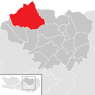
| Location of Metnitz in the district of Sankt Veit an der Glan | ||
  |
||
| Source: Municipal data from Statistics Austria | ||


Metnitz is an Austrian market town with 1953 inhabitants (as of January 1, 2020) in the district of Sankt Veit an der Glan in the state of Carinthia .
geography
Geographical location
The municipality is located in the north of Carinthia and includes most of the Metnitztal and the adjacent mountains up to the main ridge (at Laßnitz a little further): in the north the Metnitzer Berge , in the south the Mödringbergzug . Both are parts of the Gurktal Alps . The main settlement area is the Metnitztal with the river of the same name .
In the far north, the two source rivers of the Lassnitzbach , the Priewaldbach and the Auenbach, form the border between Carinthia and Styria.
The community borders in the north on the Styrian communities Murau , Sankt Georgen am Kreischberg and Stadl-Predlitz . The neighboring communities in Carinthia are, clockwise from the east, Friesach , Strasbourg , Weitensfeld im Gurktal and Glödnitz .
Community structure
The municipality's cadastral communities are Feistritz , Grades , Metnitz Land and Metnitz Markt .
The municipality consists of 22 localities (population in brackets as of January 1, 2020):
- Floodplains (9)
- Feistritz (128)
- Felfernigthal (0)
- Grades (305) including Niedermarkt
- Klachl (86)
- Lassnitz (65)
- Maria Höfl (11)
- Marienheim (20)
- Metnitz (511)
- Mödring (54)
- Upper Alps (11)
- Oberhof shady side (64)
- Oberhof sunny side (106)
- Preining (68)
- Schnatten (23)
- Schwarzenbach (53)
- Teichl (169)
- Unteralpe (61)
- Vellach (105)
- Woebring (63)
- Zanitzberg (18)
- Zwatzhof (23)
At times, the village of Untere Klachl (scattered settlement in the cadastral community of Metnitz Land; 1961: 3 houses, 20 residents), which has since been dissolved.
history
The wooded mountain area was settled relatively late. The upper Metnitztal was donated to the diocese of Gurk by Archbishop Gebhard von Salzburg in 1072 . The village of Feistritz was settled in the 11th century. The offices of Feistritz and Metnitz were established by Gurk for administration. In 1346 Grades received market rights, in 1599 Metnitz.
In the first half of the 19th century, the area of today's Metnitz municipality belonged to the Grades tax district . In the course of the administrative reforms after the revolution of 1848/49, the municipality of Grades was established in 1851 from the tax communities of Grades and Feistritz and the local community of Metnitz from the tax communities of Metnitz Markt and Metnitz Land.
Since the inhabitants of the western part of the municipality of Grades had to travel through the town of Metnitz to get to their own municipality capital Grades, there were considerations at the beginning of the 20th century to change the municipality boundaries. In 1911, a commission was set up to examine the proposal to connect a small part of the municipality of Metnitz (part of the village of Klachl ) to the municipality of Grades and at the same time the western part of the municipality of Grades (almost half of the area of the municipality at that time, with the localities Oberhof Schattseite , Mödring , Vellach ) to the municipality of Metnitz. In the course of this, consideration was also given to splitting an enlarged community of Metnitz into a market and a rural community. However, these suggestions were not implemented. Finally, in 1915, the municipality of Grades ceded part of its municipality (around 1300 hectares with the village of Zienitzen) to the then neighboring municipality of St. Salvator (now part of the municipality of Friesach ).
In 1966 there was a small exchange of territory between the municipalities of Grades and Metnitz: the municipality of Metnitz received around 1 hectare of space (near the recreational pool) and ceded around 9 hectares (in the area northeast of Marienheim) to the municipality of Grades. In 1973 the municipalities of Metnitz and Grades were merged to form the current municipality of Metnitz. At the same time, the municipality of Metnitz ceded the Flattnitz area to the then newly founded municipality of Weitensfeld-Flattnitz ; that area now belongs to the municipality of Glödnitz due to the division of the community Weitensfeld-Flattnitz .
From 1850 the entire area of today's municipality of Metnitz belonged to the political district of Sankt Veit an der Glan and the judicial district of Friesach . From 1854 to 1868 the area belonged to the mixed district of Friesach . In 1868 it became the political district of Sankt Veit an der Glan, to which the municipality still belongs to this day. As for the jurisdiction, she came to the judicial district of Friesach in 1868; since its dissolution in 1978 it has belonged to the judicial district of Sankt Veit an der Glan .
population
In 2011 the proportion of foreigners was 1.6% of the resident population, of which around 80% came from EU countries.
The community has had a very negative migration balance for decades .
population
The following population figures relate to today's area of the municipality of Metnitz; in brackets is the portion contained therein, which before 1973 was attributable to the then Metnitz municipality within its respective historical limits:
- 1869: 3,639 inhabitants (2,162)
- 1880: 3,543 inhabitants (2,143)
- 1890: 3,530 inhabitants (2,088)
- 1900: 3,410 inhabitants (2,076)
- 1910: 3,448 inhabitants (2,049)
- 1923: 3,339 inhabitants (2,024)
- 1934: 3,802 inhabitants (2,224)
- 1946: 3,615 inhabitants (1,987)
- 1951: 3,713 inhabitants (2,143)
- 1961: 3,259 inhabitants (1,918)
- 1971: 3,063 inhabitants (1,877)
- 1981: 2,845 inhabitants
- 1991: 2,711 inhabitants
- 2001: 2,450 inhabitants
- 2011: 2,114 inhabitants
- 2018: 2,011 inhabitants
Counting district
The Statistics Austria leads for the municipality Metnitz two Zählsprengel: The Zählsprengel degree covers the area of the former municipality level (2019: 750 inhabitants); the Metnitz counting district covers the area of the former municipality of Metnitz (before the unification with Grades; 2019: 1226 inhabitants).
Culture and sights


- Parish church of St. Leonhard in Metnitz
- Carnivores in Metnitz
- Pilgrimage church of St. Wolfgang ob Grades
- Castle of Grades
- Dance of Death Museum
- Customs museum
- Parish church hl. Nicholas in Oberhof Schattseite
- Maria Höfl branch church
Others
Metnitz has a privileged rifle corps, a vigilante group , to which Maria Theresa granted the right to wear uniforms in 1744.
Economy and Infrastructure
Economically, the community is characterized by small businesses and agriculture and forestry. In 1999 there were 104 full-time farmers and 144 part-time farmers as well as 6 legal entities that farmed 14,440 hectares of land. 596 people in employment were out-commuters in 2001.
In terms of traffic, the community is accessed from the L62 state road, which leads west from Friesach through the Metnitztal to Flattnitz . About 1 km west of Metnitz, the L62a (Wöbringer Straße) branches off into the Wöbring. This continues to Auen, on the Carinthian-Styrian border. The L62b (Gradeser Straße) branches off from the L62 at Zwatzhof, opens up Grades and joins the L62 again on the eastern outskirts of Metnitz (Teichlmühle). The L62c (Prekova-Straße) branches off from the L62 at Marienheim and leads over the Prekova to Strasbourg in the Gurktal. In addition, there is the L61 (Laßnitzer Strasse) in the municipality as a Carinthian section of the Styrian L502 ( Sankt-Lambrecht- Strasse). This L61 is only around 1.3 km long (starting at the border below the vlg. Santner homestead, continuing through the village of Kärntnerisch Laßnitz and ending at the Mitterbrücke between Kärntnerisch and Styrian Laßnitz).
politics
City council and mayor
The municipal council consists of 19 members and has been composed as follows since the municipal council election in 2015 :
The directly elected mayor is Anton Engl-Wurzer (ÖVP).
coat of arms
In the coat of arms of Metnitz “a silver swan is shown in red, striding to the right on a black, silver-clad rock” . It is based on a market seal from the time of Maria Theresa (trade tax list of March 9, 1751); There are no reliable findings for the interpretation of this motif. The coat of arms confirmation and flag award certificate were issued to the market town of Metnitz on August 23, 1967. The flag is red-white-black with an incorporated coat of arms.
Town twinning
Sons and daughters of the church
- Ingo Mörth (* 1949), sociologist
- Maria Stromberger (1898–1957), resistance fighter during the Nazi era
Web links
- Market town of Metnitz
- 20518 - Metnitz. Community data, Statistics Austria .
Individual evidence
- ↑ Statistics Austria: Population on January 1st, 2020 by locality (area status on January 1st, 2020) , ( CSV )
- ^ Austrian Central Statistical Office: Directory of Austria. Edited on the basis of the results of the census of March 21, 1961. Österreichische Staatsdruckerei, 1965. p. 254.
- ^ Metnitz - municipality separation. In: Kärntner Zeitung / Kärntner Tagblatt , April 8, 1911, p. 4 (online at ANNO ).
- ^ Statistics Austria, A look at the municipality of Metnitz. Retrieved January 23, 2019 .
- ↑ The population figure given relates to the sum of the municipalities of Grades (minus the village of Zienitzen) and Metnitz. Before 1973 the numbers included the place Flattnitz, which has not belonged to the municipality since then, but at that time only had a maximum single-digit population.
- ↑ KAGIS, Carinthia Atlas 3.0, traffic , accessed on 17 September 2012
- ^ State roads in Carinthia , accessed on September 17, 2012
- ↑ Office of the Carinthian Provincial Government ( Memento of the original from May 25, 2015 in the Internet Archive ) Info: The archive link was inserted automatically and has not yet been checked. Please check the original and archive link according to the instructions and then remove this notice.
- ↑ Office of the Carinthian Provincial Government ( Memento of the original from November 18, 2015 in the Internet Archive ) Info: The archive link was automatically inserted and not yet checked. Please check the original and archive link according to the instructions and then remove this notice.
Althofen | Brückl | German handles | Eberstein | Frauenstein | Friesach | Glödnitz | Cucumber | Guttaring | Hüttenberg | Kappel am Krappfeld | Little Saint Paul | Liebenfels | Metnitz | Micheldorf | Mölbling | Sankt Georgen am Längsee | Sankt Veit an der Glan | Strasbourg | Weitensfeld in the Gurktal
Cadastral communities: Feistritz | Degree | Metnitz Land | Metnitz market
Localities: Auen | Feistritz | Felfernigthal | Degree | Klachl | Lassnitz | Maria Höfl | Marienheim | Metnitz | Mödring | Oberalpe | Oberhof shady side | Oberhof Sonnseite | Preining | Schnatten | Schwarzenbach | Teichl | Unteralpe | Vellach | Wöbring | Zanitzberg | Zwatzhof
formerly managed localities: Grades Castle | Lower Klachl
(Former) parts of the village: Bach | Hinterort | Chicken pit | Niedermarkt | Oberort (Feistritz) | Oberort (Vellach) | Rötting | Sauwinkel | Schachmannthal | Downside (Feistritz) | Downside (Mödring) | Downside (Schnatten) | Downside (Vellach) | Sonnseite (Feistritz) | Sonnseite (Mödring) | Sunny side (Schnatten) | Sonnseite (Vellach) |
Counting area: Grades | Metnitz
former municipality: municipality of Grades