
Metnitz Land cadastral community
| Metnitz Land ( cadastral community ) | |||
|---|---|---|---|
|
|||
| Basic data | |||
| Pole. District , state | Sankt Veit an der Glan , Carinthia | ||
| Judicial district | Sankt Veit an der Glan | ||
| Pole. local community | Metnitz | ||
| Coordinates (K) | 47 ° 0 '27 " N , 14 ° 8' 55" E | ||
| Area d. KG | 145.83 km² | ||
| Statistical identification | |||
| Cadastral parish number | 74306 | ||
| Source: STAT : index of places ; BEV : GEONAM ; KAGIS ;
(K) Coordinate not official
|
|||

The cadastral community Metnitz Land (originally: Metnitzthal ) is one of four cadastral communities in the market town of Metnitz in the district of Sankt Veit an der Glan in Carinthia . It has an area of 14,582.91 hectares.
The cadastral community belongs to the district of the Klagenfurt land surveying office.
location
The cadastral community is located in the extreme northwest of the political district of Sankt Veit an der Glan, in the upper Metnitztal. It forms the northern part of the municipality of Metnitz, and with the exception of the small cadastral municipality of Metnitz Markt around the main town of the municipality , it encompasses the entire municipality to the left (or north) of the Metnitzbach. The cadastral community extends over an altitude of 722 meters on the Metnitzbach up to 2120 meters on the ridge of the Metnitz Mountains on the border with Styria .
Localities
The localities Auen , Felfernigthal , Klachl , Laßnitz , Oberalpe , Oberhof Sonnseite , Preining , Schwarzenbach , Teichl , Unteralpe , Wöbring and Zanitzberg are all located in the area of the Metnitz Land cadastral community .
The localities Zwatzhof (partly in the cadastral community of Grades ) and Marienheim (mostly in the cadastral community of Feistritz ) are only partially in the area of the cadastral community Metnitz Land .
At times, the village of Untere Klachl (scattered settlement in the cadastral community of Metnitz Land; 1961: 3 houses, 20 residents), which has since been dissolved.
Surveying office district
The cadastral municipality has belonged to the district of the Klagenfurt land surveying office since January 1st, 1998. Before that, she was part of the district of the St. Veit an der Glan land surveying office.
history
At the end of the 18th century, the Carinthian tax communities (later: cadastral communities) were formed and assigned to tax districts. The Metnitzthal tax community became part of the Grades tax district .
In the course of the reforms after the revolution of 1848/49, the tax districts were dissolved and the possibility was created for several cadastral communities to merge into one local community. Thus, from the amalgamation of the cadastral communities of Markt Metnitz and Metnitzthal (or rural community of Metnitz , soon to be Metnitz Land ), the new local community of Metnitz was created. The size of the cadastral community Metnitz Land was given in 1854 as 26,083 Austrian yokes and 11 fathoms (approx. 15,008 ha). In 1854 the cadastral community had 1610 inhabitants, in 1865 it was 1808.
The cadastral community of Metnitz Land belonged to the political district of Sankt Veit an der Glan and the judicial district of Friesach from 1850 . From 1854 to 1868 it belonged to the mixed district of Friesach . In 1868 she came to the political district of Sankt Veit an der Glan, to which she still belongs today. As for the jurisdiction, she came to the judicial district of Friesach in 1868; since its dissolution in 1978 it has belonged to the judicial district of Sankt Veit an der Glan .
In 1966, in the course of an area swap between the municipalities of Metnitz and Grades, properties totaling around 9 hectares were transferred from the cadastral municipality of Metnitz Land to the cadastral municipality of Feistritz (municipality of Metnitz) . In 1991 the area of the cadastral municipality was given as 14,578.25 hectares.
In 1973 the communities of Grades and Metnitz merged to form today's market town of Metnitz. At the same time, the Metnitz community ceded the Flattnitz area from the Metnitz Land cadastral community to the then newly founded community of Weitensfeld-Flattnitz ; that area now belongs to the municipality of Glödnitz due to the division of the community Weitensfeld-Flattnitz .
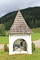
Feltrinellikreuz, Oberhof Sonnseite

House in Unteralpe


Individual evidence
- ^ Austrian Central Statistical Office: Directory of Austria. Edited on the basis of the results of the census of March 21, 1961. Österreichische Staatsdruckerei, 1965. p. 254.
- ↑ State Law and Ordinance Gazette for the Duchy of Carinthia, year 1865. p. 17.
- ↑ Austrian Central Statistical Office: Ortverzeichnis 1991, Volume 2. Österreichische Staatsdruckerei, 1993. S. 159.

Cadastral communities: Feistritz | Degree | Metnitz Land | Metnitz market
Localities: Auen | Feistritz | Felfernigthal | Degree | Klachl | Lassnitz | Maria Höfl | Marienheim | Metnitz | Mödring | Oberalpe | Oberhof shady side | Oberhof Sonnseite | Preining | Schnatten | Schwarzenbach | Teichl | Unteralpe | Vellach | Wöbring | Zanitzberg | Zwatzhof
formerly managed localities: Grades Castle | Lower Klachl
(Former) parts of the village: Bach | Hinterort | Chicken pit | Niedermarkt | Oberort (Feistritz) | Oberort (Vellach) | Rötting | Sauwinkel | Schachmannthal | Downside (Feistritz) | Downside (Mödring) | Downside (Schnatten) | Downside (Vellach) | Sonnseite (Feistritz) | Sonnseite (Mödring) | Sunny side (Schnatten) | Sonnseite (Vellach) |
Counting area: Grades | Metnitz
former municipality: municipality of Grades