List of architectural monuments in Nörten-Hardenberg
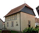
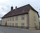
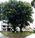
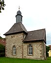
In the list of architectural monuments in Nörten-Hardenberg , all listed buildings of the Lower Saxony municipality of Nörten-Hardenberg ( district of Northeim ) are listed. The list is as of 2002.
General
Nörten-Hardenberg is mentioned for the first time in the founding document of the St. Peter's Foundation in 1055.
The columns contain the following information:
- Location: the address of the monument and the geographical coordinates . Map view to set coordinates . In the map view, monuments without coordinates are shown with a red marker and can be set on the map. Architectural monuments without a picture are marked with a blue marker, architectural monuments with a picture with a green marker.
- Official name: Name of the monument
- Description: the description of the monument. Under § 3 (2) NDSchG individual monuments and under § 3 (3) NDSchG groups of structures and their components are shown.
- ID: the number of the monument
- Image: a picture of the monument
Angerstein
| location | designation | description |
ID |
image |
|---|---|---|---|---|
| Alte Straße 2 51 ° 37 ′ 0 ″ N, 9 ° 56 ′ 7 ″ E |
Farm buildings | |||
| Bachstrasse 3/5 51 ° 37 ′ 1 ″ N, 9 ° 56 ′ 7 ″ E |
Duplex house | |||
| Kirchstrasse 51 ° 37 ′ 3 ″ N, 9 ° 56 ′ 2 ″ E |
church | The church in the middle of the village was built in 1787. |

|
Bishausen
| location | designation | description |
ID |
image |
|---|---|---|---|---|
| Bevertalstrasse 51 ° 37 ′ 58 ″ N, 9 ° 57 ′ 57 ″ E |
chapel | The chapel was built in 1883 according to plans by the consistorial builder Conrad Wilhelm Hase from 1867. The actual building was changed, so a tower with a pointed helmet was added. |

|
|
| Feldtorstrasse 5 51 ° 37 ′ 57 ″ N, 9 ° 57 ′ 48 ″ E |
Residential building | The residential building was built around 1800. It is a two-story, eaves-standing half-timbered house with a half-hipped roof. |
|
|
| County road K 415 51 ° 38 ′ 13 ″ N, 9 ° 59 ′ 37 ″ E |
Vorwerk St. Margarethe | The Vorwerk is located about two kilometers northeast of Bishausen. The Vorwerk was built in the second half of the 16th century. In the area of the Vorwerk was probably what is now the desert town of Oishausen. The house and the barn were built in the 18th century. |

|
|
| for the high cross |
Stone cross | The stone cross comes from the Middle Ages |

|
Elvese
| location | designation | description |
ID |
image |
|---|---|---|---|---|
| Großenroder Straße 51 ° 39 ′ 47 ″ N, 9 ° 56 ′ 42 ″ E |
chapel | The core of the chapel was built at the end of the 12th or beginning of the 13th century. It is a rectangular building with a hipped roof. The chapel has no tower. |

|
Lütgenrode
| location | designation | description |
ID |
image |
|---|---|---|---|---|
| Obere Dorfstrasse 51 ° 37 ′ 54 ″ N, 9 ° 54 ′ 31 ″ E |
chapel |

|
||
| Lower Dorfstrasse 2 51 ° 37 ′ 51 ″ N, 9 ° 54 ′ 43 ″ E |
Farm buildings | |||
| Untere Dorfstraße 8 |
Farm buildings |
Norten-Hardenberg
| location | designation | description |
ID |
image |
|---|---|---|---|---|
| Altes Dorf 1a |
Residential building | |||
| 1-25 at the churchyard |
Residential houses | |||
| At the waiting tower 51 ° 38 ′ 4 ″ N, 9 ° 57 ′ 16 ″ E |
Hardenbergwarte | The tower was built in 1842 as a lookout tower. |

|
|
| Castle Hill 51 ° 37 ′ 48 ″ N, 9 ° 56 ′ 56 ″ E |
Hardenberg castle ruins | The castle was built towards the end of the 11th century. |

|
|
| Burgstrasse |
Waterworks |

|
||
| Burgstraße 9 |
Residential building | Former court and prison building of the patrimonial court in the rear building. Exposed, silted quarry stone building with ashlar structure, built in the middle of the 18th century |

|
|
| Göttinger Strasse 9 51 ° 37 ′ 48 ″ N, 9 ° 56 ′ 13 ″ E |
Protestant church |

|
||
| Göttinger Straße 25 |
Residential building | |||
| Göttinger Strasse 75 51 ° 37 ′ 47 ″ N, 9 ° 56 ′ 11 ″ E |
former orphanage | The former orphanage was built in 1732. The organ in the chapel was restored in 1974 by Martin Haspelmath . |

|
|
| Good secret annexe | ||||
| 51 ° 38 ′ 3 "N, 9 ° 56 ′ 41" E | Good front building |

|
||
| Lange Straße 29-40 |
Residential houses | |||
| Lange Straße 106-114 |
Residential houses | |||
| Marienstein |
Monastery property |

|
||
| Markt 6 51 ° 38 ′ 5 ″ N, 9 ° 56 ′ 20 ″ E |
Residential building | |||
| Markt 7 51 ° 38 ′ 5 ″ N, 9 ° 56 ′ 20 ″ E |
Residential building | |||
| Stiftsplatz 51 ° 38 ′ 4 ″ N, 9 ° 56 ′ 13 ″ E |
Collegiate Church of St. Martini | After the previous building was demolished in 1894, the new building was built. |

|
|
| Stiftsplatz 51 ° 38 ′ 1 ″ N, 9 ° 56 ′ 12 ″ E |
Wayside shrine | The sandstone wayside shrine was erected in 1698 by the master sculptor Andreas Georg Kersten from Duderstadt. It is about 3.70 meters high and carved out of sandstone. Saint Paul, Saint Peter, Saint Martin and the crucifixion are shown in relief in the lantern. The shaft below is also designed on all sides with fruit pendants and framed medallions with donor inscriptions and ends below the lantern with a capital with an egg stick on the upper edge, |

|
|
| Stiftsplatz 1-10 |
Residential houses |
Parents
| location | designation | description |
ID |
image |
|---|---|---|---|---|
| Bovender Straße 1 |
Farm buildings | |||
| Hauptstraße 1 |
Estate | Three-sided estate with opening to the street. Tenant house built in 1848 with extension in 1921, half-timbered barn built in 1738 in Moringen (relocated 1750), farm building made of sandstone blocks with the inscription "1868" |

|
|
| Hauptstraße 5 |
Farm buildings | |||
| Hauptstrasse 7 |
Residential building | |||
| Hauptstraße 11 |
Rectory | Two-storey half-timbered building with six axes under a hipped gable roof, built at the beginning of the 19th century |

|
|
| 3 behind the village |
Residential building | |||
| State road L 555 51 ° 36 ′ 50 ″ N, 9 ° 54 ′ 38 ″ E |
Harste Bridge |

|
||
| Angle 51 ° 36 ′ 56 ″ N, 9 ° 54 ′ 16 ″ O |
church | The village church with its unplastered west tower made of red sandstone blocks, built in 1892 on a rectangular, simple nave that was at the same time extended to the west, but in its core older and probably repaired at the end of the 18th century. Inside two panel paintings from 1600 |

|
Sudershausen
| location | designation | description |
ID |
image |
|---|---|---|---|---|
| 4 on the plaque |
Farm buildings | |||
| Infill ditch 51 ° 37 ′ 56 ″ N, 10 ° 1 ′ 16 ″ E |
church |

|
||
| Pfarrweg 3 |
Rectory |
Wolbrechtshausen
| location | designation | description |
ID |
image |
|---|---|---|---|---|
| Am Thie 51 ° 37 '58 "N, 9 ° 53' 4" E |
Tie |

|
||
| Dorfstrasse 51 ° 38 ′ 5 ″ N, 9 ° 53 ′ 16 ″ E |
bridge |

|
||
| Dorfstrasse 51 ° 37 ′ 57 ″ N, 9 ° 53 ′ 5 ″ E |
chapel |

|
||
| Dorfstraße 3 |
Residential building | |||
| Dorfstraße 5 |
Residential building | |||
| Dorfstraße 7 |
Residential building | |||
| Dorfstraße 21 |
Residential building | |||
| Espoldestraße 9 |
Residential building | |||
| Feuergasse 2 |
Residential building | |||
| Feuergasse 4 |
Residential building | |||
| Hottenbühl 4 |
Residential building | |||
| Mühlenweg 2 |
Residential building | |||
| Neustadt 8 |
Residential building |
literature
- Monument topography Federal Republic of Germany, architectural monuments in Lower Saxony, Northeim district, Volume 7.1, 2002, edited by Christian Kämmerer and Peter Ferdinand Lufen, edited by Christiane Segers-Glocke, Verlag CW Niemeyer Buchverlage , Hameln, ISBN 3-8271-8261-1
Web links
Commons : Cultural heritage monuments in Nörten-Hardenberg - Collection of images, videos and audio files

