|
Serial No.
|
Name in the NRHP
|
image
|
Date of registration
|
Address / location
|
NRHP ID
|
description
|
|
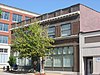
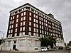
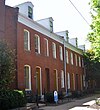
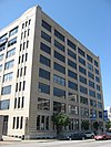
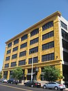
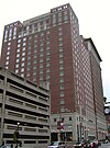
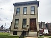
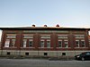
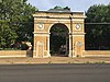
1
|
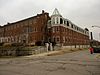
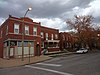
1907 Dorris Motor Car Company Building
|

|
50000210 ♠February 10, 2000
|
4063-4065 Forest Park Avenue
38 ° 38 ′ 16 "N, 90 ° 14 ′ 46" W.
|
00000084
|
|
|
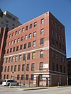
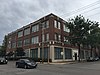
2
|
A&P Food Stores Building
|
|
50001015 ♠October 15, 2000
|
6016, 6014, and 6018 Delmar Street
38 ° 39 ′ 16 ″ N, 90 ° 17 ′ 41 ″ W.
|
00001171
|
|
|
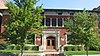
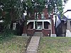
3
|
Advertising building
|

|
49850118 ♠January 18, 1985
|
1627-1629 Locust Street
38 ° 37 ′ 55 "N, 90 ° 12 ′ 14" W.
|
85000106
|
|
|
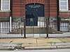
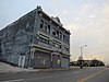
4th
|
Ambassador Theater Building
|

|
49830329 ♠March 29, 1983
|
411 North 7th Street
38 ° 37 ′ 45 ″ N, 90 ° 11 ′ 29 ″ W.
|
83001039
|
Destroyed in 1996
|
|
5
|
American Brake Company Building
|
|
50070321 ♠March 21, 2007
|
1920 North Broadway
38 ° 38 ′ 53 ″ N, 90 ° 11 ′ 13 ″ W.
|
07000172
|
|
|
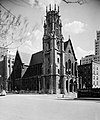
6th
|
American theater
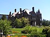
|

|
49850318 ♠March 18, 1985
|
416 North 9th Street
38 ° 37 ′ 48 "N, 90 ° 11 ′ 34" W.
|
85000617
|
|
|
7th
|
American Zinc, Lead and Smelting Company Building
|

|
49980504 ♠0May 4, 1998
|
20 South Fourth Street
38 ° 37 ′ 24 ″ N, 90 ° 11 ′ 18 ″ W.
|
98000363
|
|
|
8th
|
Anheuser-Busch Companies
|

|
49661113 ♠November 13, 1966
|
721 Pestalozzi Street
38 ° 35 ′ 51 ″ N, 90 ° 12 ′ 44 ″ W.
|
66000945
|
|
|
9
|
Antioch Baptist Church
|
|
49990917 ♠September 17, 1999
|
4213 North Market Street
38 ° 39 ′ 35 "N, 90 ° 14 ′ 17" W.
|
99001166
|
|
|
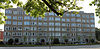
10
|
Apartments at 5561-71 Chamberlain
|

|
50110824 ♠August 24, 2011
|
5561-71 Chamberlain Street
38 ° 39 ′ 42 "N, 90 ° 16 ′ 47" W.
|
11000587
|
|
|
11
|
Arcade Building
|

|
50030323 ♠March 23, 2003
|
810 Olive Street
38 ° 37 ′ 48 ″ N, 90 ° 11 ′ 34 ″ W.
|
03000126
|
|
|
12
|
Arlington School
|
|
50080416 ♠April 16, 2008
|
1617 Burd Avenue
38 ° 40 ′ 15 ″ N, 90 ° 16 ′ 26 ″ W.
|
08000311
|
|
|
13
|
Aubert Place
|

|
49820930 ♠September 30, 1982
|
Fountain Avenue between Walton Avenue and Kings Highway
38 ° 39 ′ 19 ″ N, 90 ° 15 ′ 34 ″ W
|
82004730
|
|
|
14th
|
Autocar Sales and Service Building
|
|
50060626 ♠June 26, 2006
|
2745 Locust Street
38 ° 38 ′ 13 ″ N, 90 ° 13 ′ 4 ″ W.
|
06000530
|
|
|
15th
|
B'nai El Temple
|

|
49830721 ♠July 21, 1983
|
3666 Flad Avenue
38 ° 36 ′ 24 ″ N, 90 ° 13 ′ 56 ″ W.
|
83001042
|
|
|
16
|
Balmer & Weber Music House Co. Building
|

|
50000831 ♠August 31, 2000
|
1004 Olive Street
38 ° 37 ′ 51 ″ N, 90 ° 11 ′ 42 ″ W.
|
00001008
|
|
|
17th
|
Barr Branch Library Historic District
|

|
49820902 ♠02nd September 1982
|
2500-2630 Lafayette Avenue
38 ° 36 ′ 54 ″ N, 90 ° 13 ′ 16 ″ W.
|
82004731
|
|
|
18th
|
Beaumont Medical Building
|

|
49840119 ♠January 19, 1984
|
3714-26 Washington Avenue
38 ° 38 ′ 24 "N, 90 ° 14 ′ 4" W.
|
84002615
|
|
|
19th
|
Beaumont Telephone Exchange Building
|
|
50060216 ♠February 16, 2006
|
2654 Locust Street
38 ° 38 ′ 10 ″ N, 90 ° 12 ′ 57 ″ W.
|
06000038
|
|
|
20th
|
Beethoven Conservatory
|
|
49890302 ♠0March 2, 1989
|
2301 Locust Street
38 ° 37 ′ 59 ″ N, 90 ° 12 ′ 43 ″ W.
|
89000075
|
|
|
21st
|
Bel Air Motel
|

|
50090501 ♠0May 1, 2009
|
4630 Lindell Street
38 ° 38 ′ 33 ″ N, 90 ° 15 ′ 39 ″ W.
|
09000253
|
|
|
22nd
|
Bell Telephone Building
|
|
49990805 ♠0August 5, 1999
|
920 Olive Street
38 ° 37 ′ 50 ″ N, 90 ° 11 ′ 40 ″ W.
|
99000936
|
|
|
23
|
Benton Park District
|

|
49851230 ♠December 30, 1985
|
Bounded by Gravois Avenue, Interstate 55 , South Broadway and Jefferson Street
38 ° 35 ′ 52 ″ N, 90 ° 13 ′ 9 ″ W
|
85003232
|
|
|
24
|
Chuck Berry House
|

|
50081212 ♠December 12, 2008
|
3137 Whittier Street
38 ° 39 ′ 52 ″ N, 90 ° 13 ′ 53 ″ W.
|
08001179
|
|
|
25th
|
Berry Motor Car Service Building
|

|
50100719 ♠July 19, 2010
|
2220 Washington Avenue
38 ° 38 ′ 4 "N, 90 ° 12 ′ 40" W.
|
10000480
|
|
|
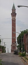
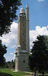
26th
|
Bissel Street Water Tower
|
|
49700605 ♠05th June 1970
|
Bissell Street and Blair Avenue
38 ° 40 ′ 13 ″ N, 90 ° 12 ′ 21 ″ W.
|
70000906
|
|
|
27
|
Blackwell-Wielandy Building
|

|
49830721 ♠July 21, 1983
|
1601-09 Locust Street
38 ° 37 ′ 55 ″ N, 90 ° 12 ′ 11 ″ W.
|
83001040
|
|
|
28
|
Frank P. Blair School
|

|
49830210 ♠February 10, 1983
|
2707 Rauschenbach Avenue
38 ° 39 ′ 3 ″ N, 90 ° 12 ′ 18 ″ W.
|
83001041
|
|
|
29
|
Blind Girls' Home
|

|
49840823 ♠23rd August 1984
|
5235 Page Boulevard
38 ° 39 ′ 38 ″ N, 90 ° 16 ′ 9 ″ W.
|
84002617
|
|
|
30th
|
Block Unit No. 1 Historic District
|

|
50000714 ♠July 14, 2000
|
4100-4191 Enright Avenue
38 ° 38 ′ 55 "N, 90 ° 14 ′ 36" W.
|
00000794
|
|
|
31
|
Board of Education Building
|

|
50050112 ♠January 12, 2005
|
901-911 Locust Street corner 401-409 N. Ninth Street
38 ° 37 ′ 53 ″ N, 90 ° 11 ′ 36 ″ W.
|
04001475
|
|
|
32
|
Boatman's Bank Building
|

|
49981022 ♠October 22, 1998
|
300 North Broadway
38 ° 37 ′ 41 ″ N, 90 ° 11 ′ 19 ″ W.
|
98001265
|
|
|
33
|
Brown Shoe Company's Homes-Take Factory
|
|
49801020 ♠20th October 1980
|
1201 Russell Boulevard
38 ° 36 ′ 29 "N, 90 ° 12 ′ 36" W.
|
80004503
|
|
|
34
|
AD Brown Building
|

|
49800328 ♠March 28, 1980
|
1136 Washington Avenue
38 ° 37 ′ 53 ″ N, 90 ° 11 ′ 47 ″ W.
|
80004502
|
|
|
35
|
Paul Brown Building
|

|
50021212 ♠December 12, 2002
|
818 Olive Street
38 ° 37 ′ 48 ″ N, 90 ° 11 ′ 36 ″ W.
|
02001496
|
|
|
36
|
William Buehler House
|

|
50001228 ♠December 28, 2000
|
2610 Tennessee Avenue
38 ° 36 ′ 32 "N, 90 ° 14 ′ 16" W.
|
00001550
|
|
|
37
|
Building at 1009 Olive St.
|

|
50020509 ♠0May 9, 2002
|
1009 Olive Street
38 ° 37 ′ 52 ″ N, 90 ° 11 ′ 41 ″ W.
|
02000468
|
|
|
38
|
Building at 1121-23 Locust St.
|

|
50040804 ♠0August 4, 2004
|
1121-23 Locust Street
38 ° 37 ′ 56 "N, 90 ° 11 ′ 47" W.
|
04000785
|
|
|
39
|
Building at 1300 Washington Avenue
|

|
49820902 ♠02nd September 1982
|
1300-1310 Washington Avenue
38 ° 37 ′ 54 "N, 90 ° 11 ′ 55" W.
|
82004732
|
|
|
40
|
Building at 3910-12 Laclede Ave.
|

|
50030530 ♠May 30, 2003
|
3910-12 Laclede Avenue
38 ° 38 ′ 16 "N, 90 ° 14 ′ 33" W.
|
03000478
|
|
|
41
|
Buildings at 2327-31 and 2333-35 Rutger Street
|
|
49840119 ♠January 19, 1984
|
2327-31 and 2333-35 Rutger Street
38 ° 37 ′ 9 ″ N, 90 ° 13 ′ 7 ″ W.
|
84002620
|
|
|
42
|
Buster Brown Blue Ribbon Shoe Factory
|
|
50050126 ♠January 26, 2005
|
1526 North Jefferson Avenue
38 ° 38 ′ 51 "N, 90 ° 12 ′ 45" W.
|
04001560
|
|
|
43
|
Butler House
|

|
49820902 ♠02nd September 1982
|
4484 W. Pine Boulevard
38 ° 38 '24 "N, 90 ° 15' 28" W.
|
82004733
|
|
|
44
|
Cadillac Automobile Company Building
|

|
50050804 ♠0August 4, 2005
|
3224 Locust Street
38 ° 38 ′ 18 ″ N, 90 ° 13 ′ 35 ″ W.
|
05000812
|
|
|
45
|
Robert G. Campbell House
|
|
49770421 ♠April 21, 1977
|
1508 Locust Street
38 ° 37 ′ 52 ″ N, 90 ° 12 ′ 5 ″ W.
|
77001560
|
|
|
46
|
Carlin-Rathgeber House
|

|
49800529 ♠May 29, 1980
|
122 Davis Street
38 ° 32 ′ 36 "N, 90 ° 15 ′ 47" W.
|
80004554
|
|
|
47
|
Carondelet School
|
|
50070321 ♠March 21, 2007
|
8221 Minnesota Avenue
38 ° 32 '48 "N, 90 ° 15' 50" W.
|
07000171
|
|
|
48
|
Carr School
|
|
50001213 ♠December 13, 2000
|
1419 Carr Street
38 ° 38 ′ 20 "N, 90 ° 11 ′ 54" W.
|
00001512
|
|
|
49
|
Cass Bank and Trust Company
|
|
50110214 ♠February 14, 2011
|
1450 N. 13th Street
38 ° 38 ′ 27 "N, 90 ° 11 ′ 38" W.
|
11000012
|
|
|
50
|
Castle Ballroom
|

|
50110218 ♠February 18, 2011
|
2839-2845 Olive Street
38 ° 38 ′ 3 ″ N, 90 ° 13 ′ 10 ″ W.
|
11000024
|
|
|
51
|
Centenary Methodist Episcopal Church, South
|
|
49970116 ♠January 16, 1997
|
55 Plaza Square
38 ° 37 ′ 48 ″ N, 90 ° 12 ′ 12 ″ W.
|
96001596
|
|
|
52
|
Centennial Malt House
|
|
50051115 ♠November 15, 2005
|
2017-19 Chouteau Avenue
38 ° 37 ′ 23 ″ N, 90 ° 12 ′ 46 ″ W.
|
05001281
|
|
|
53
|
Central Carondelet Historic District
|

|
50060222 ♠February 22, 2006
|
Bounded by Koeln Avenue, Loughborough Avenue, South Broadway and Alabama Avenue
38 ° 33 ′ 14 ″ N, 90 ° 15 ′ 27 ″ W
|
06000064
|
The boundaries of the district were expanded several times in 2007, 2009 and 2011
|
|
54
|
Central Institute for the Deaf Clinic and Research Building
|

|
50041021 ♠October 21, 2004
|
909 S. Taylor Avenue
38 ° 37 '46 "N, 90 ° 11' 38" W.
|
04001163
|
|
|
55
|
Century Building and Syndicate Trust Building
|

|
50021016 ♠October 16, 2002
|
Between Locust Street, Ninth Street, Tenth Street and Olive Street
38 ° 37 ′ 46 ″ N, 90 ° 11 ′ 38 ″ W.
|
02001054
|
|
|
56
|
Chain of Rocks Bridge
|

|
50061201 ♠0December 1, 2006
|
West Chain of Rocks Road
38 ° 45 ′ 41 ″ N, 90 ° 10 ′ 26 ″ W.
|
06001091
|
|
|
57
|
Chatillon-DeMenil House
|

|
49780609 ♠0June 9, 1978
|
3352 DeMenil Pl.
38 ° 35 ′ 32 ″ N, 90 ° 12 ′ 57 ″ W.
|
78001673
|
|
|
58
|
Chemical building
|

|
49820319 ♠March 19, 1982
|
721 Olive Street
38 ° 37 ′ 43 ″ N, 90 ° 11 ′ 32 ″ W.
|
82004734
|
|
|
59
|
Chippewa Trust Company Building
|
|
50100812 ♠August 12, 2010
|
3801-05 South Broadway
38 ° 35 ′ 9 ″ N, 90 ° 13 ′ 40 ″ W.
|
10000538
|
|
|
60
|
Kate Chopin House
|
|
49860214 ♠February 14, 1986
|
4232 McPherson Avenue
38 ° 38 ′ 35 "N, 90 ° 14 ′ 56" W.
|
86000209
|
|
|
61
|
Chouteau Apartments / Parkway Dwellings
|
|
49830210 ♠February 10, 1983
|
4937-4943 Laclede Avenue
38 ° 38 ′ 28 "N, 90 ° 17 ′ 11" W.
|
83001043
|
|
|
62
|
Chouteau Building
|
|
50060405 ♠0April 5, 2006
|
4030 Chouteau Street and 1029 South Vandeventer
38 ° 37 ′ 46 ″ N, 90 ° 14 ′ 57 ″ W.
|
06000220
|
|
|
63
|
Christ Church Cathedral
|
|
49900307 ♠0March 7, 1990
|
1210 Locust Street
38 ° 37 ′ 49 ″ N, 90 ° 11 ′ 55 ″ W.
|
90000345
|
|
|
64
|
Winston Churchill Apartments
|

|
49850404 ♠0April 4th 1985
|
5475 Cabanne Street
38 ° 39 ′ 32 ″ N, 90 ° 16 ′ 35 ″ W.
|
85000697
|
|
|
65
|
City Club Building
|

|
50020606 ♠0June 6, 2002
|
1012-1024 Locust Street
38 ° 37 ′ 47 "N, 90 ° 11 ′ 42" W.
|
02000610
|
|
|
66
|
City Hospital Historic District
|

|
50010202 ♠0February 2, 2001
|
Bounded by Lafayette Avenue, Grattan Street, Carroll Street, Dillon Street, St. Ange Street, 14th Street, and Carroll Street
38 ° 36 ′ 50 ″ N, 90 ° 12 ′ 28 ″ W
|
01000036
|
|
|
67
|
Clemens House-Columbia Brewery District
|

|
49840719 ♠July 19, 1984
|
Bounded by Maiden Lane, Cass Avenue, 21st Street, Helen Street, and Howard Street, and St. Louis Avenue, North Florissant Avenue, Maiden Lane, North 21st Street, and N. 20th Street
38 ° 38 ′ 41 ″ N, 90 ° 12 ′ 33 ″ W
|
84002622 (original), 08000807 (extension)
|
In 1986 the district was expanded
|
|
68
|
Coca-Cola Syrup Plant
|

|
50080430 ♠April 30, 2008
|
8125 Michigan Avenue
38 ° 32 '45 "N, 90 ° 15' 57" W.
|
08000359
|
|
|
69
|
Colchester Apartments
|
|
50060712 ♠July 12, 2006
|
4-10-14-20 North Kingshighway Boulevard
38 ° 38 '27 "N, 90 ° 15' 53" W.
|
06000603
|
|
|
70
|
Compton Hill Reservoir Park
|
|
49720929 ♠29th September 1972
|
Reservoir Park, Grant Boulevard, Russell Boulevard, and Lafayette Avenue
38 ° 36 ′ 51 ″ N, 90 ° 14 ′ 19 ″ W
|
72001555
|
|
|
71
|
Convent of the Sisters of St. Joseph Carondelet
|
|
49800228 ♠February 28, 1980
|
6400 Minnesota Avenue
38 ° 33 ′ 23 "N, 90 ° 15 ′ 0" W.
|
80004505
|
|
|
72
|
Cook Avenue Methodist Episcopal Church, South
|

|
50080827 ♠August 27, 2008
|
3680 Cook Avenue
38 ° 38 ′ 45 "N, 90 ° 13 ′ 50" W.
|
08000806
|
|
|
73
|
Cote Brilliante Avenue in The Ville Historic District
|

|
50120117 ♠17th January 2012
|
4200 Cote Brilliante Avenue and 1700 Annie Malone Drive
38 ° 39 ′ 21 ″ N, 90 ° 14 ′ 23 ″ W.
|
11001021
|
|
|
74
|
Cotton Belt Freight Depot
|
|
50040421 ♠April 21, 2004
|
1400 North 1st Street
38 ° 38 ′ 27 "N, 90 ° 10 ′ 57" W.
|
04000344
|
|
|
75
|
Council Plaza
|
|
50070302 ♠0March 2, 2007
|
212, 300, and 310 South Grand Boulevard
38 ° 37 ′ 57 "N, 90 ° 14 ′ 4" W.
|
06000217
|
|
|
76
|
Crittenden Historic District
|
|
49830707 ♠0July 7, 1983
|
3401 Arsenal Street, 3400 and 3500 Crittenden Street
38 ° 36 ′ 12 ″ N, 90 ° 14 ′ 24 ″ W.
|
83001044
|
|
|
77
|
Crunden-Martin Manufacturing Company
|

|
50050209 ♠0February 9, 2005
|
104 Cedar Street, 760 South 2nd Street, 757 South 2nd Street.
38 ° 37 ′ 3 ″ N, 90 ° 11 ′ 20 ″ W.
|
05000013
|
|
|
78
|
Cupples Warehouse District
|

|
49980626 ♠June 26, 1998
|
Bounded by Spruce Street and Clark Street between Seventh Street and Eleventh Street
38 ° 37 ′ 24 ″ N, 90 ° 11 ′ 48 ″ W
|
85003615
|
|
|
79
|
Samuel Cupples House
|
|
49761021 ♠October 21, 1976
|
3673 West Pine Boulevard
38 ° 38 ′ 12 "N, 90 ° 14 ′ 8" W.
|
76002260
|
|
|
80
|
SS Cyril and Methodius Historic District
|

|
49820628 ♠June 28, 1982
|
Interstate 70
38 ° 38 ′ 44 ″ N, 90 ° 11 ′ 29 ″ W.
|
82004740
|
|
|
81
|
De Hodiamont Car House Historic District
|

|
50050210 ♠February 10, 2005
|
Bounded by North Skinker Parkway, Horton Place, and the Wabash Railroad tracks
38 ° 39 ′ 45 ″ N, 90 ° 17 ′ 45 ″ W
|
05000012
|
|
|
82
|
Emmanuel DeHodiamont House
|
|
50030115 ♠January 15, 2003
|
951 Maple Place
38 ° 39 ′ 40 ″ N, 90 ° 17 ′ 32 ″ W.
|
02001708
|
|
|
83
|
Delaney School
|

|
50041223 ♠December 23, 2004
|
000000Address00000000
38 ° 33 ′ 44 ″ N, 90 ° 15 ′ 0 ″ W.
|
04001385
|
|
|
84
|
Delany Building
|

|
50020301 ♠0March 1, 2002
|
1000-06 Locust Street
38 ° 37 ′ 53 ″ N, 90 ° 11 ′ 40 ″ W.
|
02000102
|
|
|
85
|
Delmar Loop-Parkview Gardens Historic District
|

|
49840216 ♠February 16, 1984
|
Bounded by Kingsland Avenue, North Drive, Delmar Boulevard and Eastgate
38 ° 39 ′ 21 ″ N, 90 ° 18 ′ 15 ″ W
|
84002624
|
|
|
86
|
DePaul Hospital
|
|
49830329 ♠March 29, 1983
|
2415 North Kingshighway Boulevard
38 ° 40 ′ 5 ″ N, 90 ° 15 ′ 32 ″ W.
|
83001045
|
|
|
87
|
Des Peres School
|
|
49820902 ♠02nd September 1982
|
6307 Michigan Avenue
38 ° 33 '32 "N, 90 ° 15' 0" W.
|
82004735
|
|
|
88
|
Dickmann Building
|

|
49991230 ♠December 30, 1999
|
3115 South Grand Boulevard
38 ° 36 ′ 14 "N, 90 ° 14 ′ 33" W.
|
99001616
|
|
|
89
|
Dolman Row
|
|
49840119 ♠January 19, 1984
|
1424-1434 Dolman Street
38 ° 36 ′ 56 "N, 90 ° 12 ′ 36" W.
|
84002629
|
|
|
90
|
Dorris Motor Car Company
|
|
49860501 ♠0May 1, 1986
|
4100 Laclede
38 ° 38 ′ 12 ″ N, 90 ° 14 ′ 49 ″ W.
|
86000883
|
|
|
91
|
Dr. Herman S. Dreer House
|
|
50090220 ♠February 20, 2009
|
4335 Cote Brilliante Avenue
38 ° 39 '29 "N, 90 ° 14' 36" W.
|
09000035
|
|
|
92
|
Eads Bridge
|

|
49661015 ♠October 15, 1966
|
Mississippi Bridge at the end of Washington Avenue at
38 ° 37 ′ 41 ″ N, 90 ° 10 ′ 17 ″ W
|
66000946
|
|
|
93
|
Eliot School
|
|
49920902 ♠02nd September 1992
|
4242 Grove Street
38 ° 39 ′ 59 ″ N, 90 ° 12 ′ 31 ″ W.
|
92001092
|
|
|
94
|
Emerson Electric Company Building
|
|
49861106 ♠0November 6, 1986
|
2012-2018 Washington Avenue
38 ° 38 ′ 2 ″ N, 90 ° 12 ′ 30 ″ W.
|
86003138
|
|
|
95
|
Ralph Waldo Emerson School
|

|
49920902 ♠02nd September 1992
|
5415 Page Boulevard
38 ° 38 ′ 2 ″ N, 90 ° 12 ′ 30 ″ W.
|
92001145
|
|
|
96
|
Endicott-Johnson Shoe Distribution Plant
|

|
50071011 ♠October 11, 2007
|
1132 Spruce Street
38 ° 39 ′ 51 ″ N, 90 ° 16 ′ 39 ″ W.
|
07001074
|
|
|
97
|
Joseph Erlanger House
|
|
49761208 ♠0December 8, 1976
|
5127 Waterman Boulevard
38 ° 37 ′ 32 "N, 90 ° 11 ′ 57" W.
|
76002234
|
|
|
98
|
Fairgrounds Hotel
|

|
50020719 ♠July 19, 2002
|
3644 Natural Bridge Road
38 ° 39 ′ 47 ″ N, 90 ° 13 ′ 5 ″ W.
|
02000796
|
|
|
99
|
Falstaff Brewing Corporation Plant Number 1
|
|
50070712 ♠July 12, 2007
|
3644-3690 Forest Park Boulevard
38 ° 38 ′ 8 ″ N, 90 ° 14 ′ 15 ″ W.
|
07000008
|
|
|
100
|
Farm and Home Savings and Loan Association
|

|
50081029 ♠October 29, 2008
|
1001 Locust Street
38 ° 37 ′ 49 ″ N, 90 ° 11 ′ 40 ″ W.
|
08001025
|
|
|
101
|
Fashion Square Building
|

|
49851009 ♠0October 9, 1985
|
1307 Washington Avenue
38 ° 37'56 "N, 90 ° 11'55" W.
|
85003105
|
|
|
102
|
Father Dunne's News Boys' Home and Protectorate
|

|
50100812 ♠August 12, 2010
|
3010 Washington Avenue
38 ° 38 ′ 13 ″ N, 90 ° 13 ′ 22 ″ W.
|
10000550
|
|
|
103
|
Federal Cold Storage Company Building
|

|
50100112 ♠January 12, 2010
|
1800-28 North Broadway
38 ° 38 ′ 41 ″ N, 90 ° 11 ′ 9 ″ W.
|
09001226
|
|
|
104
|
Eugene Field House
|

|
49750819 ♠19th August 1975
|
634 South Broadway
38 ° 37 ′ 11 ″ N, 90 ° 11 ′ 30 ″ W.
|
75002137
|
House of journalist and poet Eugene Field (1850–1895)
|
|
105
|
Eugene Field School
|

|
49920902 ♠02nd September 1992
|
4466 Olive Street
38 ° 38 ′ 53 "N, 90 ° 15 ′ 15" W.
|
92001093
|
|
|
106
|
Ford Apartments
|

|
50050126 ♠January 26, 2005
|
1405 Pine Street
38 ° 37 ′ 53 ″ N, 90 ° 12 ′ 2 ″ W.
|
04001562
|
|
|
107
|
Forest Park Headquarters Building
|

|
49860611 ♠June 11, 1986
|
115 Union, Forest Park
38 ° 38 ′ 40 ″ N, 90 ° 16 ′ 31 ″ W.
|
86001300
|
|
|
108
|
Forest Park Hotel
|
|
49840322 ♠March 22, 1984
|
4910 West Pine Boulevard
38 ° 38 ′ 29 "N, 90 ° 15 ′ 44" W.
|
84002632
|
|
|
109
|
Forest Park Southeast Historic District
|
|
50011220 ♠December 20, 2001
|
Bounded by Chouteau Avenue, Manchester Avenue, Cadet Avenue, Kingshighway Boulevard and South Sarah Street
38 ° 37 ′ 43 ″ N, 90 ° 15 ′ 33 ″ W
|
01001360 (original), 05000612 (extension 2005), 07000015 (extension 2007)
|
The district expanded in 2005 and 2007
|
|
110
|
Forty-Eleven Delmar
|

|
50080228 ♠February 28, 2008
|
4005-4017 Delmar Boulevard
38 ° 38 ′ 45 ″ N, 90 ° 14 ′ 19 ″ W.
|
08000092
|
|
|
111
|
Fox theater
|

|
49761008 ♠0October 8, 1976
|
527 North Grand Boulevard
38 ° 38 ′ 19 ″ N, 90 ° 13 ′ 55 ″ W.
|
76002261
|
|
|
112
|
Franklin School
|

|
50050309 ♠0March 9, 2005
|
814 North 19th Street
38 ° 38 ′ 15 ″ N, 90 ° 12 ′ 19 ″ W.
|
05000121
|
|
|
113
|
Frisco Building
|

|
49830329 ♠March 29, 1983
|
906 Olive Street
38 ° 37 ′ 43 "N, 90 ° 11 ′ 43" W.
|
83001046
|
|
|
114
|
Fullerton's Westminster Place
|

|
49800410 ♠April 10, 1980
|
Westminster Pl.
38 ° 38 ′ 43 ″ N, 90 ° 15 ′ 7 ″ W.
|
80004506
|
|
|
115
|
Fulton Bag Company Building
|

|
49910905 ♠05th September 1991
|
612-618 S. South Seventh Street
38 ° 37 ′ 15 ″ N, 90 ° 11 ′ 38 ″ W.
|
91001372
|
|
|
116
|
Gateway Arch
|

|
49870528 ♠May 28, 1987
|
Memorial Drive between Poplar Street Bridge and Eads Bridge
38 ° 37 ′ 31 ″ N, 90 ° 11 ′ 0 ″ W
|
87001423
|
|
|
117
|
General American Life Insurance Co. Buildings
|

|
50021022 ♠October 22, 2002
|
1501-1511 Locust Street
38 ° 37 ′ 55 ″ N, 90 ° 12 ′ 5 ″ W.
|
02001206
|
|
|
118
|
General American Life Insurance Company National Headquarters
|
|
50080327 ♠March 27, 2008
|
706 Market Street
38 ° 37 ′ 39 ″ N, 90 ° 11 ′ 34 ″ W.
|
07000461
|
|
|
119
|
Gerhart Block
|
|
50030530 ♠May 30, 2003
|
3900-08 Laclede Avenue, 1-17 Vandeventer
38 ° 38 ′ 16 ″ N, 90 ° 14 ′ 31 ″ W.
|
03000477
|
|
|
120
|
William A. Gill Building
|

|
50090508 ♠0May 8, 2009
|
622 Olive Street
38 ° 37 ′ 41 ″ N, 90 ° 11 ′ 29 ″ W.
|
09000282
|
|
|
121
|
GOLDENROD
|

|
49671224 ♠December 24, 1967
|
400 North Wharf Street
38 ° 37 ′ 38 ″ N, 90 ° 10 ′ 54 ″ W.
|
67000029
|
|
|
122
|
Goodfellow-Julian Concrete Block District
|
|
49870813 ♠August 13, 1987
|
Bounded by Julian Avenue, Blackstone Street and Goodfellow Boulevard
38 ° 39 ′ 52 ″ N, 90 ° 17 ′ 1 ″ W
|
87001389
|
|
|
123
|
Grand Avenue Water Tower
|

|
49700615 ♠June 15, 1970
|
East Grand Avenue Junction of 20th Street
38 ° 40 ′ 13 ″ N, 90 ° 12 ′ 31 ″ W.
|
70000908
|
|
|
124
|
Grand-Bates Suburb Historic District
|

|
50090916 ♠September 16, 2009
|
Bounded by Bates Street, Grand Boulevard, Interstate 55 , Alaska Avenue, Fillmore Street, and Iron Street
38 ° 33 ′ 53 ″ N, 90 ° 15 ′ 8 ″ W
|
09000719
|
|
|
125
|
Grand-Leader (Stix, Baer & Fuller Dry Goods Co.) Building
|
|
50030717 ♠July 17, 2003
|
601 Washington Avenue
38 ° 37 ′ 57 ″ N, 90 ° 11 ′ 23 ″ W.
|
03000650
|
|
|
126
|
Grant School
|

|
50060214 ♠February 14, 2006
|
3009 Pennsylvania Avenue
38 ° 36'7 "N, 90 ° 13'57" W.
|
06000037
|
|
|
127
|
Gravois-Jefferson Streetcar Suburb Historic District
|

|
50050511 ♠May 11, 2005
|
Grovois and S. Jefferson, S. Jefferson and S. Broadway, Meramac, S. Gran and Gravois
38 ° 35 '28 "N, 90 ° 14' 3" W
|
05000115
|
|
|
128
|
Edwin F. Guth Company Complex
|
|
50040728 ♠July 28, 2004
|
2615 Washington Avenue
38 ° 38 ′ 13 ″ N, 90 ° 12 ′ 49 ″ W.
|
04000748
|
|
|
129
|
Haas Building
|

|
50040728 ♠July 28, 2004
|
410 North Jefferson Avenue and 2327 Locust Street
38 ° 38 ′ 9 ″ N, 90 ° 12 ′ 48 ″ W.
|
04000747
|
|
|
130
|
Elias Haas Building
|

|
50060412 ♠April 12, 2006
|
2223 Locust Street
38 ° 38 ′ 8 ″ N, 90 ° 12 ′ 43 ″ W.
|
06000248
|
|
|
131
|
Hadley-Dean Glass Company
|

|
49790801 ♠01st August 1979
|
701-705 North 11th Street
38 ° 37 ′ 55 "N, 90 ° 11 ′ 41" W.
|
79003634
|
|
|
132
|
C. Hager and Sons Hinge Co.
|

|
49870226 ♠February 26, 1987
|
139 Victor Street
38 ° 35 ′ 58 ″ N, 90 ° 12 ′ 4 ″ W.
|
87000508
|
|
|
133
|
Halsey-Packard Building
|

|
50051214 ♠December 14, 2005
|
2201-11 Locust Street
38 ° 38 ′ 7 ″ N, 90 ° 12 ′ 39 ″ W.
|
05001036
|
|
|
134
|
Hamilton Hotel
|

|
50110429 ♠April 29, 2011
|
956 Hamilton Avenue
38 ° 39 ′ 40 "N, 90 ° 17 ′ 21" W.
|
11000248
|
|
|
135
|
Hamilton Place Historic District
|
|
50051015 ♠October 15, 2005
|
5900-6000 blocks of Enright, Cates, and Clemens
38 ° 39 ′ 26 "N, 90 ° 17 ′ 33" W.
|
05001164
|
|
|
136
|
Hamilton-Brown Shoe Factory
|

|
50000505 ♠0May 5, 2000
|
2031 Olive Street
38 ° 38 ′ 3 ″ N, 90 ° 12 ′ 33 ″ W.
|
00000437
|
|
|
137
|
Hargadine-McKittrick Dry Goods Building
|

|
49820319 ♠March 19, 1982
|
911 Washington Avenue
38 ° 37 ′ 53 ″ N, 90 ° 11 ′ 36 ″ W.
|
82004728
|
|
|
138
|
Harris Teachers College
|

|
50040804 ♠0August 4, 2004
|
1517 South Theresa Street
38 ° 37 ′ 19 ″ N, 90 ° 14 ′ 13 ″ W.
|
04000787
|
|
|
139
|
Harrison School
|

|
50070718 ♠July 18, 2007
|
4224 Fair Avenue
38 ° 40 ′ 28 "N, 90 ° 13 ′ 26" W.
|
07000703
|
|
|
140
|
Hempstead School
|

|
50070703 ♠0July 3, 2007
|
5872 Minerva Avenue
38 ° 40 ′ 9 ″ N, 90 ° 17 ′ 4 ″ W.
|
07000653
|
|
|
141
|
Hi-Pointe-De Mun Historic District
|
|
50050507 ♠0May 7, 2005
|
Bounded by South Skinker Boulevard, Clayton Road, Seminary Place, De Mun Avenue, and Northwood Avenue
38 ° 38 ′ 14 ″ N, 90 ° 18 ′ 31 ″ W
|
05000370 and 06001207
|
|
|
142
|
Hickory Street District
|
|
49850118 ♠January 18, 1985
|
Bounded by Lasalle Street, Missouri Avenue, Rutger Street, and Jefferson Avenue
38 ° 37 ′ 12 ″ N, 90 ° 13 ′ 3 ″ W
|
85000107
|
|
|
143
|
Holly Place Historic District
|

|
50070718 ♠July 18, 2007
|
4500 block of Holly Place
38 ° 40 ′ 39 ″ N, 90 ° 13 ′ 35 ″ W.
|
07000704
|
|
|
144
|
Holy Corners Historic District
|

|
49751229 ♠December 29, 1975
|
On either side of the Kings Highway between Westminster Pl. And Washington Avenue
38 ° 38 ′ 59 ″ N, 90 ° 15 ′ 49 ″ W
|
75002138
|
|
|
145
|
Holy Cross Parish District
|

|
49800327 ♠March 27, 1980
|
8115 Church Road
38 ° 42 ′ 36 ″ N, 90 ° 12 ′ 35 ″ W.
|
80004507
|
|
|
146
|
Hotel Jefferson
|

|
50031024 ♠October 24, 2003
|
415 North Tucker Boulevard
38 ° 37 ′ 57 "N, 90 ° 11 ′ 50" W.
|
03001066
|
|
|
147
|
Hotel Statler
|
|
49820319 ♠March 19, 1982
|
822 Washington Avenue
38 ° 37 ′ 49 ″ N, 90 ° 11 ′ 34 ″ W.
|
82004729
|
|
|
148
|
Immaculate Conception Church and Rectory
|

|
50080219 ♠February 19, 2008
|
312 Lafayette Avenue
38 ° 37 ′ 4 "N, 90 ° 14 ′ 32" W.
|
08000031
|
|
|
149
|
Immaculate Conception School
|

|
49850508 ♠0May 8, 1985
|
2912 Lafayette
38 ° 36 ′ 55 "N, 90 ° 13 ′ 41" W.
|
85000995
|
|
|
150
|
International Fur Exchange Building
|

|
49980413 ♠April 13, 1998
|
2-14 S. Fourth Street
38 ° 37 ′ 25 ″ N, 90 ° 11 ′ 18 ″ W.
|
98000313
|
|
|
151
|
JC Penney Co. Warehouse Building
|

|
49981231 ♠December 31, 1998
|
400 South 14th Street
38 ° 37 ′ 27 ″ N, 90 ° 12 ′ 7 ″ W.
|
98001563
|
|
|
152
|
Jack Rabbit Candy Company Building
|
|
50070209 ♠0February 9, 2007
|
1928-1930 Martin Luther King
38 ° 38 ′ 17 ″ N, 90 ° 12 ′ 24 ″ W.
|
07000024
|
|
|
153
|
Jackson School
|

|
49920902 ♠02nd September 1992
|
1632 Hogan Street
38 ° 38 ′ 41 ″ N, 90 ° 12 ′ 3 ″ W.
|
92001094
|
|
|
154
|
Jefferson National Expansion Memorial
|
|
49661015 ♠October 15, 1966
|
Mississippi bank between Eads Bridge and Poplar Street Bridge
38 ° 37 ′ 28 ″ N, 90 ° 11 ′ 10 ″ W
|
66000941
|
|
|
155
|
Jewel box
|
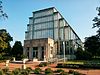
|
50000314 ♠March 14, 2000
|
Forest Park, intersection of Wells Drive and McKinley Drive,
38 ° 38 ′ 7 ″ N, 90 ° 16 ′ 46 ″ W.
|
00000147
|
|
|
156
|
William Cuthbert Jones House
|
|
50070207 ♠0February 7, 2007
|
3724 Olive Street
38 ° 38 ′ 29 ″ N, 90 ° 14 ′ 12 ″ W.
|
07000017
|
|
|
157
|
Scott Joplin House
|
|
49761208 ♠0December 8, 1976
|
2658 Delmar Boulevard
38 ° 38 ′ 14 "N, 90 ° 12 ′ 53" W.
|
76002235
|
|
|
158
|
Frederick Newton Judson House
|
|
50080430 ♠April 30, 2008
|
3733 Washington Avenue
38 ° 38 ′ 27 "N, 90 ° 14 ′ 3" W.
|
08000360
|
|
|
159
|
J. Kennard and Sons Carpet Company Building
|

|
50000505 ♠0May 5, 2000
|
400 Washington Avenue
38 ° 37 ′ 53 ″ N, 90 ° 11 ′ 14 ″ W.
|
00000438
|
|
|
160
|
Peabody Opera House
|

|
50000211 ♠February 11, 2000
|
1400 Market Street
38 ° 37 ′ 45 ″ N, 90 ° 12 ′ 8 ″ W.
|
00000016
|
|
|
161
|
Kieselhorst Piano Company Building
|

|
50080410 ♠April 10, 2008
|
1007 Olive Street
38 ° 37 ′ 46 ″ N, 90 ° 11 ′ 42 ″ W.
|
08000268
|
|
|
162
|
Koken Barbers' Supply Co. Historic District
|
|
50070207 ♠0February 7, 2007
|
Bounded by Ohio Street, Sidney Street, Victor Street and Texas Avenue
38 ° 36 ′ 28 ″ N, 90 ° 13 ′ 28 ″ W
|
07000023
|
|
|
163
|
Otto Kulage House
|

|
50020510 ♠May 10, 2002
|
1904 East College Avenue
38 ° 40 ′ 40 "N, 90 ° 12 ′ 46" W.
|
02000467
|
|
|
164
|
Laclede Building
|

|
49980806 ♠0August 6, 1998
|
408 Olive Street
38 ° 37 ′ 39 ″ N, 90 ° 11 ′ 17 ″ W.
|
98000994
|
|
|
165
|
Laclede Gas Light Company Pumping Station G
|
|
50070208 ♠0February 8, 2007
|
4401 Chouteau Avenue
38 ° 37 ′ 49 "N, 90 ° 15 ′ 31" W.
|
07000020
|
|
|
166
|
Laclede's Landing
|

|
49760825 ♠August 25, 1976
|
Delimited from North 3rd Street, Dr. Martin Luther King Bridge and the Mississippiufer
38 ° 37 ′ 50 ″ N, 90 ° 11 ′ 0 ″ W
|
76002262
|
|
|
167
|
Lafayette Garage and Repair Company Building
|

|
50111013 ♠October 13, 2011
|
2710-2716 Lafayette
38 ° 36 '54 "N, 90 ° 13' 26" W.
|
11000737
|
|
|
168
|
Lafayette Square Historic District
|
|
49720628 ♠June 28, 1972
|
Bounded from Hickory and 18th Streets, Jefferson and Lafayette Avenues
38 ° 37 ′ 0 ″ N, 90 ° 12 ′ 55 ″ W
|
72001557 (original), 86002127 (extension)
|
Expanded in 1986
|
|
169
|
Lambert Building
|

|
49830224 ♠February 24, 1983
|
2101-2107 Locust Street
38 ° 38 ′ 0 ″ N, 90 ° 12 ′ 35 ″ W.
|
83001047
|
|
|
170
|
Lambert-Deacon-Hull Printing Company Building
|

|
49801020 ♠20th October 1980
|
2100 Locust Street
38 ° 37 ′ 59 ″ N, 90 ° 12 ′ 35 ″ W.
|
80004508
|
|
|
171
|
Lambskin Temple
|

|
49870812 ♠August 12, 1987
|
1054 South Kingshighway Boulevard
38 ° 37 ′ 47 "N, 90 ° 15 ′ 49" W.
|
87001361
|
|
|
172
|
William A. Lange Subdivision
|
|
50110714 ♠July 14, 2011
|
4101-4235 Florissant Avenue, 4128-4150 Glasgow Avenue, 2141-2325 Angelica Street, 4111-4220 N. 22nd Street
38 ° 39 '58 "N, 90 ° 12' 32" W.
|
11000444
|
|
|
173
|
LaSalle Building
|

|
50051115 ♠November 15, 2005
|
501 Olive Street
38 ° 37 ′ 46 ″ N, 90 ° 11 ′ 21 ″ W.
|
05001282
|
|
|
174
|
Robert E. Lee Hotel
|

|
50070207 ♠0February 7, 2007
|
205 North 18th Street
38 ° 37 ′ 58 ″ N, 90 ° 12 ′ 22 ″ W.
|
07000021
|
|
|
175
|
Lennox Hotel
|

|
49840906 ♠0September 6, 1984
|
823-827 Washington Avenue
38 ° 37 ′ 51 ″ N, 90 ° 11 ′ 33 ″ W.
|
84002647
|
|
|
176
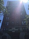
|
Leonardo
|
|
49830811 ♠August 11, 1983
|
4166 Lindell Boulevard
38 ° 38 ′ 24 "N, 90 ° 14 ′ 53" W.
|
83001048
|
|
|
177
|
Lesan-Gould Building
|

|
49861106 ♠0November 6, 1986
|
1320-1324 Washington Avenue
38 ° 37 ′ 56 "N, 90 ° 22 ′ 57" W.
|
86003137
|
|
|
178
|
Lewis Place Historic District
|
|
49800915 ♠September 15, 1980
|
Lewis Pl.
38 ° 39 ′ 16 ″ N, 90 ° 15 ′ 14 ″ W.
|
80004509
|
|
|
179
|
Liggett & Myers Historic District
|
|
50090618 ♠June 18, 2009
|
Bounded by Vandeventer Avenue, Park Avenue, Thurman Avenue, and Lafayette Avenue
38 ° 37 ′ 12 ″ N, 90 ° 15 ′ 12 ″ W
|
09000441
|
|
|
180
|
Liggett & Myers Tobacco Co. Building
|

|
49830210 ♠February 10, 1983
|
1900-1912 Pine Street
38 ° 37 ′ 50 ″ N, 90 ° 12 ′ 28 ″ W.
|
83001049
|
|
|
181
|
Liggett and Myers Building
|

|
49840216 ♠February 16, 1984
|
1000 Washington Avenue
38 ° 37 ′ 50 ″ N, 90 ° 12 ′ 28 ″ W.
|
84002648
|
|
|
182
|
Lindell Real Estate Company Building
|

|
49820319 ♠March 19, 1982
|
1015 Washington Avenue
38 ° 37'53 "N, 90 ° 11'40" W.
|
82004737
|
|
|
183
|
Lindenwood School
|

|
50050506 ♠0May 6, 2005
|
3815 McCausland Avenue
38 ° 35 ′ 52 "N, 90 ° 18 ′ 38" W.
|
05000371
|
|
|
184
|
Lister Building
|
|
49830210 ♠February 10, 1983
|
4500 Olive Street
38 ° 39 ′ 24 ″ N, 90 ° 15 ′ 18 ″ W.
|
83004298
|
|
|
185
|
Locust Street Automotive District
|

|
50050915 ♠September 15, 2005
|
2914-3124 Locust and 3043 Olive Street; 3133-3207 and 3150-3202 Locust Street
38 ° 38 ′ 15 ″ N, 90 ° 13 ′ 21 ″ W.
|
05001024
|
The second address results from an expansion of the district in 2008
|
|
186
|
Loretto Academy
|

|
49920305 ♠0March 5, 1992
|
3407 Lafayette Avenue
38 ° 37 ′ 2 ″ N, 90 ° 14 ′ 20 ″ W.
|
92000079
|
|
|
187
|
Louderman Building
|
|
50001122 ♠November 22, 2000
|
317 North Eleventh Street
38 ° 37 ′ 57 "N, 90 ° 11 ′ 43" W.
|
00001399
|
|
|
188
|
Louise Apartments
|
|
49840823 ♠23rd August 1984
|
900 Lindell Boulevard and Vandeventer Avenue
38 ° 38 ′ 18 ″ N, 90 ° 14 ′ 29 ″ W.
|
84002651
|
|
|
189
|
Lowell School
|
|
50070524 ♠May 24, 2007
|
1409 East Linton
38 ° 40 ′ 38 "N, 90 ° 12 ′ 32" W.
|
07000464
|
|
|
190
|
Lucas Avenue Industrial Historic District
|

|
50000831 ♠August 31, 2000
|
Bounded between Washington Street, Delmar Street, 20th Street, and 21st Street
38 ° 38 ′ 12 ″ N, 90 ° 12 ′ 30 ″ W
|
00001009 (original)
07000349 (extension)
|
In 2007 the boundaries of the area were expanded
|
|
191
|
Luytie's Homeopathic Pharmacy Company Building
|
|
50030327 ♠March 27, 2003
|
4200 Laclede Avenue
38 ° 38 ′ 21 "N, 90 ° 14 ′ 58" W.
|
02001442
|
|


.jpg)
.jpg)


.jpg)


.jpg)


.jpg)


.jpg)


.jpg)


.jpg)


.jpg)


.jpg)


.jpg)

.jpg)


.jpg)


.jpg)


