List of cultural monuments in Pirna (old town) (A – K)
The list of cultural monuments in Pirna (old town) contains all of the cultural monuments of the Saxon city of Pirna that were recorded by the State Office for Monument Preservation of Saxony until 2017 and are located in the redevelopment area of the “ Old Town Pirna”. This mainly includes the area within the former city wall.
In the old town of Pirna there are around 300 of the total of around 1,300 cultural monuments in Pirna. The notes are to be observed.
This list is a partial list of the list of cultural monuments in Pirna .
This list is a partial list of the list of cultural monuments in Saxony .
Due to the high number of cultural monuments, the list, arranged alphabetically by address, has been divided into the following two sub-lists:
- List of cultural monuments in Pirna (old town) (A – K)
- List of cultural monuments in Pirna (old town) (L – Z)
This partial list of cultural monuments in the streets of A-K .
Legend
- Image: shows a picture of the cultural monument and, if applicable, a link to further photos of the cultural monument in the Wikimedia Commons media archive
- Designation: Name, designation or the type of cultural monument
-
Location: If available, street name and house number of the cultural monument; The list is basically sorted according to this address. The map link leads to various map displays and gives the coordinates of the cultural monument.
- Map view to set coordinates. In this map view, cultural monuments are shown without coordinates with a red marker and can be placed on the map. Cultural monuments without a picture are marked with a blue marker, cultural monuments with a picture are marked with a green marker.
- Dating: indicates the year of completion or the date of the first mention or the period of construction
- Description: structural and historical details of the cultural monument, preferably the monument properties
-
ID: is awarded by the State Office for the Preservation of Monuments in Saxony. It clearly identifies the cultural monument. The link leads to a PDF document from the State Office for the Preservation of Monuments in Saxony, which summarizes the information on the monument, contains a map sketch and often a detailed description. For former cultural monuments sometimes no ID is given, if one is given, this is the former ID. The corresponding link leads to an empty document at the state office. The following icon can also be found in the ID column
 ; this leads to information on this cultural monument at Wikidata .
List of cultural monuments in Pirna (old town)
| image | designation | location | Dating | description | ID |
|---|---|---|---|---|---|
| Monument protection area old town Pirna | (Map) | 14th century - early 20th century (monument protection area) | Monument protection area old town Pirna |
09301764 |
|
 |
Urban wall and ramparts; promenade | (Map) | 13th century (city fortifications), 3rd quarter of the 19th century (ring system) | City wall and ramparts: remnants of the city wall (including all superstructures), on the west side of the Schlossberg with the remains of the White Tower, on the north side of the Schlossberg with the remains of a wall tower, loopholes in the city wall at Lange Straße 25 and behind the church of St. Kunigunde, Remains of the two wall towers south of Schmiedestrasse, base part of the Obertorturm at Obere Burgstrasse 10, remains of the foundations of the gate house from Obertor under the street on the north side of Tischerplatz, kennel wall at "Am Zwinger" West and behind Dr.-W.-Külz-Strasse 7 and 8 and at Obere Burgstraße 9, half-tower remains of the inner city moat wall at Dr.-W.-Külz-Straße 8 and underground in front of the Grohmannstraße multi-storey car park, furthermore with the promenade (garden monument) on the former ramparts in front of the city wall (Obere Burgstraße, Dr. .-W.-Külz-Strasse, Dohnaischer Platz, Grohmannstrasse to Klosterhof) with the following individual monuments: Julius Otto monument (individual monument ID No. 09220279), plastic "Little Faun" (individual monument ID no. 09223724) and memorial for the victims of fascism (individual monument ID No. 09301496); Significant in terms of building history, gardening, local history and the local image. |
09223768 |
| Tugboat Sachsenwald; Tow steamer Ida-Erna (formerly): Tow steamer | 1914 (tugboat) | Tugboat; Last screw tugboat on the Elbe, of historical importance, launched in 1914 at the Gebr. Wiemann shipyard under the name "Ida-Erna", since 1935 under the name "Sachsenwald". |
09229967 |
||
 |
Fountain trough on the market square (southwest of the town hall) | At the market (map) |
marked 1774 (fountain) | Artistically, technologically and historically important.
The monolithic water trough located in the southwestern part of the market square is one of the large sandstone fountains on the market. The location has remained unchanged since it was set up. The predecessor of the sandstone fountain was a wooden tubular box, which is shown on the famous market view by Bernardo Bellotto ( The market square of Pirna ). |
09220407 |
 |
Fountain trough on the market square (southeast of the town hall) | At the market (map) |
marked 1780 (fountain) | Artistically, technologically and historically important.
The monolithic water trough in the southeastern part of the market square is one of the large sandstone fountains on the market. The location has remained unchanged since it was set up. In front of the house of Mayor Volckamer (Am Markt 9) there was a wooden pipe box as the predecessor of today's fountain in 1676. |
09220406 |
 |
Fountain trough on the market square (northeast of the town hall) | At the market (map) |
marked 1775 (fountain) | Artistically, technologically and historically important
The monolithic water trough in the northeast part of the market square is one of the large sandstone fountains on the market. As early as 1676 there was a wooden tubular box here. The location has remained unchanged since it was set up. In 1905 the fountain was extended by a base on which a monument to King Albert was erected. The monument was melted down in 1942 to extract material. |
09220663 |
 More pictures |
town hall | At market 1; 2 (card) |
1555–1556 (town hall) | Town hall; Architectural history, art history, artistic, characterizing the townscape, local history and urban planning importance, multi-wing gable building (with tower) in the style of the Renaissance, baroque conversions, extension in the style of the German neo-Renaissance, free-standing in the middle of the market. |
09221177 |
 More pictures |
Peter Ulrich House; Tom Pauls Theater | Am Markt 3 (map) |
1505–1506 (residential building) | Residential house in closed development, corner house; Architecturally, art-historically and town-planning significant, late medieval building, to the rear towards the church to the neighboring house volute gable, late Gothic seat niche portal, late Gothic window garments with timber frame, inside remains of a plank room. |
09220023 |
 More pictures |
Hook house | Am Markt 4 (map) |
1717 (residential building) | Residential house (two parts of the house) in closed development and side wing in the courtyard (one property with church square 12); with shop fitting, of architectural, socio-historical and urban development importance, a hook house is the house of a small blacksmith, baroque portal, today Hotel Pirn`scher Hof |
09220024 |
 More pictures |
Hook house | Am Markt 5 (map) |
1717 (residential building) | Residential building in closed development and rear building (property extends to the church square); with shop fitting, of architectural, socio-historical and urban planning importance, a hook house is the house of a small blacksmith |
09220261 |
 More pictures |
Hook house | Am Markt 6 (map) |
1717 (residential building) | Residential house in closed development, corner house (Kirchgasse 1 also belongs to the property); with shop fitting, of architectural, socio-historical and urban planning importance, a hook house is the house of a small blacksmith |
09221176 |
 |
Canaletto house | Am Markt 7 (map) |
Early 16th century (residential building) | Residential building with gable dominating the space; Significant in terms of architectural history, artistry, urban development and the townscape, a Renaissance building with some late Gothic details; The house is one of the most iconic buildings in Pirna. It was built around 1525 as a result of a building renovation, whereby the oldest existing components of the house date from the middle of the 15th century. After the renovation, however, the house only had two full floors with four dwelling houses . The latter were demolished (probably after the Thirty Years War) in favor of a third full storey. This is why the distinctive and high gable has a "kink". In 1753/56 the painter Bernardo Bellotto , known as Canaletto, created a view of the market that already shows the shape of the building today. Although Canaletto himself had no further connection with the house, his name was transferred to the building. The house was fundamentally renovated in 1997-99 as part of the urban redevelopment and now houses a. a. the city's tourist office. |
09220025 |
 More pictures |
Residential house, corner house in semi-open development and side wing in the courtyard (a property with Schmiedestrasse 48) | Am Markt 8 (map) |
1st half of the 18th century, marked 1689 (residential building) | Significant in terms of architectural history, urban development and the appearance of the square, a baroque building with a mighty mansard roof, inside baroque stairs with docking points, younger shop fittings |
09220026 |
 More pictures |
Volkamerhaus; Townhouse 3 | Am Markt 9 (map) |
around 1500 (residential building) | Residential house in closed development (a plot of land with Schmiedestrasse 47); Of architectural, urban and artistic importance, a renaissance building with a beautiful baroque portal, inside a spiral staircase and hall with cross vault, later shop fitting. |
09220027 |
 More pictures |
Townhouse 1 | Am Markt 10 (map) |
inscribed 1551, inscribed 1686 (residential building) | Residential house in closed development (one property at Schmiedestrasse 46); Architecturally and urbanistically important, a Renaissance building, on the facade above the entrance the crowning of the former portal (this one at the town hall today) |
09220028 |
 More pictures |
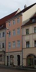
Residential building in closed development | Am Markt 11 (map) |
marked 1527 (residential building) | Significant in terms of architectural history and urban development, simple Renaissance building, with a seating niche portal (today inside) and cell vault, younger shop fitting |
09220029 |
 More pictures |
Electoral Office (formerly); Old office building | Am Markt 12 (map) |
marked 1548 on the facade (administration) | Residential building, former electoral office and side wing in the courtyard (a plot of land with Schmiedestrasse 44); Architecturally, artistically and in terms of town planning of importance, facade with rich ornamental pilaster strips, window frames with pane profiles, more recent shop fittings, arcades in the courtyard |
09220030 |
 More pictures |
Residential house, corner house (Schössergasse 1 belongs to the property) | Am Markt 14 (map) |
around 1500 (residential building) | Architecturally, artistically and urbanistically important, a renaissance building (with a cat staircase to Schössergasse) with a beautiful baroque portal, unique painted wooden beam ceiling on the first floor, younger shop fitting |
09220031 |
 More pictures |
Residential building in closed development | Am Markt 15 (map) |
2nd half of the 16th century (residential building) | with a younger shop fitting, of architectural and urban significance, a Renaissance building |
09220032 |
 More pictures |
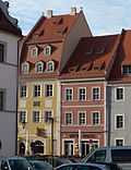
House in a corner | Am Markt 16 (map) |
marked on the house sign 1579 (residential building) | Significant in terms of building history and urban development, essentially a renaissance building with a shop fitting |
09220033 |
 More pictures |
Löwenapotheke (formerly) | Am Markt 17 (map) |
1515 (residential building) | Residential house in closed development, with side wing in the courtyard (common courtyard with Am Markt 18); Architecturally, artistically and urbanistically important, a Renaissance building with a beautiful seat niche portal, shop fittings, wooden gallery in the courtyard on pillars and Wendelstein, restaurant on the ground floor |
09220034 |
 More pictures |
Löwenapotheke (formerly) | Am Markt 18 (map) |
around 1800 (residential building) | Residential house in closed development with side wing to the courtyard and rear building (common courtyard with Am Markt 17); Significant in terms of building history and urban development, beautiful facade structure from the 19th century. |
09220035 |
 More pictures |
Gasthaus "Zum Weißen Schwan" | Am Markt 19 (map) |
marked 1699 (inn) | Inn in closed development; Architecturally, it shapes the square and is of importance in terms of urban development, simple baroque building with a beautiful house sign |
09220036 |
 More pictures |
Marienhaus | Am Markt 20 (map) |
around 1500 to 1700, inscribed 1514 (Marienfigur) | Inn and residential building (two addresses: Am Markt 20 and Töpfergasse 4) in a corner location (the outbuilding on Töpfergasse, see Töpfergasse 2); Architecturally, artistically and urbanistically important, beautiful baroque portal, on the corner of the building a late Gothic figure of Mary (marked 1514). |
09220037 |
| Spring collecting tank or drinking water purification system (below the Sonnenstein Fortress) | Am Schloßberg (map) |
around 1860 (water supply and sewage system) | Of importance in terms of building history, local history and technology history |
09223747 |
|
| Drinking water purification system (below the Sonnenstein fortress) | Am Schloßberg (map) |
probably around 1860 (water supply and sewage system) | Of importance in terms of building history, local history and technology history |
09223746 |
|
| Source collecting container (below the Sonnenstein fortress); sucked Pienitz container | Am Schloßberg (map) |
around 1860, probably rebuilt around 1910 (water supply and sewage system) | Significant in terms of building history, local history and technology history, named after Mayor Pienitz (1851–1883), who had a garden on the property |
09223745 |
|
 More pictures |
Residential house with side staircase, enclosure wall of the property and fountain at the house | Am Schloßberg 2 (map) |
marked 1840 (residential building) | Significant in terms of building history and urban planning, classicist building |
09220051 |
 |
Residential house (Am Schloßberg 4) with wall enclosing the property facing Holdergasse and ancillary building (Steinplatz 23a, former syringe house, transformer house on the property since the 1950s | Am Schloßberg 4 (map) |
18./19. Century (residential building), 18th century (syringe house) | Significant in terms of building history and urban planning, outbuildings formerly possibly part of the city's water supply |
09220252 |
| Well trough | Am Schloßberg 4 (next to) (map) |
18th century (fountain) | Significant in terms of technology and history, baroque sandstone fountain |
09301675 |
|
 |
Apartment building in closed development | Badergasse 1 (map) |
1880s (tenement) | with a shop, of architectural and urban importance, a Wilhelminian style house |
09220239 |
 |
Residential building in closed development | Badergasse 3 (map) |
1880s (residential house) | with a shop, of architectural and urban importance, a Wilhelminian style house |
09220241 |
 |
Saxonia restaurant (formerly) | Badergasse 4 (map) |
End of the 16th century (residential building) | House in corner location (structural unit with Lange Straße 39); Significant in terms of building history, local history and urban development, former »Saxonia« restaurant, a Renaissance building with a street-defining gable, shop on the ground floor |
09220240 |
 More pictures |
Residential building in corner location (two parts of the building, the hall building on Am Zwinger street) | Badergasse 5 (map) |
marked 1700 (residential building) | Significant in terms of building history and urban development, with a representative baroque portal, hall extension 19th century. The house was built in the 16th century near the former Elbe gate. The portal is dated "1760" in the keystone. The keystone is decorated with an anchor and the letters "CCSB". The entablature of the portal bears the inscription “In Deo Spes Mea” (In God there is hope). Above the portal is a wall relief from the second half of the 18th century, which shows the goddess Fortuna on a winged ball. The Bärenzwinger restaurant was once located in the extension of the house on the Elbe side |
09220243 |
 More pictures |
Residential house in closed development, with two side wings in the courtyard and rear building | Badergasse 7 (map) |
1st half of the 17th century (residential building) | Of importance in terms of building history and urban planning |
09220238 |
 More pictures |
House in a corner, with side wing in the courtyard | Badergasse 8 (map) |
Origin at the end of the 16th century (residential building) | Significant in terms of building history and urban development, at its core a renaissance building, location on the market that characterizes the plaza, with a cat staircase gable |
09220237 |
 |
Residential house (two parts of the building) in closed development, in a corner | Barbiergasse 1 (map) |
16th century (left part of the house), marked 1748 (right part of the house) | Significant in terms of building history and urban development, at its core a renaissance building, with two baroque segmented arched portals, the Am Markt component with the gable of the cat's stairs characterizes the square |
09220201 |
 |
Residential building in closed development | Barbiergasse 2 (map) |
around 1600 (residential building) | with a later shop front, of architectural and urban significance, shop from the Wilhelminian era |
09220202 |
 |
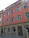
Residential building in closed development (same structural design as Barbiergasse 4) | Barbiergasse 3 (map) |
18th century (residential building) | with shop, of importance in terms of building history and urban planning |
09220204 |
 |
Residential house in closed development (same structural design as Barbiergasse 3) with side wing in the courtyard | Barbiergasse 4 (map) |
18th century (residential building) | Residential house with shop, of importance in terms of building history and urban planning |
09220205 |
 |
Residential building in closed development | Barbiergasse 5 (map) |
1st half of the 19th century (residential building) | Of importance in terms of building history and urban planning |
09220019 |
 |
Residential building in closed development | Barbiergasse 6 (map) |
1st half of the 19th century (residential building) | Of importance in terms of building history and urban planning |
09225388 |
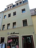 |
Residential building in closed development | Barbiergasse 7 (map) |
Late 18th century (residential building) | Of importance in terms of building history and urban planning |
09220198 |
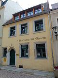 |
Residential building in closed development | Barbiergasse 8 (map) |
16th century (residential building) | Significant in terms of building history and urban development, a renaissance building with a simple arched portal |
09220196 |
 |
Residential house in closed development, corner house | Barbiergasse 9 (map) |
3rd quarter of the 16th century (residential building) | Significant in terms of building history and urban development, with a Renaissance seating niche portal |
09220194 |
 |
Angel dungeon | Barbiergasse 10 (map) |
marked 1624 (residential building) | Residential house (two building parts) in closed development, corner house with side wing in the courtyard and rear building; Architecturally, artistically, art-historically and in terms of urban development, a Renaissance building with a seating niche portal and a splendid oriel that characterizes the street (so-called angel bay) |
09220193 |
 |
Residential building in closed development | Barbiergasse 11 (map) |
17th century (residential building) | Significant in terms of building history and urban development, essentially a Renaissance building |
09220195 |
 |
Residential building in closed development | Barbiergasse 12 (map) |
Late 19th century (residential building) | Architecturally and urbanistically important, a Wilhelminian style house (clinker brick facade) |
09220197 |
 |
Residential house (two house numbers) in closed development, with side wing in the courtyard | Barbiergasse 14; 15 (card) |
Late 19th century (residential building) | Significant in terms of building history and urban development, early Wilhelminian style building |
09220199 |
 |
Apartment building in closed development | Barbiergasse 16 (map) |
marked 1887 (tenement house) | with a shop front, of architectural and urban importance, a Wilhelminian style house |
09220207 |
 |
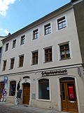
Residential building in closed development | Barbiergasse 17 (map) |
18th century (residential building) | Significant in terms of building history and urban development, with a baroque segment arch portal and a more recent shop fitting |
09221208 |
 |
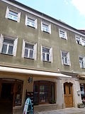
Residential house in closed development, with side wing in the courtyard and rear building | Barbiergasse 18 (map) |
End of 18th century, older in core (residential building) | Significant in terms of building history and urban development, essentially a renaissance building with a baroque segment arch portal |
09220206 |
 |
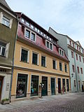
Residential house in closed development, with side wing in the courtyard | Barbiergasse 19 (map) |
marked 1752, older in the core (residential building) | Significant in terms of architectural history and urban development, a renaissance building with a baroque segment arch portal |
09220203 |
 |
Residential house in closed development, with side wing in the courtyard | Barbiergasse 20 (map) |
17./18. Century (residential building) | Significant in terms of building history and urban development, essentially a Renaissance building, shop front from the Wilhelminian era |
09220200 |
 |
villa | Dohnaischer Platz 6 (map) |
around 1910 (villa) | Significant in terms of building history and urban development, a building in the Referom style from around 1910, sophisticated in the neo-baroque style, characterizing the townscape on the ramparts |
09220267 |
 |
Tenement house, corner house in semi-open development | Dohnaischer Platz 8 (map) |
1870s (tenement) | Significant in terms of building history and urban development, a building from the early Wilhelminian era with balconies that characterize the square and characterize the townscape on the ramparts |
09220268 |
 |
Apartment building in closed development | Dohnaische Strasse 27 (map) |
Late 19th century (tenement house) | Significant building history and urban planning, a Wilhelminian style house (clinker brick facade) with a bay window that characterizes the street scene, original, lavishly decorated shop front |
09220170 |
 |
Apartment building in closed development | Dohnaische Strasse 29 (map) |
Late 19th century (tenement house) | Architecturally and urbanistically important, a Wilhelminian style house, magnificent sandstone facade with balconies |
09220171 |
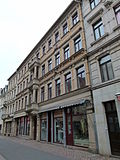 |
Apartment building in closed development | Dohnaische Strasse 31 (map) |
Late 19th century (tenement house) | with the original shop front, of architectural and urban significance, a Wilhelminian style house (clinker brick facade), magnificent facade with balconies that characterize the street |
09220173 |
 |
Apartment building in closed development | Dohnaische Strasse 33 (map) |
Late 19th century (tenement house) | with shop, of architectural, artistic and urban significance, a Wilhelminian style house (sandstone facade) in the neo-renaissance style, facade with balconies |
09220174 |
 |
Residential house in closed development, with side wing in the courtyard | Dohnaische Strasse 35 (map) |
Late 18th century (residential building) | Of importance in terms of building history and urban planning |
09220180 |
 |
Residential house in closed development and side wing in the courtyard | Dohnaische Strasse 37 (map) |
17th century, remodeled at the end of the 19th century (residential building) | Residential building with shop fitting, of architectural and urban significance, essentially a Renaissance building, redesigned in the Wilhelminian era (dwarf house with volutes in the roof) |
09220181 |
 |
Residential building in closed development | Dohnaische Strasse 39 (map) |
1st half of the 19th century (residential building) | with shop fitting, of importance in terms of building history and urban planning |
09227356 |
 |
Residential house in closed development, with side wing in the courtyard | Dohnaische Strasse 41 (map) |
1776 (according to information) | Significant in terms of architectural history and urban development, a baroque building with a representative central portal and pilaster-framed facade, gable with cat stairs |
09220188 |
 |
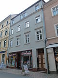
Residential house (two parts of the building) in a corner | Dohnaische Strasse 43 (map) |
2nd half of the 16th century (residential building) | Architecturally, artistically, characterizing the street scene and important in terms of urban planning, a renaissance patrician house with a mutilated seat niche portal, baroque conversions (mansard roof) |
09220168 |
 |
Residential building in closed development | Dohnaische Strasse 50 (map) |
1st half of the 19th century (residential building) | Of importance in terms of building history and urban planning |
09220169 |
 |
Residential building in closed development | Dohnaische Strasse 52 (map) |
around 1880 (residential building) | with shop fittings, of importance in terms of urban planning |
09227256 |
 |
Residential house in closed development, with rear building | Dohnaische Strasse 54 (map) |
around 1600 (residential building) | From a historical and urban point of view of importance, a renaissance building at its core, massive portal from a recent renovation |
09220172 |
 |
Residential building in closed development | Dohnaische Strasse 56 (map) |
around 1850 (residential building) | of urban significance |
09227328 |
 |
Residential house in closed development and rear building | Dohnaische Strasse 58 (map) |
1st half of the 19th century (residential building) | Residential building with built-in shop, of architectural and urban significance, interesting in terms of local history as a former bookbindery, beautiful shop front |
09220175 |
 |
Residential building in closed development | Dohnaische Strasse 60 (map) |
2nd half of the 19th century (residential building) | In terms of building history and urban planning, it is a building from the Wilhelminian era with still classicist echoes |
09220176 |
 |
Residential house in closed development and wooden arbor on Grohmannstrasse | Dohnaische Strasse 62 (map) |
1st half of the 19th century (house), around 1830 (gazebo) | Residential house with a shop fitting, of architectural and urban significance, the gazebo built on the escarp wall of the underground trench |
09220177 |
 |
Residential building in closed development | Dohnaische Strasse 64 (map) |
1st half of the 16th century (residential building) | Structurally, town-planning and art-historical of importance, in the core a late Gothic building (window frames with framework) |
09220178 |
 |
Residential house in closed development, with rear building | Dohnaische Strasse 66 (map) |
Early 18th century (residential building) | Of importance in terms of building history and urban development, unconventionally designed portal |
09220179 |
 |
Residential building in closed development | Dohnaische Strasse 70 (map) |
17th century, remodeled at the end of the 19th century (residential building) | Significant in terms of building history and urban development, at its core a Renaissance building, remodeled from the Wilhelminian era (roof extension) |
09220182 |
 |
Residential house in closed development, with side wing in the courtyard | Dohnaische Strasse 74 (map) |
around 1550, remodeling marked 1729 (residential house) | Architecturally, artistically, art-historically and in terms of urban development of importance, a Renaissance building with a beautiful portal in the auricle style |
09220183 |
 |
Abbey | Dohnaische Strasse 76 (map) |
17th century (residential house), 16th century (courtyard building) | Residential building (today the city library) in closed development, with courtyard wing and rear building (including the so-called plague house); Architecturally, artistically, art-historically, locally and in terms of urban development of importance, splendid Renaissance building with valuable round-arched portal, inside painted plank ceiling, rear building on the city wall with volute gables , as another courtyard building the so-called Pesthaus am Zollhof |
09220184 |
 |
Residential house in closed development (formerly the gateway to the Dominican monastery) | Dohnaische Strasse 78 (map) |
15th century (part of the monastery), marked 1688 (coat of arms on the facade) | Significant in terms of building history, urban development and local history, Renaissance building with a late Gothic core, the large arched passage from the former gateway to the Dominican monastery (today passage to Zollhof, see there and Grohmannstrasse 1), the coat of arms on the house comes from the broken upper gate |
09220185 |
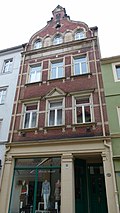 |
Residential building in closed development | Dohnaische Strasse 80 (map) |
marked 1898–1899 (residential building) | original shop front, of architectural and urban significance, a Wilhelminian style house (clinker brick facade) in the neo-renaissance style with a tail gable that characterizes the street |
09220186 |
 |
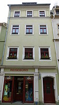
Residential building in closed development | Dohnaische Strasse 82 (map) |
16th century (residential building) | Significant in terms of building history and urban development, essentially late Gothic |
09220187 |
 |
Residential house in closed development with rear building | Dohnaische Strasse 84 (map) |
16th century, later remodeled (residential building) | Significant in terms of building history and urban planning, late Gothic in essence, remodeled from the Wilhelminian era (beautiful shop front) |
09220189 |
 |
Residential house in closed development, with rear building | Dohnaische Strasse 86 | 16th century, later remodeled (residential building) | Significant in terms of building history and urban planning, late Gothic in essence, remodeled from the Wilhelminian era (largely original shop front) |
09220190 |
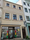 |
Residential house in closed development, with rear building and remains of the cloister of the neighboring monastery in the courtyard | Dohnaische Strasse 88 (map) |
16th century, later remodeled (residential building), late Gothic (cloister) | In terms of building history, local history and urban development, the house is essentially late Gothic, in the courtyard part of the medieval cloister (pointed arches with tracery fragments) of the neighboring former Dominican monastery |
09220191 |
 |
Residential house in closed development, with rear building | Dohnaische Strasse 90 (map) |
End of the 19th century, essentially older (16th century) | Architecturally and urbanistically important, late Gothic in essence, remodeled from the Wilhelminian era (beautiful shop front and street gable) |
09220192 |
 More pictures |
City wall and ramparts; Julius Otto Monument (individual monument for ID No. 09223768) | Dr.-Wilhelm-Külz-Strasse (map) |
marked 1874 (monument) | Individual monument of the city wall and ramparts: Monument to Julius Otto in the ramparts; Artistically and historically important, inscription: “Julius Otto. In memory of German singers. " |
09220279 |
 |
Residential and commercial building, corner house in closed development | Dr.-Wilhelm-Külz-Strasse 1 (map) |
around 1890 (tenement) | Significant in terms of building history and urban planning, a Wilhelminian style house (clinker brick facade) with corner bay window, defining the townscape on the ramparts |
09220269 |
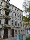 |
Apartment building in closed development | Dr.-Wilhelm-Külz-Strasse 1a (map) |
around 1880 (tenement) | Significant in terms of architectural history and urban development, a Wilhelminian style house with a representative facade, defining the townscape on the ramparts |
09220270 |
 |
Residential building in closed development | Dr.-Wilhelm-Külz-Strasse 1b (map) |
around 1850 (residential building) | Significant in terms of building history and urban development, characterizing the townscape on the ramparts |
09220271 |
 |
Catholic parish St. Kunigunde | Dr.-Wilhelm-Külz-Strasse 2 (map) |
around 1870 (rectory) | Catholic parish office of the parish of St. Kunigunde; Architecturally, artistically and in terms of urban planning, it is of importance, building a square by the church, a Wilhelminian style house in neo-Gothic style, defining the townscape on the ramparts |
09220272 |
 More pictures |
Kath. Kunigunden Church | Dr.-Wilhelm-Külz-Strasse 3 (map) |
1865 to 1869 (church); 1923 (glass painting); re. 1868 (reredos) | Catholic Church; Architecturally, artistically, art-historically and in terms of urban development of importance, parish church in neo-Gothic style, architect: Karl Adolf Canzler , characterizing the townscape on the ramparts. |
09220273 |
 |
Catholic parish St. Kunigunde | Dr.-Wilhelm-Külz-Strasse 4 (map) |
around 1870 (rectory) | Catholic rectory of the parish of St. Kunigunde; Architecturally, artistically and in terms of urban planning, it is of importance, building a square by the church, a Wilhelminian-style house in the neo-Gothic style, defining the townscape on the ramparts |
09220274 |
 |
Residential house in semi-open development | Dr.-Wilhelm-Külz-Strasse 5 (map) |
1870s (residential building) | Architecturally, artistically and urbanistically of importance, sophisticatedly designed Wilhelminian style house with still late classicist echoes, highlighted the central projection with balcony, characterizing the townscape on the ramparts |
09220275 |
 |
Residential house in semi-open development | Dr.-Wilhelm-Külz-Strasse 5b (map) |
1880s (residential house) | Significant in terms of building history and urban planning, a Wilhelminian style house, defining the townscape on the ramparts |
09220276 |
 |
Apartment building in half-open development | Dr.-Wilhelm-Külz-Strasse 6 (map) |
around 1900 (tenement) | Architecturally and urbanistically important, a Wilhelminian style house with corner bay window, representative historicist in style, characterizing the townscape on the ramparts |
09220277 |
 |
Tenement house, corner house in semi-open development | Dr.-Wilhelm-Külz-Strasse 6b (map) |
1890s (tenement) | Significant in terms of building history and urban development, a Wilhelminian style house in the German neo-renaissance style, distinctive corner design with balconies and turrets, side elevation with gable and balconies, characterizing the townscape on the ramparts |
09220278 |
 More pictures |
Residential house in semi-open development | Dr.-Wilhelm-Külz-Strasse 7 (map) |
1890s (residential building) | Significant in terms of building history and urban planning, a Wilhelminian style house, defining the townscape on the ramparts |
09220280 |
 More pictures |
Villa, with enclosure and arched door in the enclosure | Dr.-Wilhelm-Külz-Strasse 8 (map) |
around 1895 (villa) | Architecturally, artistically, in terms of town planning and local history of importance, a Wilhelminian style building in the German Neo-Renaissance style with a volute gable, characterizing the townscape on the ramparts |
09220281 |
 |
Residential building (two components) in corner location (rear building and side wing of Kirchplatz 6) | Fleischergasse 1b; 1c (card) |
End of 17th century (residential building) | Of importance in terms of building history and urban planning |
09220255 |
 |
Residential building in closed development (rear building of Niedere Burgstrasse 4) | Fleischergasse 4 (map) |
18th century (residential building) | Of importance in terms of building history and urban planning |
09223723 |
 |
Residential building in closed development | Fleischergasse 6 (map) |
marked 1792 (residential building) | Significant building history and urban planning, simple baroque building with basket arch portal |
09220254 |
 |
Residential and commercial buildings, with farm buildings | Fleischergasse 7; 7a; 7b; 8th; 8a; 8b; 8c (card) |
19th century (slaughterhouse) | Residential and commercial building (two parts of the house), with farm buildings on Holdergasse (No. 8a – 8c, today residential building with several entrances - forms a plot of land with Fleischergasse 9–9h); Significant in terms of building history and local history, originally part of the slaughterhouse |
09220253 |
| Farm building (today residential building) | Fleischergasse 9; 9a; 9b; 9c; 9d; 9e; 9f; 9g; 9h (card) |
19th century (farm building) | Farm building (today a residential building with several entrances, a plot of land with Fleischergasse 8–8c); of importance in terms of building history and local history |
09301264 |
|
 |
Tenement house, in a corner | Richtstrasse 4 (map) |
around 1905 (tenement) | In terms of building history and urban development, it is a building from the Wilhelminian era with echoes of Art Nouveau, characterizing the townscape on the ramparts |
09220282 |
 |
Tenement house | Richtstrasse 5 (map) |
1890s (tenement) | Of importance in terms of building history and urban planning |
09220283 |
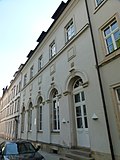 |
Wieders Variety Theater (formerly) | Richtstrasse 6 (map) |
marked 1896 (Varieté) | Theater, hall with large arched windows; of importance in terms of local history and urban planning |
09221230 |
 More pictures |
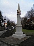
Saxon postal mileage column; Copy of a distance column
Post mileage |
Grohmannstrasse (map) |
marked 1722 (post distance column) | Copy of a distance column, of importance for traffic history Monument text Copy of a Kursächsische distance column marked 1722, made of sand, approx. 4.5 m is an obelisk in the typical form with distance information on a high base, each with two Polish and spa coats of arms and "AR" monogram and post horn mark was erected. The column originally stood in the Breite Gasse. In 1843 the column was moved to the entrance of the "Bread Basket Path". Around 1905, a new piece of writing made of Cotta sandstone was added to her and she was moved to Tischerplatz. The column has been placed at the entrance to Jacobäer Strasse since 1956. In 1983 the tip was replaced. |
09221076 |
 |
City wall and ramparts: bronze sculpture "Little Faun" in the promenade (individual monument for ID no. 09223768) | Grohmannstrasse (map) |
Cast 1913 (statue) | Individual monument of the urban wall and ramparts: bronze sculpture "Little Faun" in the promenade; Artistically and historically of importance, donated by the Beautification Association |
09223724 |
 More pictures |
City wall and ramparts: Memorial for the victims of fascism, in the promenade (individual monument for ID No. 09223768) | Grohmannstrasse (map) |
1953 (VdN / OdF) | Individual monument of the city wall and ramparts: Memorial for the victims of fascism, in the promenade; Historically and locally of importance, with the inscription “Die Toten admon”. |
09301496 |
 |
Main customs office | Grohmannstrasse 1 (map) |
1834 (customs house) | Administration building with side wing in the courtyard (so-called customs yard); Significant in terms of building history, urban development and local history, stately classical building with a central projection with triangular gable, defining the townscape on the ramparts |
09220260 |
| Garden shed and enclosure | Grohmannstrasse 2b (map) |
around 1830 (garden house) | Significant in terms of building history, urban development and local history, classicist garden house, built on the escarp wall of the underground trench, characterizing the townscape on the ramparts |
09220263 |
|
| Garden shed | Grohmannstrasse 2c (map) |
around 1830 (garden house) | Significant in terms of building history, urban development and local history, classicist garden house, built on the escarp wall of the underground trench, characterizing the townscape on the ramparts |
09220264 |
|
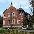 |
villa | Grohmannstrasse 2d (map) |
marked 1891 (residential building) | Significant in terms of architectural history and urban development, a Wilhelminian-style building (raw brick construction) with turrets and tail gable, defining the townscape on the ramparts |
09220265 |
 |
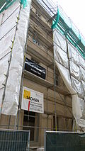
Residential building in closed development | Holdergasse 1 (map) |
18th century (residential building) | Of importance in terms of building history and urban planning |
09227085 |
 |
Residential house, corner house in closed development | Holdergasse 3 (map) |
around 1850 (residential building) | Significant in terms of building history, house history and urban development, sophisticated facade facing Langen Straße, defining the street scene |
09220102 |
 |
Residential building | Holdergasse 4 (map) |
18th century (residential building) | Architecturally and urbanistically important, with basket arch portal |
09220103 |
 |
Residential building (set back from the street) | Holdergasse 5 (map) |
19th century (residential building) | Structurally and historically important, probably built on the city wall |
09227086 |
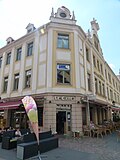 |
Residential house, corner house in half-open development, with shops and rear building | Jacobäerstraße 1 (map) |
1890s, older in essence (residential building) | Significant in terms of architectural history and urban development, facades from the Wilhelminian era with gables that characterize the street scene (these with obelisks), the building is essentially older |
09221075 |
 |
Single storey sales pavilion | Jacobäerstraße 2 (map) |
1920s (sales pavilion) | Significant in terms of building history and urban development, Art Deco design |
09225223 |
 |
Tenement house, corner house | Jacobäerstraße 3 (map) |
marked 1891 (tenement house) | with a shop, of architectural and urban significance, a Wilhelminian style house (clinker brick facade) with a corner bay that characterizes the street and defines the townscape on the ramparts |
09221071 |
 |
House in a corner | Jacobäerstraße 4 (map) |
19th century (residential building) | Significant in terms of building history and urban development, characterizing the townscape on the ramparts |
09227076 |
 |
Apartment building in closed development, with shops | Jacobäerstraße 5 (map) |
1880s (tenement) | In terms of building history and urban development, it is a building from the Wilhelminian era |
09221072 |
 |
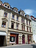
Apartment building in closed development | Jacobäerstraße 6 (map) |
1880s (tenement) | with a shop, of architectural and urban importance, a Wilhelminian style house |
09221073 |
 |
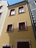
Apartment building in closed development | Jacobäerstraße 7 (map) |
1880s (tenement) | Significant in terms of building history and urban development, a Wilhelminian style house with a central projecting that defines the street scene and roof houses and original shop fronts |
09221074 |
 |
Residential building in closed development (a plot of land with Am Markt 6) | Kirchgasse 1 (map) |
18th century (residential building) | Of importance in terms of building history and urban planning |
09221223 |
 |
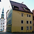
Residential building in closed development | Kirchgasse 2 (map) |
probably 17th century (residential building) | Of importance in terms of building history and urban planning |
09221224 |
 |
Residential house in closed development, in a corner | Kirchgasse 3 (map) |
2nd half of 17th century (residential building) | Architecturally and urbanistically of importance, gable-independent building (semi- gable ) |
09221225 |
 |
Well trough (northeast of the choir of St. Marien) | Kirchplatz (map) |
marked 1768 (fountain) | Artistically, technologically and historically important |
09220050 |
 More pictures |
Residential house, corner house in closed development | Kirchplatz 1 (map) |
around 1550 (residential building) | From an architectural and urban point of view of importance, a Renaissance building with a volute gable facing Töpfergasse |
09220038 |
 More pictures |
Residential building in closed development | Kirchplatz 2 (map) |
marked 1525 in the portal (residential building) | Architecturally, artistically and in terms of urban development, a Renaissance building with a seating niche portal, inside a spiral staircase |
09220039 |
 More pictures |
Residential building in closed development | Kirchplatz 3 (map) |
2nd half of the 16th century (residential building) | Architecturally and urbanistically important, a Renaissance building with the remains of a seating niche portal and gate passage |
09220040 |
 More pictures |
Residential house (restaurant on the ground floor) in closed development, with rear building | Kirchplatz 4 (map) |
around 1550 (residential building) | Architecturally and urbanistically important, a Renaissance building with a seating niche portal |
09220041 |
 More pictures |
Hotel German House | Kirchplatz 5 (map) |
marked on the relief 1561, remodeling marked 1804 (residential house) | Residential building (later a hotel) in closed development, with shops; From an architectural and urban point of view of importance, a redesigned Renaissance building with a later gate passage |
09220042 |
 More pictures |
House (three entrances) in a corner | Church square 6; 6a; 6b (card) |
Early 17th century (residential building) | Residential building (three entrances) in the corner (rear building and side wing, see Fleischergasse 1b / 1c); Significant in terms of building history and urban development, essentially a Renaissance building |
09220043 |
 More pictures |
Residential house in (formerly) closed development | Kirchplatz 7 (map) |
Early 17th century (residential building) | Significant in terms of building history and urban development, typical Renaissance building |
09220044 |
 More pictures |
Old girls school | Kirchplatz 10 (map) |
End of the 16th century (residential building) | Residential building (former school) in closed development; Architecturally, historically and urbanistically of importance, a Renaissance building with remarkable window frames, former girls' school (Mägdleinschule). |
09220045 |
 More pictures |
Residential house in semi-open development | Kirchplatz 11 (map) |
18th century (residential building) | Residential house in semi-open development (a plot of land with Schloßstraße 1) with side gate entrance; Of importance in terms of building history and urban planning |
09220046 |
 More pictures |
Residential house in closed development (a plot of land with Am Markt 4) | Kirchplatz 12 (map) |
18th century (residential building) | Significant in terms of building history and urban development, with a beautiful portal |
09220047 |
 More pictures |
Rectory | Kirchplatz 13 (map) |
around 1890 (rectory) | Corner house in closed development; Architecturally and urbanistically important, a Wilhelminian style house with a representative facade in the style of the neo-renaissance |
09220048 |
 More pictures |
Ev. St. Marien town church; Marienkirche | Kirchplatz 14 (map) |
1466–1479 (tower), inscribed 1502 and inscribed 1546 (nave), mid-16th century (cycle of paintings), 1889/1890 (glass painting), 1570/71 (north gallery) | Church (with equipment); one of the important late-Gothic hall churches in Saxony, historically, art-historically, artistically, shaping the townscape, important in terms of local history and urban planning. The ev.-luth. The town church of St. Mary was built between 1502 and 1546 in place of an older Gothic building. |
09220049 |
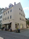 |
House in a corner | Klosterhof 1 (map) |
1st third of the 18th century (residential building) | Of importance in terms of building history and urban planning |
09221190 |
 |
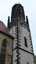
Dominican monastery (formerly); city Museum | Klosterhof 2 (map) |
around 1500 (refectory) | Probably the former summer refectory of the Dominican monastery (also called Marienkapelle) and then the two-storey former chapter house of the monastery, now the city museum; Architecturally, art-historically, artistically, in terms of urban development and local history of importance, characterizing the townscape near the ramparts. The Pirna City Museum was created from the merger of the Museum of the Municipal Trade Association, established in 1861, and the museum collections of the Mountain Association for Saxon Switzerland, which had been in existence since 1878 . Since 1923, the city museum's exhibitions have been located in the chapter house building of the former monastery. |
09220258 |
 More pictures |
Dominican monastery church (formerly); St. Heinrich Monastery Church | Klosterhof 2 (near) (map) |
around 1300 (part of the monastery) | Former monastery church of the Dominican monastery, today cath. Church; Architecturally, historically, art-historically, artistically, characterizing the townscape and important in terms of urban planning, rare two-aisled, late Gothic hall church, located between the cloister courtyard and Zollhof, characterizing the townscape near the ramparts |
09221213 |
 |
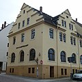
Former school, today administration building (city archive) | Klosterhof 3 (map) |
1828–1830, later reshaped (school) | Former School, important in terms of building history, local history and urban development, stately building of classicism , defining the townscape on the ramparts |
09220257 |
 More pictures |
Restaurant to the steamship | Klosterhof 4 (map) |
around 1900 (residential building) | Residential house (two buildings), the corner house with restaurant; In terms of building history and urban development, the corner house is a Wilhelminian style building with volute gables that characterize the street |
09220256 |
Remarks
- This list is not suitable for deriving binding statements on the monument status of an object. As far as a legally binding determination of the listed property of an object is desired, the owner can apply to the responsible lower monument protection authority for a notice.
- The official list of cultural monuments is never closed. It is permanently changed through clarifications, new additions or deletions. A transfer of such changes to this list is not guaranteed at the moment.
- The monument quality of an object does not depend on its entry in this or the official list. Objects that are not listed can also be monuments.
- Basically, the property of a monument extends to the substance and appearance as a whole, including the interior. Deviating applies if only parts are expressly protected (e.g. the facade).
Detailed memorial texts
- ↑ The Pirna Town Hall is essentially one of the oldest buildings in the city; it was first mentioned in 1386. After a fire in 1486 a new building was built in the late Gothic style. The main portal on the east side bears witness to this. In 1555/56 the three-storey building was fundamentally converted. The distinctive Renaissance gables, the window frames and the cornices that structure the building have been preserved from this renovation. The baroque tower was added in 1718, the balcony on the south side followed in 1769. For centuries the town hall was more a trading than an administrative building. It offered the butchers ( meat bank), bakers and cloth makers fixed sales stands and rooms. It also housed the council chamber as well as archive and combing rooms. With the introduction of the Saxon City Code (1832), the space required by the administration increased, so that the meat banks were demolished in 1878 and replaced on the west and north side by an extension in the neo-renaissance style. But until the beginning of the 20th century, shops and stores were on the ground floor. The building has several historically remarkable details, including in particular the old city coat of arms (east side), which was valid until 1549, the relief of Mayor Fuchs from 1551 (south side), the figure of Justitia created in 1612 (west side), the sundial from 1637 (south side) and the art clock with the three-dimensional city coat of arms (east side). The lions strike the hours with their paws. The eastern dial of the clock still has a Renaissance dial, here the long hand shows the hours and the small hand shows the minutes. The building was completely renovated between 1991 and 1997 as part of the urban redevelopment.
- ↑ The three-story house at Am Markt 3 is one of the most important buildings in Pirna in terms of architectural history. It was built in 1506 by the master builder Peter Ulrich and used as his own house. At that time Ulrich was entrusted with the construction of the neighboring town church of St. Mary . Over the centuries, the building has undergone multiple changes in use and renovations. The first Pirna pharmacy was housed in a ground floor room with a cell vault from 1572 to 1575 (later Am Markt 17). Numerous late Gothic window frames as well as the striking seat niche portal with five-fold keel arch have been preserved from the original building. The Renaissance gable on the east side (church square) of the house, which is also worth seeing, is largely covered by a neighboring building. On the upper floor there is also a plank and beam ceiling dated to the year of construction 1506. The building is now owned by the famous artist Tom Pauls , who had it completely renovated from 2009 to 2011. It is used as a theater and is the seat of the Ilse Bähnert Foundation .
- ↑ In 1722, the Electorate of Saxony began to erect the Saxon post-mile pillars. Elector Friedrich August I wanted to build a modern traffic and transport control system in the electorate in order to promote trade and economy. He entrusted Magister Adam Friedrich Zürner (1679–1742) with the implementation. The system of post mile pillars comprised distance pillars, quarter milestones, half and full mile pillars. The distance columns should be set up in the cities in front of the city gates, later only on the marketplaces. Quarter milestones, half and full mile pillars were set up along the Poststrasse. They received a consecutive numbering (row number), starting from the beginning of the measurement. The all-mile columns were set up outside the cities on the post roads at a distance of 1 mile (= 9.062 km). The distance pillars were marked with the monogram "AR" for "Augustus Rex", the Electoral Saxon and Polish-Lithuanian double coat of arms and the Polish royal crown. The full mile, half mile columns and quarter milestones were all similarly labeled, none of them had a coat of arms, but the monogram "AR". The distances were given in hours (1 hour = ½ post mile = 4.531 km). This mile system was the first European traffic management system. As part of the nationally significant postal system, the pillar considered here is of great importance for the history of traffic (LfD / 2013).
- ↑ It is a three-aisled hall church with seven bays. The central nave is provided with semitons and net vaults, the side aisles have star vaults. With its internal dimensions of 65 meters in length and 35 meters in width, the Marienkirche is one of the largest Saxon hall churches after the Peterskirche in Görlitz and the Annenkirche in Annaberg-Buchholz . With a roof ridge height of 40 meters, it characterizes the image of Pirna's old town. The interior offers space for around 1,000 visitors. The 60 meter high tower was added to the previous building as early as 1466–1479. Inside, the painting of the vaulted ceiling from 1545/46 is particularly worth seeing. The central themes of the Lutheran teaching (which was still new at the time) are presented . The late Gothic sandstone pulpit (around 1520), the 10 meter high sandstone altar (1612) and the baptismal font with its 26 children's figures (1561) are also noteworthy in terms of monument preservation. Between 1995 and 2005, around € 4.5 million was invested in the structural renovation of the interior and exterior of the Marienkirche.
swell
Web links
Individual evidence
- ↑ Redevelopment area 'Old Town Pirna' (accessed on July 25, 2012; PDF; 212 kB)
- ^ Oskar Speck (Ed.): The former town fortifications of Pirna and their remains (accessed on July 25, 2012)
