List of listed objects in St. Gotthard im Mühlkreis
The list of listed objects in St. Gotthard im Mühlkreis contains the 13 listed , immovable objects of the municipality of St. Gotthard im Mühlkreis in Upper Austria ( Urfahr-Umgebung district ).
Monuments
| photo | monument | Location | description | Metadata |
|---|---|---|---|---|

|
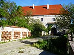
Eschelberg Castle ObjectID : 10386 |
Eschelberg 1 KG location : St. Gotthard |
The three-storey four-wing building with an asymmetrical rectangular courtyard, gate tower and chapel was built from 1596. |
ObjectID : 10386 Status : Notification Status of the BDA list: 2020-02-29 Name: Schloss Eschelberg GstNr .: 1029 Schloss Eschelberg |

|
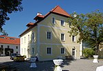
Forsthaus, former Pflegerstöckl ObjectID: 10387 |
Eschelberg 2 KG location : St. Gotthard |
The Pflegerstöckl is a two-story Renaissance building from the end of the 16th or beginning of the 17th century. The facade from around 1600 was accentuated by means of cast stone blocks , a console cornice, a cordon cornice and a rounded entrance gate. |
ObjectID: 10387 Status: Notification Status of the BDA list: 2020-02-29 Name: Forsthaus, former Pflegerstöckl GstNr .: 1029 |

|
Former Prison ObjectID : 10389 |
Eschelberg 4 KG location : St. Gotthard |
The former prison was built in the 17th and 18th centuries and was used until the 19th century. The two-storey baroque building with a rectangular floor plan and a crooked roof has a facade with a plaster frame structure. |
ObjectID : 10389 Status : Notification Status of the BDA list: 2020-02-29 Name: Former Prison GstNr .: 1029 Former prison Eschelberg |

|
Castle and castle ruins Rottenegg ObjektID: 10392 |
Hofberg 1 KG location : St. Gotthard |
The castle, mentioned in a document in 1285, lies at the confluence of the small Rodl and the large Rodl and has been in decline since 1712. There are four-storey outer walls on three sides. Only a few remains of the wall remain. |
ObjectID: 10392 Status: Notification Status of the BDA list: 2020-02-29 Name: Rottenegg castle and palace ruins GstNr .: 1782/1 Rottenegg castle ruins (St. Gotthard) |

|
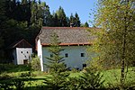
Unterreithmühle including Pressstöckl ObjectID : 10383 |
Reithmühl 13 KG location : St. Gotthard |
Medieval building with house, mill and free-standing press house. The remarkable facility has a Riemling ceiling with armor tree from 1783 and is adapted to the site. |
ObjectID: 10383 Status: Notification Status of the BDA list: 2020-02-29 Name: Unterreithmühle including Pressstöckl GstNr .: 287/2; 295/2 Unterreithmühle |

|
Via Regia ObjectID : 10398 |
Rottenegg location KG: St. Gotthard |
Technical monument. The former trade route, also known as the Krumau Reichsstrasse , is around 1 km long and still has the historical paving with river stones. |
ObjectID : 10398 Status: § 2a Status of the BDA list: 2020-02-29 Name: Via Regia GstNr .: 1892/1 |

|
Residential building, former butcher's shop , so-called butcher's house ObjectID : 10397 |
Rottenegger Straße 3 KG location : St. Gotthard |
The three-wing group of buildings was built around 1800 with a classical facade. Inside there is a barrel vault, outside a picture of a house depicting a bull slaughter. |
ObjektID : 10397 Status : Notification Status of the BDA list: 2020-02-29 Name: Residential house, former butcher shop , so-called butcher's house GstNr .: 1562 butcher's house |

|
Catholic parish church hl. Gotthard ObjectID : 10369 |
St. Gotthard location KG: St. Gotthard |
A two-story hall church with a late Gothic choir. The interior decoration and painting are still completely preserved from the later historicism. |
ObjectID : 10369 Status: § 2a Status of the BDA list: 2020-02-29 Name: Catholic parish church hl. Gotthard GstNr .: 1 parish church St. Gotthard |

|
Parsonage Object ID: 10370 |
St. Gotthard 1 KG location : St. Gotthard |
Located to the northeast of the church with surrounding gardens. Two-storey residential building with three wings that was built at the end of the 16th century. |
ObjectID : 10370 Status: § 2a Status of the BDA list: 2020-02-29 Name: Pfarrhof GstNr .: 9 Pfarrhof St. Gotthard |

|
Christian cemetery ObjectID : 10371 |
at St. Gotthard 1 location KG: St. Gotthard |
Located in a ring around the church and surrounded by a wall. A war memorial stands north on the wall. |
ObjectID : 10371 Status: § 2a Status of the BDA list: 2020-02-29 Name: Friedhof christlich GstNr .: 1; 9 St. Gotthard cemetery |

|
Residential building, former elementary school ObjectID : 10372 |
St. Gotthard 2 KG location : St. Gotthard |
Built around 1833 and converted into a residential building in 1953. |
ObjectID : 10372 Status: § 2a Status of the BDA list: 2020-02-29 Name: Residential house, former elementary school GstNr .: 208 Former elementary school St. Gotthard |

|
Elementary school ObjectID : 10373 |
St. Gotthard 3 KG location : St. Gotthard |
Built between 1949 and 1951. Cubic floor plan with hipped roof with two storeys. |
ObjectID : 10373 Status: § 2a Status of the BDA list: 2020-02-29 Name: Volksschule GstNr .: 208 Volksschule St. Gotthard |

|
Castle ruins ObjectID : 10385 |
Eschelberg location KG: St. Gotthard |
A Romanesque-Gothic complex in the southeast of the castle with a medieval wall. Connected to the castle via the chapel and the keep. Remnants of the wall still exist today. |
ObjectID : 10385 Status : Notification Status of the BDA list: 2020-02-29 Name: Burgruine GstNr .: 1029 |
literature
- Peter Adam, Beate Auer, u. a: Dehio Handbook Upper Austria. Volume 1, Mühlviertel. Verlag Berger, Horn, Vienna 2003, ISBN 3-85028-362-3
Web links
Commons : Listed objects in St. Gotthard im Mühlkreis - collection of images, videos and audio files
Individual evidence
- ^ Upper Austria - immovable and archaeological monuments under monument protection. (PDF), ( CSV ). Federal Monuments Office , as of February 18, 2020.
- ↑ § 2a Monument Protection Act in the legal information system of the Republic of Austria .
