
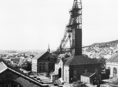
List of mines in Saarland
The list of mines in Saarland shows the pits, mines, tunnels and other operating points in Saarland that fall under mining law . Mining in Saarland already existed in Celtic times and has been documented since 1429. Hard coal was mainly mined. With the onset of industrialization in Germany from 1850 onwards, the sharp increase in demand for coal resulted in an enormous expansion of mining on the Saar. In June 2012, mining in Saarland ended with the closure of the Saar mine .
| Surname | District / City | Remarks | Depth (noun) | Beginning |
The End |
RAG no. / Source | location | image |
|---|---|---|---|---|---|---|---|---|
| Düppenweiler | Merzig-Wadern (LK) | Copper; today visitor mine | 1723 | 1916 | location |

|
||
| (in the high forest) | Merzig-Wadern (LK) | ore | 1845 | 1943 | ||||
| Altenwald | Neunkirchen (LK) | Day slot A; coal | 60 | 1901 (approx.) | 1937 | S 20104 | location |

|
| Altenwald | Neunkirchen (LK) | Day slot B; coal | 70 | S 20105 | location |

|
||
| Dechen | Neunkirchen (LK) | Dechen shaft 1, also called: middle shaft; coal | 386 | 1854 | 1973 | S 20138 | location |

|
| Dechen | Neunkirchen (LK) | Dechen shaft 2; coal | 635 | 1856 | 1968 | S 20131 | location |

|
| Dechen | Neunkirchen (LK) | Dechen shaft 3, also called: middle shaft; Coal; first shaft in the Saar district with iron expansion | 615 | 1867 | 1963 (approx.) | S 20136 | location |

|
| Dechen | Neunkirchen (LK) | Dechen shaft 4; coal | 318 | 1868 | 1938 | S 20048 | location |

|
| Dechen | Neunkirchen (LK) | Moselle shaft; Coal; Remains of the iron weather system can be seen | 366 | 1887 | 1952 | S 20046 | location |

|
| Dechen | Neunkirchen (LK) | 30-inch weather shaft on seam; coal | 11 | S 20256 | location |

|
||
| Dudweiler hunter's joy | Saarbrücken (RV) | Coal; Consolidation of Dudweiler and Jägersfreude | ||||||
| Eisenstein Carl | Neunkirchen (LK) | Ore gallery; Iron; Gallery of the Carl iron mine; reconstructed mouth hole | 1802 | location |

|
|||
| Pit basket | Iron (Nohfelden) | Operator Feldhaus Schwerspatgrube GmbH; Iron ore, manganese, barite | 120 | 1912 | 1989 | location |

|
|
| Dechen | Neunkirchen (LK) | 30-inch weather shaft on seam; coal | 11 | S 20256 | location |
|
||
| Hendt | ? | Coal? | 1868 (at least) | |||||
| Friedrichsthal | Neunkirchen (LK) | Rising cross passage; Coal; rising crosscut in the Motz seam | 1873 | 1931 (or earlier) | SM 20191 | location |

|
|
| Gottelborn | Neunkirchen (LK) | Collapsing line of seam Wahlschied; Coal; Covered with concrete slab; Cross section approx. 3 × 4 m | 1907 | SM 60003 | location |

|
||
| Heinitz | Neunkirchen (LK) | Wayside shrine shaft, also called: wayside shrine shaft 2; coal | 451 | 1887 | 1938 | S 20059 | location |

|
| Heinitz | Neunkirchen (LK) | Heinitz Stollen; Coal; Portal was implemented in the Heinitzpark in 1979; An iron plaque was installed at the original position of the former tunnel mouth hole | 1847 | 1979 (or earlier) | location |

|
||
| Heinitz | Neunkirchen (LK) | Heinitz shaft 1; coal | 255 | 1851 | 1924 | location |

|
|
| Heinitz | Neunkirchen (LK) | Heinitz shaft 2; coal | 566 | 1852 | 1964 | location |
|
|
| Heinitz | Neunkirchen (LK) | Day access in seam Waldemar; Coal; 28 m northwest of Heinitzschacht 1 | 1854 | location |

|
|||
| Heinitz | Neunkirchen (LK) | Geisheckschacht 1; coal | 585 | 1881 | 1971 | S 20139 | location |

|
| Heinitz | Neunkirchen (LK) | Geis tail shaft 2; coal | 578 | 1897 | 1963 | S 20058 | location |

|
| Heinitz | Neunkirchen (LK) | Binsenthal shaft; coal | 316 | 1874 | 1938 | S 20049 | location |

|
| Heinitz | Neunkirchen (LK) | Heinitz WS tunnel; Coal; Tunnel opening directly in front of the fan shaft; possibly a second access to the shaft | location |

|
||||
| Heinitz | Neunkirchen (LK) | Fan shaft 2; Coal; had a 22 m high chimney and weather stove; Decommissioned in 1938 | 338 | 1871 | 1957 | location |

|
|
| Heinitz | Neunkirchen (LK) | Freidelstollen; Water supply tunnel for the Heinitz mine | 1863 | SM 20242 | location |

|
||
| Heinitz | Neunkirchen (LK) | Heinitz tunnel in the hanging wall; Coal; Breakthrough into Binsenthal | 1849 | location |

|
|||
| Heinitz | Neunkirchen (LK) | Heinitz shaft 3; coal | 587 | 1855 | 1964 | S 20055 | location |

|
| Heinitz | Neunkirchen (LK) | Heinitz shaft 4; coal | 388 | 1866 | 1934 | S 20056 | location |

|
| Heinitz | Neunkirchen (LK) | Heinitz P tunnel; coal | location |

|
||||
| Heinitz | Neunkirchen (LK) | Weather shaft to Borstel seam; Coal; Location of a weather furnace | 1867 | 1961 | location |

|
||
| Itzenplitz | Neunkirchen (LK) | Itzenplitz 1; coal | 423 | 1860 | 1999 (or earlier) | location |

|
|
| Itzenplitz | Neunkirchen (LK) | Itzenplitz 2; coal | 1872 | 1999 | location |

|
||
| Itzenplitz | Neunkirchen (LK) | Itzenplitz 3; Coal; Oldest winding tower in Saarland | 406 | 1882 | 1996 | location |

|
|
| Itzenplitz | Neunkirchen (LK) | Kallenbrunnenschacht; Coal; The brick walls are still in pretty good shape | 1900 | location |

|
|||
| Itzenplitz | Neunkirchen (LK) | Incident route; Coal; Inclining route to the Rußhütte tunnel; second exit of the air raid shelter | SM 20096 | location |

|
|||
| Itzenplitz | Neunkirchen (LK) | Heiligenwald shaft; Coal; Location of a fan | 184 | 1866 | 1938 | location |

|
|
| Kohlwald | Neunkirchen (LK) | Annaschacht 2, also called: Brunhilde-Schacht; coal | 608 | 1911 | 1969 (approx.) | S 20172 | location |

|
| Kohlwald | Neunkirchen (LK) | Annaschacht 4; coal | 362 | 1954 | 1969 | S 20173 | location |

|
| Kohlwald | Neunkirchen (LK) | Marcel-Bertrand-Schacht 1, also called: Schiffweilerschacht 1; coal | 596 | 1925 | 1980 | location |

|
|
| Kohlwald | Neunkirchen (LK) | Marcel-Bertrand-Schacht 2, also called: Schiffweilerschacht 2; coal | 377 | 1943 | 1980 | location |

|
|
| Kohlwald | Neunkirchen (LK) | Driving distance; Coal; possibly identical to "Herminenstollen", SBK 1938 | 1878 | SM 20138 | location |

|
||
| Kohlwald | Neunkirchen (LK) | Hermineschacht 1, also called: Schacht auf der Oberschmelz; coal | 520 | 1889 | 1966 | S 20034 | location |

|
| Kohlwald | Neunkirchen (LK) | Hermineschacht 2, also called: Ventilatorschacht Hermione; coal | 499 | 1880 | 1966 | S 20035 | location |

|
| Kohlwald | Neunkirchen (LK) | Hermineschacht 3, also called: Schacht Oberschmelz III; coal | 634 | 1929 | 1985 | location |

|
|
| Kohlwald | Neunkirchen (LK) | Old Kohlwaldschacht, also called: Kohlwaldschacht; Coal; had problems with strong water influx | 175 | 1868 | 1954 | S 20030 | location |

|
| Kohlwald | Neunkirchen (LK) | Annaschacht 1, also called: Sieglindeschacht 1; coal | 366 | 1892 | 1959 | S 20062 | location |

|
| Kohlwald | Neunkirchen (LK) | Annaschacht 3, also called: Sieglindeschacht 2; coal | 160 | 1898 | 1959 | location |
|
|
| Kohlwald | Neunkirchen (LK) | Landsweilerweg shaft; coal | 18th | 1820 (or earlier) | 1887-1900 | S 20069 | location |

|
| Kohlwald | Neunkirchen (LK) | Eulenthalstollen; Coal; served for driving and as a water solution tunnel | 1790 (approx.) | 1883 (or later) | location |

|
||
| Kohlwald | Neunkirchen (LK) | Wolfangerseck experimental pit; coal | 73 | 1860-1870 | 1885-1900 | S 20067 | location |

|
| Kohlwald | Neunkirchen (LK) | Eulenthal weather shaft; Coal; Weather shaft to Follenius seam | 50 | S 20032 | location |

|
||
| Kohlwald | Neunkirchen (LK) | Wingertsgraben weather shaft; coal | 30th | 1886 | S 20031 | location |

|
|
| Kohlwald | Neunkirchen (LK) | 1.40 m seam; Coal; recorded in Kliver map 1887; Flöz later called "Freund" | 1887 (or earlier) | location |

|
|||
| king | Neunkirchen (LK) | Wilhelmschacht 1, also called: conveying and drainage shaft or main shaft or machine shaft; coal | 854 | 1844 | 1985 | S 20153 | location |

|
| king | Neunkirchen (LK) | Wilhelmschacht 2; coal | 660 | 1854 | 1972 | S 20140 | location |

|
| king | Neunkirchen (LK) | Wilhelmschacht 4; coal | 420 | 1886 | 1953 | location |

|
|
| king | Neunkirchen (LK) | Gegenortschacht; Coal; Headframe from 1900 is the third oldest in the Saar district and was used by the Frankenholz 3 shaft until 1960 | 1859 | 1957 | 1994 | location |

|
|
| King Wellesweiler | Neunkirchen (LK) | Coal; Consolidation of König and Wellesweiler | ||||||
| Maybach | Neunkirchen (LK) | Jungewald-Schacht; Coal; Moving weather shaft | 906 | 1910 | 1981 | S 20137 | location |

|
| Maybach | Neunkirchen (LK) | Erkershöhe shaft; coal | 153 | 1879 | S 20082 | location |

|
|
| Merchweiler | Neunkirchen (LK) | Bodelschwingh tunnel; Coal; Parts of the mouth portal still visible; The tunnel led from Illingen (Gennweiler) via Merchweiler (Wildseitersschacht) to the Itzenplitz mine. | 1840 | 1881 | location |

|
||
| Merchweiler | Neunkirchen (LK) | Hermesstollen; coal | 1822 | 1881 | location |

|
||
| Merchweiler | Neunkirchen (LK) | Test track; coal | SM 20060 | location |

|
|||
| Quiver | Neunkirchen (LK) | Thomasstollen; Coal; named after the glassworks owner Johann Thomas Koehl | 1821 | 1832 | SM 20189 | location |

|
|
| Quiver | Neunkirchen (LK) | Deep tunnel; Coal; Coal mining for the Quiigart glassworks; already recorded as a crime in 1817 | 1779? | 1817 (or earlier) | SM 20192 | location |

|
|
| Talk | Neunkirchen (LK) | Talking Stollen; Coal; the portal is a reconstruction from 1999 | 1846 | location |

|
|||
| Talk | Neunkirchen (LK) | Wayside shrine shaft (speeches), also called: wayside shrine shaft 1; coal | 578 | 1899 | 1963 | S 20074 | location |

|
| Talk | Neunkirchen (LK) | Wildseiters-Schacht, also called: Moltke-Schacht; Coal; Conveying shaft for flame coal u. a. as deputation coal | 233 | 1867 | 1892 | S 20081 | location |

|
| Talk | Neunkirchen (LK) | Dachswaldschacht; coal | location |

|
||||
| Talk | Neunkirchen (LK) | Conveyor shaft near the Dachswald; coal | S 20171 | location |
|
|||
| Talk | Neunkirchen (LK) | Speeches IV; Coal; Crane hood was removed in 2006; Conveyor ropes are still on, but no longer in operation | 881 | 1887 | location |

|
||
| Talk | Neunkirchen (LK) | Reden V shaft; coal | 943 | 1914 | location |

|
||
| Talk | Neunkirchen (LK) | Inspector; Coal; Weather shaft inspector; recorded on Kliver map in 1886 | 40 | 1886 (or earlier) | S 20090 | location |

|
|
| Talk | Neunkirchen (LK) | Saddle shaft; Coal; Marked on old cracks as "ancien Puits" (old shaft) | 46 | S 20088 | location |

|
||
| Talk | Neunkirchen (LK) | Weather shaft; Coal; recorded on Kliver map in 1887 | location |

|
||||
| Talk | Neunkirchen (LK) | Weather shaft; Coal; Weather shaft on a base section in the 80 cm seam; recorded on Kliver map | location |

|
||||
| Talk | Neunkirchen (LK) | Reden III shaft; coal | 500 | 1856 | location |

|
||
| Talk | Neunkirchen (LK) | Weather shaft; Coal; small dump, refill mountains, old shaft stone | 40.5 | 1880 | S 20128 | location |

|
|
| Talk | Neunkirchen (LK) | Forest meadow shaft; Coal; Refill opening in the form of a manhole cover | 320 | 1889 | 1938 | location |

|
|
| St.Barbara | Neunkirchen (LK) | Allenfeldschacht; Coal; Weather shaft, material transport and cable car ride | 609 | 1953 | 1984 | S 20152 | location |

|
| St.Barbara | Neunkirchen (LK) | St. Barbara Shaft; coal | 732 | 1949 | 1965 | location |
|
|
| Wellesweiler | Neunkirchen (LK) | Burggrabenschacht, also called: Weather shaft in the forest district Burggraben; coal | 65 | 1870 | 1936 | S 20023 | location |

|
| Wellesweiler | Neunkirchen (LK) | Hammelsdell-Schacht, also called: Versuchsschacht; Coal; not covered, backfilled in 1936, backfilled in 1990 | 120 | 1848 | 1936 | S 20024 | location |

|
| Wellesweiler | Neunkirchen (LK) | Palm tree tunnel, also called: tunnel A (in seam No. 4); Coal; Name comes from a fossil find in the tunnel; used until approx. 1845; used as an air raid shelter in World War II; new portal erected as a memorial in 1989 | 1771 | 1945 (or later) | location |

|
||
| Wellesweiler | Neunkirchen (LK) | Stollen; Coal; larger sack funnel | SM 20495; SM 20466 | location |

|
|||
| Ziehwald | Neunkirchen (LK) | Ziehwaldstollen, also called: Rhein-Nahe-Eisenbahnstollen; Coal; eastern mouth hole of the Ziehwaldstollen | 1857 | 1965 | SM 20159 | location |

|
|
| Ziehwald | Neunkirchen (LK) | Stollen; Coal; recorded on the Kliver map, length about 80 m | 1887 (or earlier) | location |
|
|||
| Ziehwald | Neunkirchen (LK) | Weather shaft in the Kallenberg seam; Coal; Remains of a natural stone wall | 11 | 1887 (or earlier) | S 20164 | location |

|
|
| Ziehwald | Neunkirchen (LK) | Weather shaft in the Kallenberg seam; Coal; Stockpile in good condition, recorded on Kliver map | 14th | 1887 (or earlier) | S 20165 | location |

|
|
| Neunkirchen (LK) | Höfertal shaft; coal | 82 | location |

|
||||
| Neunkirchen (LK) | Emsenbrunnenschacht 2; coal | 692 | 1906 | S 20076 | location |

|
||
| Neunkirchen (LK) | Landsweiler shaft; coal | 205 | 1889? 1899? | 1959-1960 | S 20073 | location |

|
|
| Neunkirchen (LK) | Weather shaft to Flöz Kallenberg; coal | 3m | S 20167 | location |

|
|||
| Neunkirchen (LK) | Mountain route; Coal; former mining gallery; Used as an air raid shelter during WWII | 1919 | 1996 (approx.) | location |

|
|||
| Neunkirchen (LK) | Weather shaft in the Sinnerthal; Coal; Octagonal concrete frame, approx. 2 m high | location |

|
|||||
| Altenwald | Saarbrücken (RV) | Altenwald gallery 1; coal | location |

|
||||
| Altenwald | Saarbrücken (RV) | Altenwald gallery 2; coal | location |

|
||||
| Altenwald | Saarbrücken (RV) | Altenwaldschacht 1, formerly: Railway shaft 1; Coal; Out of service in 1932, backfilled in 1951, re-sunk in 1953, finally shut down in 1964 | 519 | 1851 | 1973 | location |

|
|
| Altenwald | Saarbrücken (RV) | Flottwell tunnel, formerly: Altenwalder tunnel (until 1844); Coal; 1954 converted into a weather tunnel | 1840 | 1963 | location |

|
||
| Altenwald | Saarbrücken (RV) | Hermannschacht, formerly: wayside shrine; coal | 444 | 1891 | 1972 | S 20100 | location |

|
| Altenwald | Saarbrücken (RV) | Moorbachschacht; Coal; Decommissioned and covered in 1932 | 375 | 1868 | 1974 | S 20101 | location |

|
| Brefeld | Saarbrücken (RV) | Brefeldschacht 1, formerly: Kreuzgräbenschacht 1; coal | 784 | 1872 | 1967 | location | ||
| Brefeld | Saarbrücken (RV) | Brefeldschacht 2, formerly: Kreuzgräbenschacht 2; coal | 698 | 1872 | 1966 | location | ||
| Brefeld | Saarbrücken (RV) | Friedrichschacht, formerly: Weather shaft 1; Coal; is now on private property | 645 | 1885 | 1961 | location | ||
| Brefeld | Saarbrücken (RV) | Heinrichschacht, formerly: Wettererschacht 2 or Wilhelmschacht; Coal; Delivered to Hirschbach in 1938; backfilled | 635 | 1889 | 1948 | S 40023 | location |

|
| Brefeld | Saarbrücken (RV) | Smoke duct; was used to discharge the exhaust gases from the underground steam engine on the shallow Heinrichschacht | 146 | 1858 (approx.) | S 30046 | location |

|
|
| Brefeld | Saarbrücken (RV) | Day shaft on seam A; Coal; backfilled | 10 | 1923 | 1924 | S 40071 | location |

|
| Camphausen | Saarbrücken (RV) | Ernaschacht, formerly: Ostschacht 1; Coal; until 1920 east shaft 1 | 645 | 1885 | 1957 | location |

|
|
| Camphausen | Saarbrücken (RV) | Franziskaschacht 1, formerly: Westschacht II; Coal; Diameter 4 m | 628.5 | 1886 | 1968 | S40013 | location |

|
| Camphausen | Saarbrücken (RV) | Franziskaschacht 2, formerly: Westschacht 3; coal | 631 | 1944 | 1990 | location | ||
| Camphausen | Saarbrücken (RV) | Netzbachschacht; Coal; 1989 possible secondary use for free-fall tests for space travel evaluated but never realized. | 1186 | 05/01/1959 | 1998 | S 40043 | location |

|
| Camphausen | Saarbrücken (RV) | Camphausen shaft 1; coal | 782 | 1871 | 1990 | location | ||
| Camphausen | Saarbrücken (RV) | Camphausen 2 shaft, formerly: Fischbach shaft 2 | 982 | 1871 | 1990 | location | ||
| Camphausen | Saarbrücken (RV) | Camphausen 3 shaft; coal | 639 | 1871 | 1953 | location | ||
| Camphausen | Saarbrücken (RV) | Camphausen shaft 4; coal | 779 | 1908 | 1990 | location | ||
| Camphausen | Saarbrücken (RV) | Erna; Possibly supply tunnels for eating | location |

|
||||
| Dilsburg | Saarbrücken (RV) | Dilsburgstollen; coal | 1844 | 1945 (or later) | location |

|
||
| Dilsburg | Saarbrücken (RV) | Shallow shaft in the angel bush; Coal; Inclined shaft of the Dilsburg tunnel for lifting the coal onto the bottom of the Dilsburg tunnel; from 1886 steam engine with boiler house; later weather shaft. | 550 | 1880 | 1931 | S 60053 | location |

|
| Dilsburg | Saarbrücken (RV) | Dilsburg shaft; coal | 632 | 1912 | 2000 | location | ||
| Dilsburg | Saarbrücken (RV) | Side studs; Coal; Weather access; in Kliver map 1892 | 1892 (or earlier) | 1931 (or earlier) | location | |||
| Dilsburg | Saarbrücken (RV) | Daily route Flöz Dilsburg; Coal; went to the Dilsburg tunnel sole | location |

|
||||
| Dilsburg | Saarbrücken (RV) | Connecting studs; Connecting tunnel to the Dilsburg tunnel, set up for the circulation of the wagons | 1910 | 1945 (or later) | location |

|
||
| Fischbach | Saarbrücken (RV) | Fischbach; operated by Merschweiler mbH; Coal; last coal mine in Germany | 1975 | 2010 | location | |||
| Friedrichsthal | Saarbrücken (RV) | Easy route, Motz seam; coal | SM 20229 | location |

|
|||
| Friedrichsthal | Saarbrücken (RV) | Franzschacht; coal | 117 | 1893 | 1912 | location | ||
| Friedrichsthal | Saarbrücken (RV) | Grühlingsstollen; coal | 1856 | location |

|
|||
| Friedrichsthal | Saarbrücken (RV) | Shaft Helene I, formerly: conveyor shaft; Railroad shaft; Coal; Discarded in 1918 (1928) but not backfilled | 185 | 1857 | 1955 | S 20094 | location |

|
| Friedrichsthal | Saarbrücken (RV) | Shaft Helene II, formerly: conveyor shaft or railway shaft; coal | 667 | 1885 | 1936–1955 (conflicting sources) | location |

|
|
| Friedrichsthal | Saarbrücken (RV) | Stollen Helene; coal | location |

|
||||
| Friedrichsthal | Saarbrücken (RV) | Weather shaft (wayside shrine); coal | 65 | S 20134 | location |

|
||
| Geislautern | Saarbrücken (RV) | Sewer tunnel; formerly: Canal-Stolln; Coal; from 1955 converted into an air raid tunnel | 1874 | location |

|
|||
| Gerhard | Saarbrücken (RV) | Albertschacht | 315 | 1862 | 1963 | |||
| Gerhard | Saarbrücken (RV) | Albert tunnel, formerly: parallel tunnel or George tunnel; Coal; runs 144 m parallel to the Veltheim tunnel, then angled another 255 m to Albertschacht | 1894 | location |

|
|||
| Gerhard | Saarbrücken (RV) | Old Mathilde shaft; Coal; Planned as an entry shaft to seam Heinrich; Already closed in 1874 due to water ingress | 25th | 1873 | 1967 | S 30005 | location |

|
| Gerhard | Saarbrücken (RV) | Annaschacht, formerly: Simschelter Schacht; Coal; 3.30 m diameter | 237 | 1876 | 1937 | S30047 | location | |
| Gerhard | Saarbrücken (RV) | Beust-Ostschacht; Coal; Main weather shaft for the Ostfeld Beust seam; 3.40 m diameter | 171 | 1865 | 1972 | location |

|
|
| Gerhard | Saarbrücken (RV) | Beuststollen, formerly: Neuer Mittelstollen; Coal; Allocation via Kliver card 1885 | 1818 | SM 30058 | location |

|
||
| Gerhard | Saarbrücken (RV) | Flat Karlschacht; Coal; assigned to Kliver card 1885 | 1863 | 1883 | SM 30064 | location |

|
|
| Gerhard | Saarbrücken (RV) | Gerhardstollen; coal | 1822 | SM 30059 | location |

|
||
| Gerhard | Saarbrücken (RV) | Josefaschacht, formerly: Josephaschacht; Coal; backfilled in 1933, backfilled in 1976; 2014 shaft head renovation | 255 | 1852 | 1933 | location |

|
|
| Gerhard | Saarbrücken (RV) | Lumpenberger weather shaft; Coal; Cross section 2 m × 2.50 m; served to ventilate the upper parts of the Josefa seam. | 77 | 1888 | S 30092 | location |

|
|
| Gerhard | Saarbrücken (RV) | Marthaschacht; Coal; Extending weather shaft of the Serlo with Kapell's fan. | 219 | 1890 | 1939 | location |

|
|
| Gerhard | Saarbrücken (RV) | East shaft; Coal; East shaft of the former Albert mine; Backfilled in 1922, covered in 1942; 3.60 m diameter | 158 | 1873 | 1922 | location |

|
|
| Gerhard | Saarbrücken (RV) | Rammelter shaft; coal | 58 | 1865 | 1960 | location |

|
|
| Gerhard | Saarbrücken (RV) | Shaft; Coal; Allocation unclear, not recorded in Klivkarte 1889 | 1889 (or later) | location |

|
|||
| Gerhard | Saarbrücken (RV) | Altenkessel cable shaft; Coal; Covered in 1930, backfilled in 1972 | 118 | 1865 | 1978 | S30058 | location |

|
| Gerhard | Saarbrücken (RV) | Daily distance; Coal; Daily distance in the Carl-Flöz; marked on old crack Grube Gerhard 1829–64. | 1864 (or earlier) | 1889 (or earlier) | location | |||
| Gerhard | Saarbrücken (RV) | Veltheim tunnel; Coal; Driven in 1837 as a conveyor tunnel from the Luisenthal mine, only extended to the Viktoriaschächten (Püttlingen) in 1888 | 1837 | 1888 | location |

|
||
| Gerhard | Saarbrücken (RV) | Völklinger day route; Coal; Driving distance to the 2nd level | 1887 | 1931 | location |

|
||
| Gerhard | Saarbrücken (RV) | Fürstenhausen weather shaft; filled but not covered; Brick walling visible. | 50 | 1908 (or earlier) | 1933 | S 30051 | location |

|
| Gerhard | Saarbrücken (RV) | Weather shaft no. 1; recorded on the Gerhard (1829–1864) mine plan, but no longer on the 1889 Kliver map. | 58 | 1864 (or earlier) | 1889 (or earlier) | S 30072 | location |

|
| Gerhard | Saarbrücken (RV) | Weather shaft no. 3; Assigned to Gerhard (1829–1864) on the basis of a mine plan, not recorded in the 1889 Kliver map | 68 | 1829 | 1889 (or earlier) | location |

|
|
| Gerhard | Saarbrücken (RV) | Weather shaft No. 6; Location of a weather furnace. | 87 | 1842 | S 30026 | location |

|
|
| Gerhard | Saarbrücken (RV) | Weather shaft No. 7; Weather shaft on the cross passage of the Johannes day route; Weather stove; recorded on pit plan Gerhard (1829–1864) | 67 | 1844 | 1861-1889 | location |

|
|
| Gerhard | Saarbrücken (RV) | Pottaschdell weather shaft; listed on Kliver map | 28 | 1860 | location |

|
||
| Gottelborn | Saarbrücken (RV) | Route Eilert; Coal; Function unclear | location |

|
||||
| Gottelborn | Saarbrücken (RV) | Göttelborn shaft 1; coal | 164 | 1887 | 1955 | S 60020 | location |

|
| Gottelborn | Saarbrücken (RV) | Göttelborn shaft 2; Coal; 5.10 m diameter | 1887 | location |

|
|||
| Gottelborn | Saarbrücken (RV) | Göttelborn shaft 3; Coal; 6 m diameter | 1921 | location |

|
|||
| Gottelborn | Saarbrücken (RV) | Göttelborn shaft IV | 1160 | location |

|
|||
| Gottelborn | Saarbrücken (RV) | Peterschacht; Coal; Fan shaft | 322 | 1891 | S 60096 | location |

|
|
| Gottelborn | Saarbrücken (RV) | Shaft wood; coal | 800 (or lower) | 1913 | 1995 | location |

|
|
| Gottelborn | Saarbrücken (RV) | Schacht Lummigart; coal | 770 | 1937 | 2001 | location |

|
|
| Gottelborn | Saarbrücken (RV) | Göttelborn gallery; coal | location |

|
||||
| Gottelborn | Saarbrücken (RV) | Fan daily route at seam Eilert; coal | 1893 | location | ||||
| Gottelborn | Saarbrücken (RV) | Weather shaft; Assignment to Göttelborn presumed | S 60066 | location |

|
|||
| Heinitz | Saarbrücken (RV) | Oak shaft; coal | 468 | 1911 | 1963 | S 20057 | location |

|
| Hirschbach | Saarbrücken (RV) | Counter-location shaft 1; Coal; Cross section 2.04 m × 4.53 m | 401 | 1843 | 1928 | S40021 | location |

|
| Hirschbach | Saarbrücken (RV) | Counter location shaft 2; Coal; Cross-section 1.88 m × 2.20 m | 405 | 1851 | 1942 | S40022 | location |

|
| Hirschbach | Saarbrücken (RV) | Gustavstollen, formerly: Abhubstollen; Coal; Funding from Gegenortschacht I; in World War II: air raid tunnels | 1843 | SM 40044 | location |

|
||
| Hirschbach | Saarbrücken (RV) | Hirschbach tunnel; Coal; served as a conveyor and driving tunnel | 1866 | location |

|
|||
| Hirschbach | Saarbrücken (RV) | Middle shaft, formerly: Sattelwetterschacht I (until 1889); coal | 391 | 1856 | 1941 | location | ||
| Hirschbach | Saarbrücken (RV) | Ostschacht 2, formerly: Muldenwetterschacht; Coal; Extending weather shaft of the Hirschbach mine | 400 | 1856 | 1923 | S 40001 | location |

|
| Hirschbach | Saarbrücken (RV) | Richardschacht, formerly: experimental shaft; Coal; Brick walls well preserved up to a height of approx. 3 m | 262 | 1866 | 1948 | location |

|
|
| Hirschbach | Saarbrücken (RV) | Scalley shaft I; coal | 632 | 1849 | 1952 (April 1) | location | ||
| Hirschbach | Saarbrücken (RV) | Scalley Shaft II; coal | 550 | 1850 | 1952 (April 1) | location | ||
| Hirschbach | Saarbrücken (RV) | Scalley shaft III; coal | 432 | 1860 | 1952 (April 1) | location | ||
| Hirschbach | Saarbrücken (RV) | West Shaft II; coal | 339 | 1891 | 1959 | S 40020 | location |

|
| Hunting joy | Saarbrücken (RV) | Jägerfreude-Schacht 1; Coal; Shaft 1 was used to raise the coal from the first underground level to the Sulzbach tunnel base | 95 | 1856 | 1921 | S 40002 | location |

|
| Hunting joy | Saarbrücken (RV) | Jägersfreude-Schacht 2; coal | 149 | 1856 | 1931 | location |

|
|
| Hunting joy | Saarbrücken (RV) | Pascal shaft; coal | 225 | 1915 | 1975 | location | ||
| Hunting joy | Saarbrücken (RV) | Schiedenbornschacht; Coal; 4.05 m diameter; backfilled, overbuilt with residential houses | 274 | 1898 | 1969 | location | ||
| Hunting joy | Saarbrücken (RV) | Sulzbach tunnel; Coal; was through to the Fischbachtal via the basic route in the Hardenberg seam | 1830 | 1969 | location |

|
||
| Lamp nest | Saarbrücken (RV) | Heinrich; Coal; Tunnel on a basic stretch in seam Heinrich | 1914 | SM 60047 | location |

|
||
| Lamp nest | Saarbrücken (RV) | Lamp nest studs; coal | 1853 | > 1945 | location |

|
||
| Lamp nest | Saarbrücken (RV) | Osterfeldstollen; coal | 1850-1893 | 1916 (or earlier) | SM 60052 | location |

|
|
| Lamp nest | Saarbrücken (RV) | Cross passage meter seam; Coal; not on the Kliver card | 1885 (or later) | 1916 (or earlier) | location |

|
||
| Lamp nest | Saarbrücken (RV) | Daily distance meter seam; Coal; not listed on Kliver map 1885 | 1885 (or later) | 1916 (or earlier) | location |

|
||
| Lamp nest | Saarbrücken (RV) | Weather shaft; coal | 1885 (or later) | 1916 (or earlier) | location |

|
||
| Lamp nest | Saarbrücken (RV) | Weather shaft 6 Beust Oberbank; Coal; 2 × 2 m | 5 | S 60038 | location |

|
||
| Lamp nest | Saarbrücken (RV) | Weather shaft meter seam; coal | 384 | 1885 (or earlier) | 1916 (or earlier) | S 60022 | location |

|
| Lamp nest | Saarbrücken (RV) | Weather shaft to seam Heinrich; Coal; possibly Bremsberg; recorded on Kliver map | 1885 (or earlier) | 1916 (or earlier) | S 60031 | location |

|
|
| Luisenthal | Saarbrücken (RV) | Alsbachschacht; coal | 889 | 1957 | location | |||
| Luisenthal | Saarbrücken (RV) | Alsbachstollen (West), formerly: Jean-Siegler-Stollen; Coal; western mouth hole in the Frommersbach valley; Transport tunnel to the wood yard in Alsbachtal; later air raid tunnels | 1921 | location |

|
|||
| Luisenthal | Saarbrücken (RV) | Alsbachstollen (east), formerly: Jean-Siegler-Stollen; Coal; Eastern mouth hole in the Alsbach valley. Transport tunnel to the wood yard in Alsbachtal, later air protection tunnel | 1921 | location |

|
|||
| Luisenthal | Saarbrücken (RV) | Calmeletschacht, formerly: Klarenthalschacht or Ostschacht; Coal; Filling date unclear; In 2005 the daily facilities were demolished | 684 | 1910 | S30015 | location |

|
|
| Luisenthal | Saarbrücken (RV) | Calmeletschacht (tunnel) | location |

|
||||
| Luisenthal | Saarbrücken (RV) | Delbrückschacht I, formerly: Klarenthalschacht I or Beaunierschacht I; Coal; 5 m diameter | 1899 | 1992 | location | |||
| Luisenthal | Saarbrücken (RV) | Delbrückschacht II, formerly: Klarenthalschacht II; Beaunierschacht II; Coal; 6 m diameter | 1907 | location |

|
|||
| Luisenthal | Saarbrücken (RV) | Richardschacht 1, formerly: Davyschacht 1; coal | 866 | 1899 | 2012 | location | ||
| Luisenthal | Saarbrücken (RV) | Richardschacht 2, formerly: Davyschacht 2; coal | 1065 | 1905 | 2012 | location | ||
| Maybach | Saarbrücken (RV) | Klaraschacht, formerly: Weather shaft on Grühlingstrasse | 564 | 1885 | 1939 | S 20093 | location |

|
| Maybach | Saarbrücken (RV) | East shaft, formerly: Margarethe shaft; coal | 704 | 1890 | 1967 | location | ||
| Maybach | Saarbrücken (RV) | Quierschieder shaft, formerly: weather shaft for the west field; coal | 670 | 1905 | 1982 | S 20150 | location |

|
| Maybach | Saarbrücken (RV) | Shaft Erkershöhe 1; coal | 828 | 1872 | location |

|
||
| Maybach | Saarbrücken (RV) | Bay bay height 2; coal | 775 | 1874 | 1964 | location |

|
|
| Mellin | Saarbrücken (RV) | Furnace shaft; coal | 233 | 1869 | 1903 | location |

|
|
| Mellin | Saarbrücken (RV) | Lochwiessachacht; coal | 450 | 1873 | 1960 | location | ||
| Mellin | Saarbrücken (RV) | Mellin shaft 1, formerly: railway shaft; coal | 453 | 1853 | 1964 | S 20109 | location |

|
| Mellin | Saarbrücken (RV) | Mellin shaft 2, formerly: railway shaft 4; coal | 458 | 1853 | 1964 | S 20110 | location |

|
| Mellin | Saarbrücken (RV) | Mellin shaft 3; coal | 438 | 1901 | 1965 | S 20111 | location |

|
| Mellin | Saarbrücken (RV) | Venitzschacht, formerly: Gegenortschacht to the Mellinschächten; coal | 340 | 1855 | 1950 | location |

|
|
| Merlebach | Saarbrücken (RV) | Merlebach Nord shaft; Coal; the only shaft in Saarland that was operated by France until it was closed | 1070 | 1948 | 2007 | location |

|
|
| Prince Wilhelm | Saarbrücken (RV) | Daily route to Flöz Milde (tunnel); Coal; 2 m deep burglary ditch | SM 30132 | location |

|
|||
| Prince Wilhelm | Saarbrücken (RV) | Experimental shaft in the Aschbachtal; coal | 7.73 m | 1868 | S 30052 | location |

|
|
| Quiver | Saarbrücken (RV) | Quierschieder tunnel, formerly: daily distance on the 48 "seam; coal | 1850 | 1890 (approx.) | SM 60022 | location |

|
|
| Quiver | Saarbrücken (RV) | Kallenberg seam mine; coal | 1959 | location |

|
|||
| Talk | Saarbrücken (RV) | Kallenbergschacht; coal | 40 | 1885 | 1960 | S 20085 | location |

|
| Talk | Saarbrücken (RV) | Marsaut shaft; Coal; from 1960 to the Heinitz mine | 810 | 1911 | 1964 | location |

|
|
| Shepherd Reisbach | Saarbrücken (RV) | Schacht Hirtel; Coal; Inclined shaft | 1992 | 2002 | location |

|
||
| St. Ingbert | Saarbrücken (RV) | A-tunnel, formerly: Sulzbach tunnel; Coal; Today only the mine house is visible, through whose cellar the tunnel led | 1800 (or earlier) | 1973 | location | |||
| St. Ingbert | Saarbrücken (RV) | Inclining mountain crosscut; Coal; ascended from underground | 1924 | 1961 | location |

|
||
| St. Ingbert | Saarbrücken (RV) | Hubertus shaft 1, formerly: conveyor shaft 1; Coal; Shaft 1 was backfilled in 1909 and re-sunk as Hubertusschacht 1 in 1924 | 513 | 1851 | 1964 | location | ||
| St. Ingbert | Saarbrücken (RV) | Hubertusschacht 2, formerly: conveyor shaft 3; Coal; from 1926 converted into a weather shaft | 314 | 1870 | 1964 | location | ||
| St. Ingbert | Saarbrücken (RV) | Pump shaft; to support dewatering in case of larger water inflows. | 251 | 1860 | 1919 | location |

|
|
| St. Ingbert | Saarbrücken (RV) | Schnappach shaft, formerly: artificial or drainage shaft 1; one of the first underground construction shafts in the Saar coal area; exposed during the shaft head renovation in 2014 | 250 | 1834 | 1927 (approx.) | S 20119 | location |

|
| St. Ingbert | Saarbrücken (RV) | Tunnel Q; Coal; oldest preserved tunnel portal of the St. Ingbert mine and one of the oldest in the saar coal mining industry; Refilled in 2014 | 1821 (or earlier) | 1934 | location |

|
||
| St. Ingbert | Saarbrücken (RV) | Open pit at seam 6; coal | 1911 (or earlier) | S 20178 | location |

|
||
| St. Ingbert | Saarbrücken (RV) | Day shaft seam 7; coal | 1876 | S 20180 | location |

|
||
| Velsen | Saarbrücken (RV) | Gustav I shaft, formerly: Rossel shaft; coal | 500 | 1899 | location |

|
||
| Velsen | Saarbrücken (RV) | Gustav II shaft, formerly: Annaschacht; coal | 1095 | 1913 | 2005 | location | ||
| Velsen | Saarbrücken (RV) | Ludweiler shaft, formerly: West shaft; coal | 1951 | 1982 | location | |||
| Velsen | Saarbrücken (RV) | Velsen gallery; Former explosives room of the Velsen mine, most recently oil storage | location |

|
||||
| Velsen | Saarbrücken (RV) | Vaubanschacht; Coal; 6 m diameter | 726 | 1927 | 1966 | 70006 | location |

|
| Velsen | Saarbrücken (RV) | Entrance 1 (gallery); coal | location |

|
||||
| Velsen | Saarbrücken (RV) | Entrance 2 (gallery); coal | location |

|
||||
| Velsen | Saarbrücken (RV) | Entrance 3 (gallery); coal | location |

|
||||
| Victoria | Saarbrücken (RV) | Andréstollen; Coal; approx. 700 m to the beginning of the tunnel bottom (Andréfeld) | 1920 | 1964 (approx.) | location |

|
||
| Victoria | Saarbrücken (RV) | Aspenschacht; Coal; 4.00 m diameter | 522 | 1891 | 1965 | S30009 | location | |
| Victoria | Saarbrücken (RV) | Bremsberg 2 West (shaft); coal | 1921 | 1931 (approx.) | location |

|
||
| Victoria | Saarbrücken (RV) | Bremsberg 3 (shaft); Coal; Remnants of a small stone shaft | 1921 (approx.) | 1925 (approx.) | location |

|
||
| Victoria | Saarbrücken (RV) | Falling rock section; Coal; Connection to Andréflöz; runs parallel to the Viktoriastollen | 1915 | 1963 | location |

|
||
| Victoria | Saarbrücken (RV) | Air shaft; Coal; connected to the Bremsberg 1 West in Flöz Aspen with the first level | 7th | 1923 | S30039 | location |

|
|
| Victoria | Saarbrücken (RV) | Air shaft; Coal; on seam Aspen | 10 | 1929 | 1931 | S 30038 | location |

|
| Victoria | Saarbrücken (RV) | Mathildeschacht; Coal; Got carrier house; Mine accident in 1907 with 22 dead | 493 | 1890 | 1963 | location | ||
| Victoria | Saarbrücken (RV) | (Small shaft); Coal; from Bremsberg 1 West to the lower aspen seam | 19th | 1927 | S 30040 | location |

|
|
| Victoria | Saarbrücken (RV) | (Small shaft); coal | 1926 (approx.) | 1931 (approx.) | location |

|
||
| Victoria | Saarbrücken (RV) | Victoria I; Coal; first circular shaft in the Saarbrücken district; 1976 application for backfilling documented; Headframe dismantled since 1980 | 678 | 1866 | 1976 (approx.) | location |

|
|
| Victoria | Saarbrücken (RV) | Victoria II; Coal; End of funding 1963; Schacht was still in operation with a cable car for drainage until 2013; Partially filled at the end of 2013 (concrete plug) | 673 | 1881 | 2013 | location |

|
|
| Victoria | Saarbrücken (RV) | Viktoriaschacht III, formerly: Edwardschacht; coal | 320 | 1902 | 1965 | location |

|
|
| Victoria | Saarbrücken (RV) | Viktoriastollen; Coal; Conveyor tunnel from the Engelfangen operating point for processing in Püttlingen; very well preserved | 1901 | 1963 | SM30001 | location |

|
|
| Victoria | Saarbrücken (RV) | Viktoriastollen; Coal; Mouth hole was immediately behind the shafts; The tunnel runs through the basement of the hoisting machine house | 1901 | 1963 | location | |||
| Warns | Saarbrücken (RV) | Ludweiler; former explosives room | location |

|
||||
| Warns | Saarbrücken (RV) | Ludweiler II; Coal; Tunnel to the Warndt pit for mountain transport | 1981 | location |

|
|||
| Warns | Saarbrücken (RV) | Air shaft; Coal; Air shaft to the warning tunnel | location |

|
||||
| Warns | Saarbrücken (RV) | Lauterbach shaft; coal | 1978 | 2009 (or later) | location | |||
| Warns | Saarbrücken (RV) | St. Charles IV shaft; coal | 1948 | 2003 | location |

|
||
| Warns | Saarbrücken (RV) | Warndt tunnel; Coal; Compound route Gruben Warndt - St. Charles IV | 1963 | location | ||||
| Warns | Saarbrücken (RV) | Warndtstollen (mouth hole Großrosseln); coal | location |

|
||||
| Saar mine | Saarbrücken (RV) | South shaft; coal | 666 | 1986 | 2012 | location |

|
|
| Saar mine | Saarbrücken (RV) | North shaft; Coal; second deepest shaft in Germany | 1750 | 2012 | location |

|
||
| Eisenstein mine in Burbach | Saarbrücken (RV) | Eisensteinstollen Burbach; Iron; old iron stone tunnel, possibly later conversion, as a modern tunnel portal; recorded on Kliver map 1886 | 1885 (or earlier) | location |

|
|||
| Fenner shaft | Saarbrücken (RV) | Fenner shaft; Coal; to Seam Cäcilie. | 95 | 1887 | 1922 | location |

|
|
| Hixberg shaft | Saarbrücken (RV) | Hixbergschacht; Coal; Material and weather shaft of the Victoria mine; Shut down in 1932 | 120 | 1900 | 1961 | location |

|
|
| Karlschacht | Saarbrücken (RV) | Karlschacht, formerly: Carl-Schacht; Coal; from 1879 with fan; in operation until 1917, blown up in 1932 (because of illegal mining) | 1932 | location |

|
|||
| Schäfer shaft | Saarbrücken (RV) | Schäfer Schacht; Coal; Concrete headframe, only demolished after 2008 | 168 | 1956 | 1963 | location |

|
|
| Saar tunnel | Saarbrücken (RV) | Gegenortschacht, formerly: Dorotheaschacht; Coal; served u. a. for faster driving of the deep Saar tunnel (opposite site operation) | 1853 | 1939-1948 | location |

|
||
| Saar tunnel | Saarbrücken (RV) | Saar tunnel shaft 4, previously: Lichtloch 4; Light hole 4 of the deep Saar tunnel (weather shaft); Backfilled in 1866, reopened in the 1970s | 22 (approx.) | location |

|
|||
| Erkershöhe tunnel | Saarbrücken (RV) | Dipping section on the Breuer seam; coal | SM 20225 | location |

|
|||
| Rußhütte tunnel | Saarbrücken (RV) | Rußhütte tunnel; Coal; Mouth hole (concrete) partially preserved | location |

|
||||
| Unknown | Saarbrücken (RV) | Iron ore mine in the Netzbachtal; iron | 1853 | 1854 | location |

|
||
| Unknown | Saarbrücken (RV) | Shaft; Coal; Probably shallow Heinrichflöz shaft, but assignment not entirely certain | 1916 (or earlier) | SM 60043 | location |

|
||
| Unknown | Saarbrücken (RV) | Stollen; Coal; probably side tunnels of the Burbach tunnel; not the Von der Heydt tunnel | location |

|
||||
| Unknown | Saarbrücken (RV) | stollen | location | |||||
| Unknown | Saarbrücken (RV) | Weather shaft | 47 | 1971 | location |
|
||
| Von der Heydt | Saarbrücken (RV) | Old cherry tail shaft 2; Coal; upper part (54 m) backfilled before 1923; Remainder connected to a new shaft; Cross-section 2 m × 3.80 m | 131 | 1859 | 1932 | S40081 | location |

|
| Von der Heydt | Saarbrücken (RV) | Amoschacht; Coal; was unsuccessful search for the Josephaflöz. Timber construction 4 m × 2 m | 159 | 1891 | 1905 | location |

|
|
| Von der Heydt | Saarbrücken (RV) | Buchschachen studs; Coal; Tunnel from the test shaft towards the lamp nest; air raid tunnels in World War II | ~ 1878 | location |

|
|||
| Von der Heydt | Saarbrücken (RV) | Burbach tunnel, formerly: Steinbach tunnel; Coal; Double mouth hole; Conveying tunnel for the coal from the Steinbachtal | 1855 | 1931 | location |

|
||
| Von der Heydt | Saarbrücken (RV) | Jackdaw pit; Coal; Fan to ventilate the connection between the Gruben Lampennest and Von der Heydt routes | 1854 (or earlier) | 1932 | location | |||
| Von der Heydt | Saarbrücken (RV) | Wing location to the Burbach tunnel; Coal; Side tunnel from the Rätteranlage to the Burbach tunnel | 1855 | location |

|
|||
| Von der Heydt | Saarbrücken (RV) | Gouvysweiher Shaft; Coal; backfilled in 1971 | 203 | 1894 | 1932 | S40004 | location |

|
| Von der Heydt | Saarbrücken (RV) | Cherry tail shaft 1; Coal; Cross section 6.12 m × 2.04 m; Backfilled in 1962 | 269 | 1857 | 1962 | location | ||
| Von der Heydt | Saarbrücken (RV) | Cherry tail shaft 2; Coal; 2.90 m diameter; connected to the old cherry stern shaft 2 at a depth of 54 m; backfilled in 1971 | 131 | 1923 (approx.) | 1932 | S40006 | location | |
| Von der Heydt | Saarbrücken (RV) | Cherry tail shaft 3; Coal; dropped and covered 1912; Backfilled in 1971 | 1890 | 1971 | location | |||
| Von der Heydt | Saarbrücken (RV) | Lamp nest shaft 1; Coal; Cross section 2 × 3.60 m; Backfilled in 1917, concrete cover with inspection hatch in 1931 | 314 | 1872 | 1916 | S 60092 | location |

|
| Von der Heydt | Saarbrücken (RV) | Lamp nest shaft 2; Coal; Cross section 2 × 3 m; Backfilled in 1916, concrete cover with inspection hatch in 1931 | 48 | 1888 | 1916 | S 60093 | location |

|
| Von der Heydt | Saarbrücken (RV) | Lamp nest shaft 3; Coal; Diameter 4.20 m; Backfilled on October 12, 1978, concrete cover with inspection hatch from April 7, 1979 | 202 | 1891 | 1916 | S 60043 | location |

|
| Von der Heydt | Saarbrücken (RV) | Neuhausschacht 1, formerly: Steinbachschacht II; Coal; Diameter 4.00 m; Cable trip and weather shaft | 755 | 1901 | 1990 | S40042 | location |
|
| Von der Heydt | Saarbrücken (RV) | Neuhaus shaft 2; Coal; Diameter 5.00 m; Cable trip and weather shaft. | 776 | 1921 | 1988 | S40033 | location | |
| Von der Heydt | Saarbrücken (RV) | Shaft; Coal; Concrete socket with entry | 1932 (or earlier) | location |

|
|||
| Von der Heydt | Saarbrücken (RV) | Amelung I shaft; Coal; Diameter 4.20 m | 341 | 1884 | 1970 | S30006 | location |

|
| Von der Heydt | Saarbrücken (RV) | Amelung II shaft; coal | 1899 | 1969 | location |
|
||
| Von der Heydt | Saarbrücken (RV) | Von der Heydt; Coal; Secondary shaft; 6.00 m × 2.50 m cross-section; Concrete cover with steel tube | 84 | 1900 (or earlier) | S30059 | location |

|
|
| Von der Heydt | Saarbrücken (RV) | Steinbachschacht; Coal; Diameter 6.25 m; Backfilled and covered in 1973 | 650 | 1900 | 1932 | S40029 | location |

|
| Von der Heydt | Saarbrücken (RV) | Stollen; coal | 1916 (or earlier) | location | ||||
| Von der Heydt | Saarbrücken (RV) | Stollen; Coal; Tunnel entrance to the Von der Heydt mine in Steinbachfeld | location |

|
||||
| Von der Heydt | Saarbrücken (RV) | Stollen; coal | location |

|
||||
| Von der Heydt | Saarbrücken (RV) | Daily distance Flöz Beust; Coal; probably to ventilate the basic route; recorded on Kliver map 1885 | 1885 (or earlier) | 1931 (or earlier) | location |

|
||
| Von der Heydt | Saarbrücken (RV) | Daily distance meter-seam; coal | 1885 (or earlier) | 1931 (or earlier) | SM 30012 | location |

|
|
| Von der Heydt | Saarbrücken (RV) | Day route no. 2 Beust seam; Coal; Von der Heydt tunnel in Flöz Beust | S 30028 | location |

|
|||
| Von der Heydt | Saarbrücken (RV) | Day route no. 3 at Flöz Carl; Coal; Colliery house, until 1895 picking and access point "Strebchen" | 1885 (or earlier) | 1931 (or earlier) | location |

|
||
| Von der Heydt | Saarbrücken (RV) | Experimental shaft; Coal; Oval shaft 4.60 × 2.20 m; due to firedamp development, exploration ceased | 227 | 1881 | S 40008 | location |

|
|
| Von der Heydt | Saarbrücken (RV) | Von der Heydt Schacht, formerly: Old Heidhübel shaft; Coal; Secondary shaft | 122 | 1850 | 1936 | 30064 | location |

|
| Von der Heydt | Saarbrücken (RV) | Weather shaft; coal | S 30070 | location |

|
|||
| Von der Heydt | Saarbrücken (RV) | Weather section to the 90m level; Coal; former fan | SM 40021 | location |

|
|||
| Von der Heydt | Saarbrücken (RV) | Wilhelm; Coal; Bremsberg No. 3 seam Wilhelm | 1900 | 1916 (or earlier) | SM 60055 | location |

|
|
| Von der Heydt | Saarbrücken (RV) | Wilmschacht; Coal; unsuccessful search for the Beust seam; Timber construction 4 × 2 m | 159 | 1892 | 1905 | location |

|
|
| Warning shaft | Saarbrücken (RV) | Warning shaft; coal | 1161 | 1963 | 2005 | location |

|
|
| Arnold Schäfer | Saarlouis (LK) | Former Schäfer Reisbach II mine; Coal; Inclined shaft at the angle of incidence of the seam | 1962 | 2000 | location |
|
||
| Mine Saar | Saarlouis (LK) | North shaft; Coal; Europe's deepest operational shaft by 2012, today partially filled with concrete plugs at a depth of 1037 m, until then it was mobile | 1750 | 1981 | location |
|
||
| Mine Saar | Saarlouis (LK) | Ney shaft, also called: East shaft; Coal; 2013 sealed with concrete plugs up to a depth of 67m; one of the oldest headframes in the Saar district | 651 | 1867 | 2013 | location |

|
|
| Mine Saar | Saarlouis (LK) | Primsmulde shaft; Coal; The youngest shaft of the Saarland coal mining industry | 1260 | 2006 | 2013 | location |
|
|
| Emilianus | Saarlouis (LK) | Upper Emilianus tunnel; Copper; the Emilianus tunnel is part of a Roman copper mine; the ancient tunnel with its inscription carved into stone is the only direct evidence of underground mining in Central Europe from Roman times | location |

|
||||
| Emilianus | Saarlouis (LK) | Bruss gallery; Copper; In operation in Roman, Middle Ages and early modern times; azurite lenses can still be found here today | location |

|
||||
| Emilianus | Saarlouis (LK) | Lower Emilianus tunnel; Copper; in operation in Roman times | location |

|
||||
| Ensdorf | Saarlouis (LK) | Elm shaft; Coal; Diameter 4.50 m | 281 | 1936 | 1990 (approx.) | location |
|
|
| Ensdorf | Saarlouis (LK) | Duhamel shaft, also called: Saar shaft; Coal; last production location in Saarland | 868 | 1913 | 2012 | location |
|
|
| Paul Hope Union | Saarlouis (LK) | Pambeth stollen; Copper; Mining on azurite in the 19th century | location |

|
||||
| Griesborn | Saarlouis (LK) | Ensdorfer tunnel; Coal; Conveying tunnel from the Kronprinz Friedrich Wilhelm pit in Schwalbach for loading ships on the Saar; Thrown in 1910, blown up in several places in 1945 | 1833 | 1945 | location |

|
||
| Griesborn | Saarlouis (LK) | Griesborn-Schacht, also called: Eisenbahnschacht; coal | 352 | 1857 | 1950 | S 50010 | location |

|
| Griesborn | Saarlouis (LK) | Chain conveyor tunnels; Coal; Side tunnel of the Ensdorfer tunnel; After the Griesborn pit was closed in 1950, it was still used as a teaching tunnel | 1891 (or earlier) | 1969 | SM 50011 | location |

|
|
| Griesborn | Saarlouis (LK) | Ensdorfer Schacht; Coal; Production ended in 1928, then used as an extending ventilation shaft | 1866 | location |
|
|||
| Griesborn | Saarlouis (LK) | Hohlbachschacht, also called: Westschacht 3; coal | 226 | 1906 | 1934 | S 50011 | location |

|
| Hostenbach | Saarlouis (LK) | Werbelner Schacht; Coal; started in the 1st World War, coal land sales, later extending ventilation shaft with fan | 167 | 1917 | 1938 | location |
|
|
| Hostenbach | Saarlouis (LK) | Barbaraschacht, also called: New conveyor and driving shaft; Coal; Extending weather shaft with weather stove, from 1879 fan | 158 | 1847 | 1932 | location |

|
|
| Hostenbach | Saarlouis (LK) | Loreleyschacht, also called: Nordschacht; Coal; retracting weather shaft; Brick wall about 1–2 m high. | 338 | 1900 | 1936 | S 70003 | location |

|
| Hostenbach | Saarlouis (LK) | Karl-Schacht; Coal; From 1872 to 1906 the only driving art in Saar mining was practiced here | 219 | 1869 | 1932 | S 70007 | location |

|
| Hostenbach | Saarlouis (LK) | Union Bay; coal | 268 | 1865 | 1932 | S 70002 | location |

|
| Crown Prince Wilhelm | Saarlouis (LK) | Jacobschacht 2, also called: Westschacht 2; Coal; Renamed Jacobschacht in 1920, closed in 1928 | 68 | 1865 | 1928 | S 50015 | location |

|
| Crown Prince Wilhelm | Saarlouis (LK) | Jacobschacht 1, also called: Westschacht 1; Coal; Renamed Jacobschacht in 1920, closed in 1928 | 204 | 1865 | 1928 | S 50014 | location |
|
| Crown Prince Wilhelm | Saarlouis (LK) | Wilhelmschacht; coal | 66 | 1877 | 1897 | S 50017 | location |

|
| Crown Prince Wilhelm | Saarlouis (LK) | Weather shaft 2, also called: Weather shaft No. 9; Coal; listed on Kliver map 1891 as weather shaft no. 9 | 1891 (or earlier) | S 50018 | location |

|
||
| Crown Prince Wilhelm | Saarlouis (LK) | Knausholzschacht; coal | 144 | 1873 | S 50007 | location |

|
|
| Saarlouis (LK) | Peterswald tunnel; Red ocher | 1874 | 1878 | location |

|
|||
| Saarlouis (LK) | Experimental shaft; Coal; at the Neuforweiler junction | 36.6 | S 70024 | location |

|
|||
| Saarlouis (LK) | Emiliani weather shaft; Copper; Weather shaft, connects the upper and lower Emilianus tunnels | 8th | location |

|
||||
| Saarlouis (LK) | Limbergstollen; copper | Medieval | location |

|
||||
| Saarlouis (LK) | Shaft; Copper; Remnants of a small shaft to an unknown tunnel system | Medieval | location |

|
||||
| Saarlouis (LK) | Experimental tunnel; Copper; | Medieval | location |

|
||||
| Saarlouis (LK) | Rose; Iron; runs the Dörrenbach under the waste dump of iron ore mining (Lebacher eggs) | 1820 (approx.) | location |

|
||||
| Consolidated north field | Saarpfalz district | Nordfeld gallery; Coal; Collapsed in 1905 after the mine was closed due to a firedamp explosion | 1894 | 1905 | SM 20012 | location |

|
|
| Consolidated north field | Saarpfalz district | Fortunaschacht; coal | 631 | 1889 | 1939 | S20002 | location |

|
| Consolidated north field | Saarpfalz district | Wilhelmine shaft; coal | 867 | 1894 | 1905 | S 20001 | location |

|
| Frankenholz | Saarpfalz district | Hangard shaft, also called: Frankenholz 5; Coal; extending weather shaft; later to St. Barbara pit | 604 | 1937 | 1984 | S 20151 | location |

|
| Frankenholz | Saarpfalz district | Frankenholz 1; Coal; Main shaft of the Frankenholz pit | 721 | 1879 | 1960 | S 20003 | location |

|
| Frankenholz | Saarpfalz district | Frankenholz 2; Coal; Promotion, cable ride and weather shaft | 905 | 1882 | 1959 | S 20004 | location |

|
| Frankenholz | Saarpfalz district | Frankenholz 6; Coal; Brick masonry preserved | 15th | 1938 | 1939 | location |

|
|
| Frankenholz | Saarpfalz district | Terminal studs; Coal; Marker post, rubble stones and bricks visible | 1873 | SM 20032 | location |

|
||
| Frankenholz | Saarpfalz district | Experimental tunnel C; Coal; Source probably fed from remains of the tunnel | 1873 | location |
|
|||
| Mittelbexbach | Saarpfalz district | Wasserberg fan shaft; coal | 40 | 1898 | 1936 | S 20013 | location |

|
| Mittelbexbach | Saarpfalz district | Hangard 1 bay; coal | 23 | 1936 | location |

|
||
| Mittelbexbach | Saarpfalz district | Hangard 2 bay; coal | 38 | 1874 | 1936 | location |

|
|
| Mittelbexbach | Saarpfalz district | Weiherwald shaft; coal | 105 | 1902 | 1936 | location |

|
|
| St. Ingbert | Saarpfalz district | Birkelbachschacht; Coal; Decommissioned and covered in 1925; Backfills in 1926, 1967 and 1982 | 86 | 1922 | 1925 | S 20122 | location |

|
| St. Ingbert | Saarpfalz district | R-studs; Coal; Developed seams above the bottom of the Rischbach tunnel; used for water drainage from 1933 | SM 20424 | location |

|
|||
| St. Ingbert | Saarpfalz district | Rothellschacht, also called: Versuchsschacht in der Rothell; Coal; Experimental shaft for exploring the southern St. Ingbert mine field; The head frame abutment is well preserved | 441 | 1895 | 1913 | S 20127 | location |

|
| St. Ingbert | Saarpfalz district | Rischbach tunnel, also called: Sulzbach tunnel; Coal; Extension of tunnel A from Schnappach to St. Ingbert, penetrated in 1852 | 1852 | 1959 | location |

|
||
| St. Ingbert | Saarpfalz district | Stollen; Coal; Side tunnel, is connected to the Rischbach tunnel, part of the visitor mine | location |
|
||||
| Saarpfalz district | Stock shaft; Coal; Ceased in 1872 due to strong water influx without encountering coal. | 62 | 1871 | 1923 (or earlier) | location |

|
||
| Auguste | St. Wendel (LK) | New tunnel; Coal; Half of the tunnel is under water | 1880 | 1903 | location |

|
||
| Auguste | St. Wendel (LK) | Daily route Karl, also called: daily route Carl; Coal; In 1996 the brick portal was expensively exposed, and in 2010 it was leveled | 1825 | 1880 | SM 20009 | location |

|
|
| House of Saxony | St. Wendel (LK) | Adolfstollen; Coal; Plastic pipe to maintain natural ventilation | 1868 | 1873 | location |

|
||
| House of Saxony | St. Wendel (LK) | Old weather shaft; coal | 30th | 1833 (or later) | 1949 (or earlier) | S 20246 | location |

|
| House of Saxony | St. Wendel (LK) | Upper day distance; Coal; Decommissioned in 1863, reopened in 1947, natural ventilation clearly noticeable | 1852 | 1948 | location |

|
||
| House of Saxony | St. Wendel (LK) | Daily distance Heinrich; coal | 1840 | 1868 | location |

|
||
| Luisengrube Urexweiler | St. Wendel (LK) | Urexweiler gallery; coal | 1816 (or later) | 1895 (or earlier) | location |

|
||
| Luisengrube Urexweiler | St. Wendel (LK) | Weather shaft; Coal; Weather shaft on a mine tunnel. Blind hole visible. | 5 | > 1816 | 1895 (or earlier) | S 20242 | location |

|
| Walhausen | St. Wendel (LK) | Copper, lead | 32 | <1454 | 1792 | [1] |
|
Web links
For mobile and offline use, all coordinates can be downloaded as a KML file or as a GPX file:
External images
- ↑ Figure Grube im Hochwald
- ↑ Figure Camphausen 2 shaft
- ↑ Figure Camphausen 4 shaft
- ↑ Figure Pascalschacht
- ↑ Figure Schiedenbornschacht
- ↑ Figure Alsbachschacht
- ↑ Figure Richardschacht 1
- ↑ Figure Richardschacht 2
swell
- ↑ a b c d e f g h i j k l m n o p q r s t u v w x y z aa ab ac ad ae af ag ah ai aj ak al am an ao ap aq ar as at au av aw ax ay az ba bb bc bd be bf bg bh bi bj bk bl bm bn bo bp bq br bs bt bu bv bw bx by bz ca cb cc cd ce cf cg ch ci cj ck cl cm cn co cp cq cr cs ct cu cv cw cx cy cz da db dc dd de df dg dh di dj dk dl dm dn do dp dq dr ds dt du dv dw dx dy dz ea eb ec ed ee ef eg eh ei ej ek el em en eo ep eq er es et eu ev ew ex ey ez fa fb fc fd fe ff fg fh fi fj fk fl fm fn fo fp fq fr fs ft fu fv fw fx fy fz ga gb gc gd ge gf gg gh gi gj gk gl gm gn go gp gq gr gs gt gu gv gw gx gy gz ha hb hc hd he hf hg hh hi hj hk hl hm hn ho hp hq hr hs ht hu hv hw hx hy hz ia ib ic id ie if ig ih ii ij ik il im in io ip iq ir is it iu iv iw ix Geschichtkarte ( www.historic.place ), OpenStreetMap contributors, in particular users: Zecke, map data from February 15, 2016
- ↑ a b c d e f g h i j k l m n o p q r s t u v w x y z aa ab ac ad ae af ag ah ai aj ak al am an Geschichtkarte ( www.historic.place ), OpenStreetMap contributors, in particular users: hebolz, map data from February 15, 2016
- ↑ a b c d e f g h i Geschichtkarte ( www.historic.place ), OpenStreetMap contributors, in particular users: user_5359, map data from February 15, 2016
- ↑ a b c d e f g h i j k l m n o p q r s t u v w x y z aa ab ac ad ae af ag ah ai aj ak al am an ao history card ( www.historic.place ) , OpenStreetMap contributors, in particular users: Med, map data from February 15, 2016
- ^ A b c Official Gazette of the Government in Wiesbaden, 1869
- ↑ History map ( www.historic.place ), OpenStreetMap contributors, in particular users: Chris_Race, map data from February 15, 2016
- ↑ a b c d e f g h i Geschichtkarte ( www.historic.place ), OpenStreetMap contributors, especially users: FahRadler, map data from February 15, 2016
- ↑ History map ( www.historic.place ), OpenStreetMap contributors, especially users: geozeisig, map data from February 15, 2016
- ↑ History map ( www.historic.place ), OpenStreetMap contributors, in particular users: Theodin, map data from February 15, 2016
- ↑ a b history map ( www.historic.place ), OpenStreetMap contributors, in particular users: jbernardi, map data from February 15, 2016
- ↑ History map ( www.historic.place ), OpenStreetMap contributors, in particular users: cgu66, map data from February 15, 2016
- ↑ History map ( www.historic.place ), OpenStreetMap contributors, in particular users: derFred, map data from February 15, 2016
- ↑ History map ( www.historic.place ), OpenStreetMap contributors, in particular users: harmor, map data from February 15, 2016