Lomberg (Velbert)
|
Lomberg
City of Velbert
Coordinates: 51 ° 20 ′ 52 ″ N , 7 ° 5 ′ 18 ″ E
|
||
|---|---|---|
|
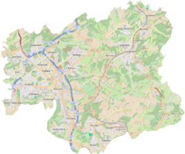
Location of Lomberg in Velbert |
||
Lomberg was a place of residence in the Richrath peasantry in the Bergische Herrschaft Hardenberg , which later became the Prussian municipality Richrath in the mayor's office Hardenberg in the Elberfeld district or Mettmann district .
The place is recorded on the topographical survey of the Rhineland from 1824. In 1822 the village, called (on the) Lomberg , had twelve inhabitants and belonged to the parish of Langenberg in the Hardenberg district. It was categorized as a farm and school . In addition, a Lomberg school with four residents is explicitly mentioned. In 1832 the place (at the time called Aufm Lomberg ) had a school with nine residents, ten residential and nine agricultural buildings. It had a total of 85 inhabitants, nine of them with Catholic and 76 with Protestant faith. He was a member of the Catholic parish of Langenberg and the Protestant parish of Langenberg and Velbert .
In 1885 Lomberg still had five residents in one building. In 1895 there are still four residents noted.
The place is no longer recorded by name on the Prussian new recording from 1892 and on later measuring table sheets , but the place name school is sometimes found there.
There is the birth house of the Lomberg family, which used to be called Lomberg auf dem Lomberg . The school is still standing today.
Individual evidence
- ↑ Alexander A. Mützell: New topographical-statistical-geographical dictionary of the Prussian state . tape 1 . Karl August Künnel, Halle 1821.
- ↑ Friedrich von Restorff : Topographical-statistical description of the Royal Prussian Rhine Province , Nicolai, Berlin and Stettin 1830
- ↑ At this time, additional localities were added, for example Acker.
- ^ Georg von Viebahn : Statistics and topography of the government district of Düsseldorf: The statistical table of localities and distances and the alphabetical list of place names containing . tape 2 . Carpenter, 1836.
- ^ Community encyclopedia for the province of Rhineland. Based on materials from the census of December 1, 1885 and other official sources, edited by the Royal Statistical Bureau. In: Royal Statistical Bureau (Hrsg.): Community encyclopedia for the Kingdom of Prussia. tape XII , 1888, ZDB -ID 1046036-6 ( digitized version ).
- ^ Community encyclopedia for the province of Rhineland. Based on materials from the census of December 1, 1895 and other official sources, edited by the Royal Statistical Bureau. In: Royal Statistical Bureau (Hrsg.): Community encyclopedia for the Kingdom of Prussia. tape XII , 1897, ZDB -ID 1046036-6 .
- ^ History of the Lomberg family: including coat of arms, family tree, overview map and family tree table with the help of family members . Lomberg Agriculture Council. ( google.de [accessed December 14, 2018]).
