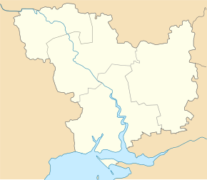
Lukjaniwka (Bashtanka)
| Lukjanivka | ||
| Лук'янівка | ||

|
|
|
| Basic data | ||
|---|---|---|
| Oblast : | Mykolaiv Oblast | |
| Rajon : | Bashtanka district | |
| Height : | 24 m | |
| Area : | 1.202 km² | |
| Residents : | 565 (2004) | |
| Population density : | 470 inhabitants per km² | |
| Postcodes : | 56123 | |
| Area code : | +380 5158 | |
| Geographic location : | 47 ° 29 ' N , 32 ° 8' E | |
| KOATUU : | 4820682601 | |
| Administrative structure : | 4 villages | |
| Address: | вул. Центральна 20 56123 с. Лук'янівка |
|
| Statistical information | ||
|
|
||
Lukjaniwka ( Ukrainian Лук'янівка ; Russian Лукьяновка Lukjanowka ) is a village in the Ukrainian Oblast of Mykolaiv with about 560 inhabitants (2004).
The village, founded in 1782, has been called Lenine since Soviet rule and was given its current name in 2016 in the course of decommunization in Ukraine .
Geographical location
Lukjaniwka is located in the west of the Rajon Bashtanka 29 km northwest of the Rajon center Bashtanka on the bank of the Hromoklija ( Громоклія ), a 102 km long tributary of the Inhul . Mykolaiv Oblast Center is 65 km south of the village.
Two kilometers west of the village, the N 14 trunk road runs in a north-south direction .
local community
The district council , whose administrative center is Lukianivka, also includes the villages Archanhelske ( Архангельське ⊙ ) with about 200 inhabitants, Lysyanka ( Лисянка ⊙ ) with about 70 inhabitants and Mychajliwka ( Михайлівка ⊙ ) with about 180 inhabitants.
Individual evidence
- ↑ Lukyanivka on the official website of the Verkhovna Rada , last accessed on February 17, 2017

