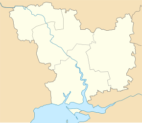
Lyssa Hora (Pervomajsk)
| Lyssa Hora | ||
| Лиса Гора | ||

|
|
|
| Basic data | ||
|---|---|---|
| Oblast : | Mykolaiv Oblast | |
| Rajon : | Pervomaysk Raion | |
| Height : | 106 m | |
| Area : | 1.5 km² | |
| Residents : | 4,502 (2001) | |
| Population density : | 3,001 inhabitants per km² | |
| Postcodes : | 55250 | |
| Area code : | +380 5161 | |
| Geographic location : | 48 ° 11 ' N , 31 ° 6' E | |
| KOATUU : | 4825484601 | |
| Administrative structure : | 2 villages | |
| Address: | вул. Велика буд. 79 55 250 с. Лиса Гора |
|
| Website : | City council website | |
| Statistical information | ||
|
|
||
Lyssa Hora ( Ukrainian Лиса Гора ; Russian Лысая Гора Lyssaja Gora ) is a village in the north of the Ukrainian Oblast Mykolaiv with about 4500 inhabitants (2001).
The village, founded in 1751, is the administrative center of the district council of the same name in the northeast of Pervomajsk Raion , which also includes the village of Novopawliwka ( Новопавлівка , ⊙ ) with about 70 inhabitants.
Lyssa Hora is located on the banks of the Chornyj Taschlyk and on the territorial road T-15-04 25 km northeast of the district center Pervomajsk and about 170 km northwest of the oblast center Mykolaiv .
Individual evidence
- ↑ Local website on the official website of the Verkhovna Rada ; accessed on October 3, 2017 (Ukrainian)
- ^ Local history Lyssa Hora in the history of the cities and villages of the Ukrainian SSR ; accessed on October 3, 2017 (Ukrainian)

