Mékrou
| Mékrou | ||
| Data | ||
| location | West Africa Benin Burkina Faso Niger |
|
| River system | Niger | |
| Drain over | Niger → Atlantic | |
| source | in Benin, southeast of Natitingou | |
| muzzle | in the Say department in Niger Coordinates: 12 ° 24 ′ 26 " N , 2 ° 49 ′ 34" E 12 ° 24 ′ 26 " N , 2 ° 49 ′ 34" E
|
|
| length | 410 km | |
| Catchment area | 10,500 km² | |
| Discharge at the Barou A Eo gauge : 10,500 km² |
MNQ 1961-1967 MQ 1961-1967 Mq 1961-1967 MHQ 1961-1967 |
0 l / s 32.5 m³ / s 3.1 l / (s km²) 184 m³ / s |
|
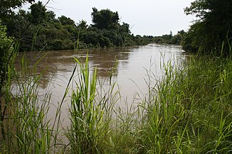
The Mékrou in National Park W near Point Triple |
||
The Mékrou ( pronunciation : [ meˈkʁuː ]) is a tributary of the Niger in the states of Benin , Burkina Faso and Niger .
geography
The Mékrou rises in Benin, southeast of Natitingou in the Atakora department . It flows through the Alibori department to the northeast . Then it forms the state border between Benin and Burkina Faso and finally with Niger, where it flows into the Niger River. They crossed the transnational W National Park .
The course of the river is characterized by frequent changes of direction. The Mékrou cuts through a karst landscape and ultimately has an average width of 25 meters. Its catchment area is 10,500 km². The mean discharge is approximately 920 million m³ / year.
Hydrometry
Average monthly flow of the Mékrou measured at the hydrological station near Barou in m³ / s.

history
The Mékrou valley was already populated in the Acheuléen . Early evidence of metallurgy was found here. Iron rods, burins and awls - as a whole and fragments thereof - are among the most common finds.
literature
- Oumarou Amadou Idé: La question du fer dans la vallée de la Mékrou, Niger méridional . In: Sonja Magnavita, Lassina Koté, Peter Breunig, Oumarou Amadou Idé (eds.): Crossroads / Carrefour Sahel. Cultural and technological developments in first millenium BC / AD West Africa / Développements culturels et téchnologigiques pendant le premier millénaire BD / AD dans l'Afrique de l'Ouest (= Journal of African Archeology Monograph Series ). tape 2 . Africa Magna, Frankfurt am Main 2009, ISBN 978-3-937248-17-2 , pp. 157-166 .
Individual evidence
- ↑ a b Monograph Hydrologique du Bassin du Niger - 1ère Partie le Niger Superieur et le Bani
- ↑ a b Oumarou Amadou Idé: La question du fer dans la vallée de la Mékrou, Niger méridional . In: Sonja Magnavita, Lassina Koté, Peter Breunig, Oumarou Amadou Idé (eds.): Crossroads / Carrefour Sahel. Cultural and technological developments in first millenium BC / AD West Africa / Développements culturels et téchnologigiques pendant le premier millénaire BD / AD dans l'Afrique de l'Ouest (= Journal of African Archeology Monograph Series ). Vol. 2. Africa Magna, Frankfurt am Main 2009, ISBN 978-3-937248-17-2 , pp. 157-166 .
- ↑ Schéma Directeur de Mise en Valeur et de Gestion des Ressources en Eau. Le Référentiel du secteur de l'eau et de l'assainissement au Niger. (Word file) (No longer available online.) Ministère de l'Hydraulique et de l'Environnement, June 1999, formerly in the original ; Retrieved June 8, 2014 (French). ( Page no longer available , search in web archives ) Info: The link was automatically marked as defective. Please check the link according to the instructions and then remove this notice.
- ^ Oumarou Amadou Idé: La question du fer dans la vallée de la Mékrou, Niger méridional . In: Sonja Magnavita, Lassina Koté, Peter Breunig, Oumarou Amadou Idé (eds.): Crossroads / Carrefour Sahel. Cultural and technological developments in first millenium BC / AD West Africa / Développements culturels et téchnologigiques pendant le premier millénaire BD / AD dans l'Afrique de l'Ouest (= Journal of African Archeology Monograph Series ). tape 2 . Africa Magna, Frankfurt am Main 2009, ISBN 978-3-937248-17-2 , pp. 162 .

