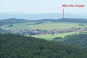
Mörsche Kuppe
| Mörsche Kuppe | ||
|---|---|---|
|
View of the Mörschen Kuppe from the north |
||
| height | 416.7 m above sea level NN | |
| location | Thuringia ( Germany ) | |
| Mountains | Thuringian Forest | |
| Coordinates | 50 ° 53 '6 " N , 10 ° 17' 5" E | |
|
|
||
| rock | Red sandstone | |
| particularities | Sallmannshäuser Rennsteig | |
The Mörsche Kuppe is a 416.7 m high mountain in the Etterwind district of the Moorgrund municipality in the Wartburg district in Thuringia .
The Mörsche Kuppe is seen from the place in the direction of the neighboring village Möhra and is a mountain with meadows and arable land, on the steep south side only used for forestry on the southern edge of the place Etterwind. The historic border between Saxony-Meiningen and Saxony-Weimar-Eisenach runs over the Möhrsche Kuppe . The ridge trail marked by boundary stones is also a section of the Sallmannshausen Rennsteig and has two viewpoints - to the north into the upper Elte valley, to the south into the moorland.
Individual evidence
- ↑ Official topographic maps of Thuringia 1: 10,000. Wartburgkreis, district of Gotha, district-free city of Eisenach . In: Thuringian Land Survey Office (Hrsg.): CD-ROM series Top10 . CD 2. Erfurt 1999.

