Müngsten
|
Müngsten
City of Wuppertal
Coordinates: 51 ° 9 ′ 59 ″ N , 7 ° 8 ′ 11 ″ E
|
||
|---|---|---|
| Height : | 100 m above sea level NN | |
|
Location of Müngsten in Wuppertal |
||
|
Morsbach reservoir around 1905
|
||
Until the beginning of the 20th century, Müngsten was a settlement as well as an industrial and popular excursion destination. Today Müngsten is only a field name for the border area between the cities of Wuppertal , Solingen and Remscheid at the confluence of the Wupper and Morsbach rivers .
Location and geography
The place was in the valley of the Wupper near the famous Müngstener bridge at an altitude of 100 meters above sea level. The buildings of the settlement were spread over the urban area of all three cities, the focus was on the Remscheid area. The statistical data of the place are distributed for the area south of the Morsbach to the mayor's office and from 1929 to the city of Remscheid and for the area north of the Morsbach to the mayor's office Kronenberg , from 1929 to the Cronenberg district of the city of Wuppertal.
history
Müngsten was first mentioned in a document in 1437. In 1815/16 the place had 26 (17 in Remscheid and nine in Cronenberg) residents.
In 1832 the area of Müngstens south of the Morsbach belonged to the Reinshagen district of the Remscheid mayor, the area north to the Sudberger district of the Kronenberg mayor. The place, which was categorized as a hamlet with several hammers according to the statistics and topography of the administrative district of Düsseldorf , had six residential buildings (four in Remscheid, two in Cronenberg), six factories and mills (all in Remscheid) and six agricultural buildings (four in Remscheid, two to Cronenberg). At that time there were 47 (22 and 25) residents in the place, one Catholic and 46 (21 and 25) Protestant. In the municipality lexicon for the province of Rhineland from 1888 seven houses (four and three) with 85 (43 and 42) inhabitants are given.
The buildings that were abandoned today included the Halbach scythe factory (ancestral home of the von Bohlen and Halbach family , members of the later Krupp industrial dynasty ), as well as a well-known restaurant (Baumgärtner's locality Haus Müngsten), all of which were part of the expansion of the connecting road from Solingen to Remscheid In the middle of the construction of Landesstrasse 74 in the middle of the 1960s.
The approx. 480 m long and 45 m wide reservoir, which was created by the dam of the Morsbach just before its confluence with the Wupper, is also no longer in existence. The sandstone, stepped arch bridge over the Wupper from Remscheid to Solingen, built around 1850, has been preserved as a pedestrian bridge. For reasons that have not yet been clarified, it has been called the Napoleon Bridge since at least the 1990s .
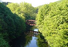
Müngsten was a stop on the Ronsdorf-Müngstener railway , which was shut down and dismantled in installments until 1952, and which ran from the Toelleturm in Wuppertal-Barmen via Ronsdorf along the Morsbach via Müngsten to Solingen-Krahenhöhe. The steel railway bridge of the narrow-gauge railway from Wuppertal to Solingen over the Wupper (not to be confused with the Müngsten bridge ) was demolished in December 2014 due to its very dilapidated condition.
The nearby Hofschaft Grunenburg , the Solingen Schaltkotten an der Wupper as well as the abandoned Solingen electricity works and the also abandoned Solingen waterworks in the valley of the Wupper are often counted among the most popular in literature.
literature
- Günther Schmidt: Hammer and Kotten research in Remscheid. Volume 2: From Müngsten to Gerstau. Buchhandlung R. Schmitz, Remscheid-Lennep 2000, ISBN 3-9800077-2-3 .
Web links
Individual evidence
- ↑ a b Johann Georg von Viebahn : Statistics and Topography of the Administrative District of Düsseldorf , 1836
- ↑ Königliches Statistisches Bureau (Prussia) (Ed.): Community encyclopedia for the Rhineland Province, based on the materials of the census of December 1, 1885 and other official sources, (Community encyclopedia for the Kingdom of Prussia, Volume XII), Berlin 1888.


