
Münsterdorfer Geestinsel


The Münsterdorfer Geestinsel is a part of the Heide-Itzehoer Geest , up to 32 m high Geestinsel in the Steinburg district , which is bordered to the north and west by Stör and Störmarsch; in the south lies the Kremper Marsch .
In the north of the Geestinsel is the area of the municipality Münsterdorf , after which it is named. The wave crests are also located here . In the Breitenburg district of Nordoe, located on the Geest Island, there are the Nordoer Heide and inland dunes and also the Temple of Nordoe , which is located on a hill . The " Binnendünen Nordoe " has been the 207th designated nature reserve in Schleswig-Holstein since March 2013 .
Due to its elevated position, the Geest Island was one of the starting points for the settlement of the Kremper Marsch.
Emergence
The Geestinsel was created - similar to the Segeberger Kalkberg - by lifting a salt dome and the chalk formation above it. In addition to the Segeberger Kalkberg or the red rock on Heligoland , the Münsterdorfer Geestinsel is one of the few elevations in Schleswig-Holstein that was not caused by the Ice Ages .
Sinkholes
In the field of Geest island was and is it even in recent times to sinkholes . The largest and most famous is the sinkhole 14 to 15 m deep bend Kuhle ( Folk etymology distorted into High German to rabbit Kuhle ) in the forest between Münsterdorf and Nordoe ( location ) whose age is unknown and as a natural monument was expelled. There is also a regional legend about it. Soil investigations showed that lime can be found at a depth of about 45 m.

Inland dunes Nordoe
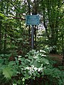
Sign next to the "Knickenkuhle"


Individual evidence
- ^ Heinz Mönch: Chronik Breitenburg , Breitenburg 2000, p. 13.
- ↑ See Rudolf Irmisch : Geschichte der Stadt Itzehoe , Itzehoe 1960, p. 47.
- ↑ State ordinance on the "Binnendünen Nordoe" nature reserve ( memento of March 18, 2014 in the Internet Archive ) of March 6, 2013.
- ↑ Otto Fischer: The water system on the Schleswig-Holstein North Sea coast , part III, vol. 6: Elbmarschen , Berlin 1957, p. 49.
- ↑ When the ground collapses - sinkholes in Schleswig-Holstein , p. 5. (PDF; 530 kB)
- ↑ Geotopes in Schleswig-Holstein , p. 6. (PDF; 433 kB); When the ground collapses - sinkholes in Schleswig-Holstein , p. 5. (PDF; 530 kB); Information from the Münsterdorf Local History Working Group (PDF; 297 kB); Information and photos about the cave
- ↑ H. Schulz: Die Sagen des Kreises , in: Heimatbuch-Kommission (ed.): Heimatbuch des Kreis Steinburg , Vol. 1, Glückstadt 1924, pp. 379-422 (383 f.).
- ↑ Klaus Wätzel: The Knickenkuhle in the Nordoer Wald, a little-noticed gem of our homeland , in: Steinburger Jahrbuch 1983, pp. 240–242.
literature
- Walter Asmus: On the genesis of the settlements on the Münsterdorfer Geestinsel. In: Heimatverband Kreis Steinburg (ed.): Steinburger Jahrbuch 1976, pp. 83–91.
Web links
Coordinates: 53 ° 53 ′ 28 " N , 9 ° 31 ′ 42" E