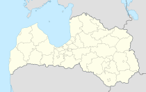
Marupe
| Marupe | ||
|---|---|---|
 Help on coat of arms |
|
|
| Basic data | ||
| State : |
|
|
| Landscape: | Livonia ( Latvian : Vidzeme ) | |
| Administrative district : | Mārupes novads | |
| Coordinates : | 56 ° 54 ' N , 24 ° 3' E | |
| Residents : | 11,130 (Aug 26, 2015) | |
| Area : | ||
| Population density : | ||
| Height : | 10 m | |
| Website: | www.marupe.lv | |
| Post Code: | ||
| ISO code: | ||
Mārupe ( German Marienbach ) is a south-western suburb of the city of Riga in Latvia and the center of the district of the same name (Mārupes novads), which emerged from the municipality in 2009 without changing its territory. In 2015 Mārupe had a population of around 11,000.
There are extensive wetlands in the municipality. The peat produced in these swamps is extracted on a large scale for some German hardware stores.
literature
- Hans Feldmann , Heinz von zur Mühlen (ed.): Baltic historical local dictionary, part 2: Latvia (southern Livonia and Courland). Böhlau, Cologne 1990, ISBN 3-412-06889-6 , p. 375.
- Astrīda Iltnere (ed.): Latvijas Pagasti, Enciklopēdija. Preses Nams, Riga 2002, ISBN 9984-00-436-8 .
Footnotes
- ↑ Latvijas Ģeotelpiskās informācijas aģentūra (LGIA): Vietvārdu datubāze (database of place names), edition of September 30, 2015 (Latvian).
- ↑ ARD brand check: The Bauhaus / OBI check ( memento of the original from August 13, 2016 in the Internet Archive ) Info: The archive link was inserted automatically and has not yet been checked. Please check the original and archive link according to the instructions and then remove this notice. , Broadcast on June 24, 2013, accessed on June 25, 2016.
