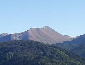
Maierangerkogel
| Maierangerkogel | ||
|---|---|---|
|
The Maierangerkogel |
||
| height | 2356 m above sea level A. | |
| location | Styria , Austria | |
| Mountains | Seckauer Tauern , Lower Tauern | |
| Dominance | 2 km → Seckauer Zinken | |
| Notch height | 256 m ↓ Vorwitzsattel | |
| Coordinates | 47 ° 20 '51 " N , 14 ° 42' 48" E | |
|
|
||
| rock | Granite and gneiss granite | |
The Maierangerkogel is 2356 m above sea level. A. high mountain in Upper Styria .
It is located north of Gaal in the Seckauer Tauern . The summit can be reached via the Vorwitzgraben and the Vorwitzsattel ( 2100 m ), from which you can walk northwest to the Maierangerkogel or southeast via the Maiersteig to the Seckauer Zinken . Allow 5–7 hours for this hike. If you descend from the Maierangerkogel along the ridge to the south, you can see the Ingeringsee . If you go north-west from the summit, you come to the Hochreichhart via the Brandstätterkogel .

