Malalane
| Malalane | ||
|---|---|---|
|
|
||
| Coordinates | 25 ° 29 '24 " S , 31 ° 30' 33" E | |
| Basic data | ||
| Country | South Africa | |
| Mpumalanga | ||
| District | Ehlanzeni | |
| ISO 3166-2 | ZA-MP | |
| local community | Nkomazi | |
| height | 317 m | |
| surface | 2.9 km² | |
| Residents | 3486 (2011) | |
| density | 1,185.7 Ew. / km² | |
| founding | 1949 | |
|
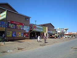
Street scene in Malalane
|
||
Malalane , until 2007 Malelane , is a city in the South African province of Mpumalanga . It is the administrative seat of the municipality of Nkomazi in the Ehlanzeni district .
geography
In 2011 there were 3486 inhabitants in Malalane. Malalane is located south of Kruger National Park , the southern border of which is the Crocodile River , and north of Swaziland .
history
In 1949 the place was founded as Malelane. Like the name adopted in 2007, the name comes from Siswati and is derived from eMlalani for "palm square " or lala for "to sleep".
Economy and Transport
The main source of income is agriculture. Mainly sugar cane , tropical fruits and vegetables are grown. Because of its proximity to Malalane Gate , the main entrance to the Kruger National Park immediately to the north, many tourists stay in Malalane.
Malalane is on National Route 4 , which runs west-east along the southern edge of the Kruger National Park south of the Crocodile River and connects Mbombela in the west with Komatipoort in the east. Malalane also has a freight yard on the Pretoria – Maputo railway line .
Web links
Individual evidence
- ↑ 2011 census , accessed November 9, 2017

