Mana pass
| Mana pass | |||
|---|---|---|---|
|
Road to the Mana Pass near Mana (India) |
|||
| Compass direction | North | south | |
| Pass height | 5545 m | ||
| region | Tibet Autonomous Region ( PR China ) | Uttarakhand State ( India ) | |
| Watershed | Abijugang glacier → Satluj | Saraswati → Alaknanda → Ganges | |
| Valley locations | Mana | ||
| expansion | Street | ||
| Mountains | Himalayas | ||
| Map (Uttarakhand) | |||
|
|
|||
| Coordinates | 31 ° 4 ′ 6 ″ N , 79 ° 25 ′ 0 ″ E | ||
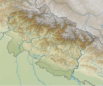
The Mana Pass crosses the Himalayas on the border between the Indian state of Uttarakhand and the autonomous region of Tibet (China).
Over the pass earlier led a trade route, the Garhwal region with the West in Tibet on the upper reaches of the Satluj lying region Ngari Korsum association. The pass crossing is located on the watershed between the catchment areas of the Ganges and the Indus . The Mana Pass also represents the transition from the Kamet Group in the east to the Gangotri Group in the southwest.
On the Indian side a road leads through the river valley of the Alaknanda and its tributary Saraswati past the village of Mana to the 5545 m high Mana Pass.
The Portuguese Jesuit, missionary and explorer Antonio Freire de Andrade traveled over the Mana Pass in 1625.

