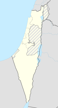
Mateh Ascher
| Mateh Ascher | ||
|---|---|---|

|
||
| Basic data | ||
| hebrew : | מועצה אזורית מטה אשר | |
| State : |
|
|
| District : | North | |
| Coordinates : | 32 ° 58 ' N , 35 ° 6' E | |
| Area : | 216.059 km² | |
| Residents : | 22,200 (2009) | |
| Population density : | 103 inhabitants per km² | |
| Time zone : | UTC + 2 | |
| Community type: | Regional administration | |
| Mayor : | Yehuda Savit | |
|
|
||
The Mateh Ascher regional administration ( Hebrew מועצה אזורית מטה אשר Mo'atza Azorit Mateh Asher ) is an Israeli regional government . It is named after one of the twelve tribes of Israel , the tribe of Ascher .
location
The regional administration is located in the western Galilee in the northern district of Israel.
history
The regional administration was founded in 1982 from the previous regional administrations Ga'aton, Na'aman and Sulam Tzur.
structure
The regional administration is responsible for:
- 18 kibbutzim : → List of kibbutzim
- 9 moshavim : → table of moshavim
- 2 community settlements : → table of community settlements
- 1 Municipal town : Nes Ammim
- 2 Arab towns : Arab al-Aramsche and Sheik Danun
Residents
The Israeli Central Statistical Office gives the following population figures for regional administration in the censuses of May 22, 1961, May 19, 1972, June 4, 1983, November 4, 1995 and December 28, 2008:
| Year of the census | 1961 | 1972 | 1983 | 1995 | 2008 |
| Number of inhabitants | 12,400 | 12,700 | 15,700 | 19,100 | 21,700 |
Twin town
-
 Oldenburg , Lower Saxony , Germany , since 1996
