
Matuku (Fiji)
| Matuku | ||
|---|---|---|
 North is on the right of the picture |
||
| Waters | Koro lake | |
| Archipelago |
Moala Group , Lau Islands |
|
| Geographical location | 19 ° 10 ′ 0 ″ S , 179 ° 46 ′ 0 ″ E | |
|
||
| length | 8.5 km | |
| width | 6.5 km | |
| surface | 57 km² | |
| Highest elevation | Korolevu 385 m |
|
| main place | Lomati | |

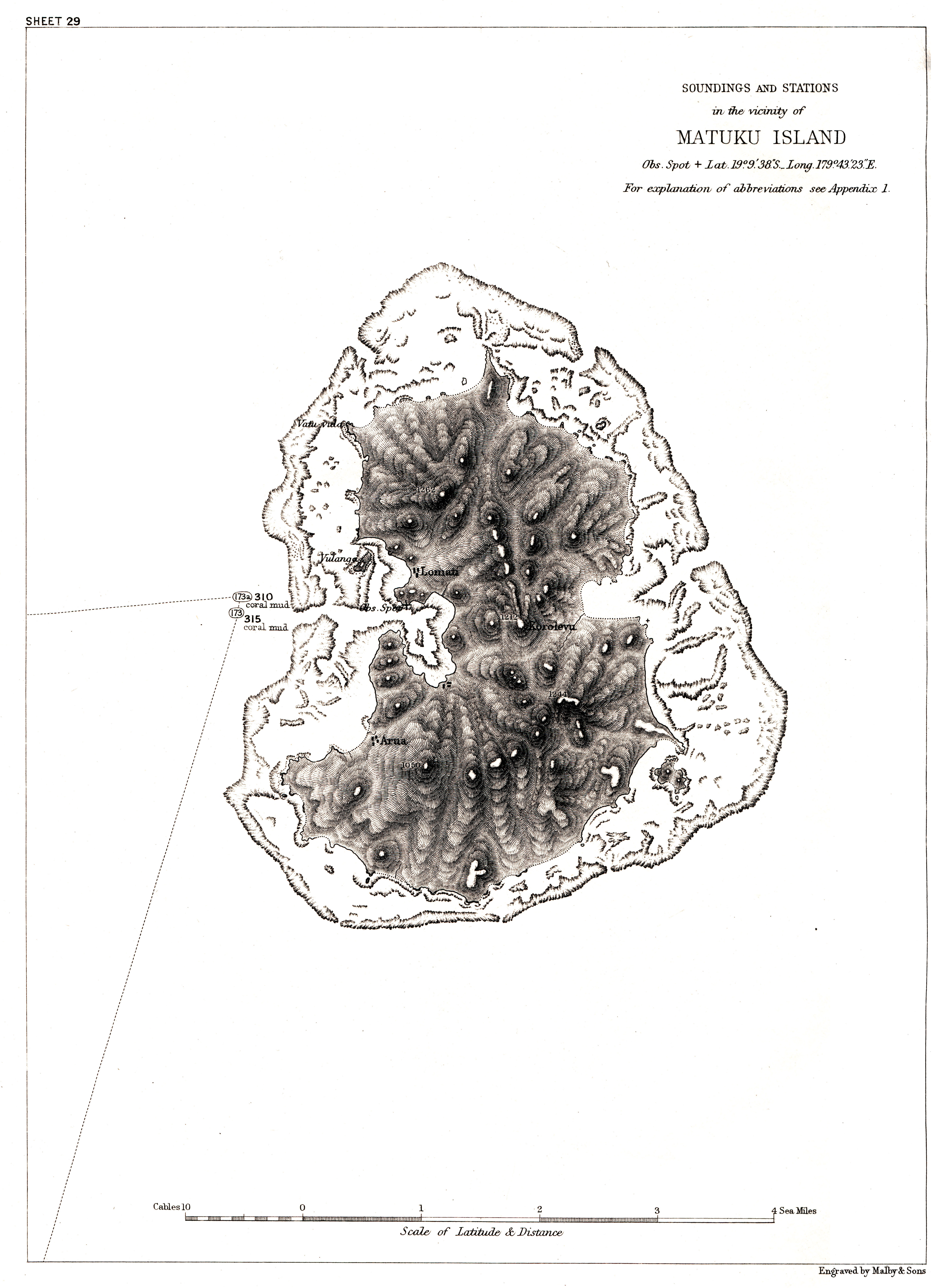
Matuku is an island of volcanic origin in the southwest of the Lau Archipelago in the Pacific Ocean . Politically, it belongs to the Eastern Division of the island state of Fiji .
geography
Matuku is part of the so-called Moala Group , a group of three islands that form the southwestern area of the Lau Archipelago. The island is located around 40 km southwest of Totoya and 55 km south-southwest of Moala and thus represents the westernmost island of the Lau Islands. It is - besides Moala - the only island in the archipelago west of the 180th degree of longitude . The kidney-shaped island has a length of 8.5 km, a width of up to 6.5 km and an area of about 57 km². It forms the central island of a comparatively young atoll and is completely surrounded by a coral reef except for four places . The hilly island is forested and in the Korolevu reaches a height of 385 m above sea level.
administration
Matuku forms one of the 13 traditional districts ( Fiji : Tikina ) of the Lau province and is divided into the eight villages ( Koro ) Yaroi and Natokalau in the north, Qalikarua in the east, Levukaidaku in the south, and Andako, Makadro, Raviravi and Lomati in the west. The main town of the island is Lomati at Matuku Harbor , a well navigable passage in the west of the atoll.
Web links
- Matuku in the Seacology Islands Project (English)
- Images from Matuku on flickr
- Historical, topographical map of Matuku
Individual evidence
- ↑ a b UNEP Islands Directory (English)
- ↑ Sailing Directions (enroute), Pub. 126, Pacific Ocean (PDF; English; 5.1 MB)