McGees Bridge
Coordinates: 42 ° 48 ′ 23 " S , 147 ° 31 ′ 33" E
| McGees Bridge | ||
|---|---|---|
| use | Road traffic | |
| Convicted |
Tasman Highway ( |
|
| Crossing of | Pitt Water ( Tasman Sea ) | |
| place | Sorell (Tasmania) | |
| construction | Precast concrete segment bridge | |
| overall length | 460 m | |
| width | 15 m | |
| building-costs | AU $ 20 million | |
| start of building | 2001 | |
| completion | 2002 | |
| opening | December 2002 | |
| planner | John Holland P / L | |
| location | ||
|
|
||
| Above sea level | 0 m | |
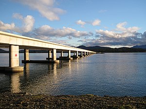
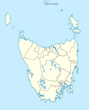
The McGees Bridge is a bridge in the southeast of the Australian state of Tasmania . The Tasman Highway (A3) runs over the bridge and connects Hobart Airport and Seven Mile Beach south of Pitt Water Bay with Midway Point and the town of Sorell on the north side of the bay.
From Hobart, the McGees Bridge opens up two major attractions in Tasmania, the historic city of Port Arthur on the Tasman Peninsula and the island's picturesque east coast.
history
The Tasmanian state government decided in the middle of the 19th century to create a direct road connection from Hobart to Sorell, which should cross the Pitt Water and so shorten the travel time significantly. It was decided to cross two thirds of the bay (approx. 1,000 m) with a dam and to span the rest with a bridge.
Australia's first prestressed concrete girder bridge was not completed until 1957. A special feature of this bridge was the creation of cavities by inserting inflated tires, which were removed after the concrete had hardened. The bridge was designed for a lifetime of 50 years. In 2001, however, it was recognized that the penetration of chlorides had led to serious corrosion of the concrete. The Tasmanian government commissioned John Holland P / L to design and build a new bridge.
The new bridge is intended to be the first precast segment road bridge of the canal type outside of France and the USA. The AU $ 20 million bridge was the largest single infrastructure project the Tasmanian government had funded in more than 15 years.
The new bridge was named after Dr. Rodney William McGee , who died on February 1, 2002 at the age of 47 after a long battle with cancer. At that time he was chief engineer of the Tasmanian Department of Infrastructure, Energy and Resources and a nationally and internationally recognized capacity in bridge construction.
The project was characterized by the extensive involvement of the local authorities and special efforts to protect the environment, as the bridge runs through a wetland of international standing and a designated monument protection area.
The Prime Minister of Tasmania , Jim Bacon , was present at the official opening of the bridge, as well as the Minister for Infrastructure, Jim Cox , Mayor of Sorell, Carmel Torenius and family by Rod McGee.
Web links
Individual evidence
- ↑ a b CIA conference . John Holland P / L . 2003. Archived from the original on April 11, 2007. Info: The archive link was inserted automatically and has not yet been checked. Please check the original and archive link according to the instructions and then remove this notice. Retrieved April 15, 2007.
- ↑ a b c d Secretary's Overview . Department of Infrastructure, Energy and Resources . 2003. Archived from the original on October 10, 2006. Info: The archive link was automatically inserted and not yet checked. Please check the original and archive link according to the instructions and then remove this notice. Retrieved April 11, 2007.

