Tasman Highway
| Tasman Highway | ||||||||||||||||||||||||||||||||||||||||||||||||||||||||||||||||||||||||||||||||||||||||||||||||||||||||||||||||||||||||||||||||||||||||||||||||||||||||||||||||||||||||||||||||||||||||||||||||||||||||||||||||||||||||||||||||||||||||||||||
|---|---|---|---|---|---|---|---|---|---|---|---|---|---|---|---|---|---|---|---|---|---|---|---|---|---|---|---|---|---|---|---|---|---|---|---|---|---|---|---|---|---|---|---|---|---|---|---|---|---|---|---|---|---|---|---|---|---|---|---|---|---|---|---|---|---|---|---|---|---|---|---|---|---|---|---|---|---|---|---|---|---|---|---|---|---|---|---|---|---|---|---|---|---|---|---|---|---|---|---|---|---|---|---|---|---|---|---|---|---|---|---|---|---|---|---|---|---|---|---|---|---|---|---|---|---|---|---|---|---|---|---|---|---|---|---|---|---|---|---|---|---|---|---|---|---|---|---|---|---|---|---|---|---|---|---|---|---|---|---|---|---|---|---|---|---|---|---|---|---|---|---|---|---|---|---|---|---|---|---|---|---|---|---|---|---|---|---|---|---|---|---|---|---|---|---|---|---|---|---|---|---|---|---|---|---|---|---|---|---|---|---|---|---|---|---|---|---|---|---|---|---|---|---|---|---|---|---|---|---|---|---|---|---|---|---|---|---|---|

|
||||||||||||||||||||||||||||||||||||||||||||||||||||||||||||||||||||||||||||||||||||||||||||||||||||||||||||||||||||||||||||||||||||||||||||||||||||||||||||||||||||||||||||||||||||||||||||||||||||||||||||||||||||||||||||||||||||||||||||||
| Basic data | ||||||||||||||||||||||||||||||||||||||||||||||||||||||||||||||||||||||||||||||||||||||||||||||||||||||||||||||||||||||||||||||||||||||||||||||||||||||||||||||||||||||||||||||||||||||||||||||||||||||||||||||||||||||||||||||||||||||||||||||
| Operator: | THIS | |||||||||||||||||||||||||||||||||||||||||||||||||||||||||||||||||||||||||||||||||||||||||||||||||||||||||||||||||||||||||||||||||||||||||||||||||||||||||||||||||||||||||||||||||||||||||||||||||||||||||||||||||||||||||||||||||||||||||||||
| Start of the street: |
|
|||||||||||||||||||||||||||||||||||||||||||||||||||||||||||||||||||||||||||||||||||||||||||||||||||||||||||||||||||||||||||||||||||||||||||||||||||||||||||||||||||||||||||||||||||||||||||||||||||||||||||||||||||||||||||||||||||||||||||||
| End of street: |
Launceston ( 41 ° 27 ′ S , 147 ° 9 ′ E ) |
|||||||||||||||||||||||||||||||||||||||||||||||||||||||||||||||||||||||||||||||||||||||||||||||||||||||||||||||||||||||||||||||||||||||||||||||||||||||||||||||||||||||||||||||||||||||||||||||||||||||||||||||||||||||||||||||||||||||||||||
| Overall length: | 410 km | |||||||||||||||||||||||||||||||||||||||||||||||||||||||||||||||||||||||||||||||||||||||||||||||||||||||||||||||||||||||||||||||||||||||||||||||||||||||||||||||||||||||||||||||||||||||||||||||||||||||||||||||||||||||||||||||||||||||||||||
|
States : |
||||||||||||||||||||||||||||||||||||||||||||||||||||||||||||||||||||||||||||||||||||||||||||||||||||||||||||||||||||||||||||||||||||||||||||||||||||||||||||||||||||||||||||||||||||||||||||||||||||||||||||||||||||||||||||||||||||||||||||||
| Tasman Highway at St. Helens | ||||||||||||||||||||||||||||||||||||||||||||||||||||||||||||||||||||||||||||||||||||||||||||||||||||||||||||||||||||||||||||||||||||||||||||||||||||||||||||||||||||||||||||||||||||||||||||||||||||||||||||||||||||||||||||||||||||||||||||||
|
Course of the road
|
||||||||||||||||||||||||||||||||||||||||||||||||||||||||||||||||||||||||||||||||||||||||||||||||||||||||||||||||||||||||||||||||||||||||||||||||||||||||||||||||||||||||||||||||||||||||||||||||||||||||||||||||||||||||||||||||||||||||||||||
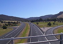
The Tasman Highway is a trunk road in the east of the Australian state of Tasmania . The Tasman Highway is 410 km long, making it one of the longest highways in Tasmania. Just like the Midland Highway , the Tasman Highway connects the two largest cities of Tasmania, Hobart and Launceston , but along the east coast of the island.
course
The Tasman Highway begins in downtown Hobart, where the Brooker Highway (N1), Davey Street (A6) and Macquarie Street (A6) all start.
Since the Tasman Highway leaves the capital to the east, the first few kilometers are also called Eastern Outlet . This section of the route crosses the Tasman Bridge , which is equipped with a system for regulating the traffic lanes during rush hour, to Hobart Airport, approximately 20 km east of the city center. The Eastern Outlet and Tasman Bridge are also the main road link for commuters from the eastern neighborhoods.
After the branch to Hobart International Airport , the Tasman Highway continues to Sorell . There the Arthur Highway (A9) branches off to the east. The Tasman Highway initially continues north, before turning east-northeast just before Runnymede and reaching the east coast of Tasmania at Orford .
From Orford the Tasman Highway continues north, partly directly along the coast to the Tasman Sea and offers spectacular views and a special driving experience. The section from Orford via Swansea to St Helens is advertised in travel guides as an East Coast Escape .
From St. Helens, the trunk road leads back inland and runs in a north-westerly direction to Herrick , where it swings west. It leads through rainforests, deep gorges and past waterfalls. Behind Scottsdale , the highway leads to the southwest, is better developed again and takes on the typical character of a main road into the city when you reach the suburbs of Launceston. The Tasman Highway reaches its end in central Launceston at the junction of Brisbane Street and George Street, where it connects to the Midland Highway (N1), the East Tamar Highway (A7) and the West Tamar Highway (A8).
Bridge structures and dams
Immediately at its beginning in Hobart, the Tasman Highway leads over the Tasman Bridge, the southernmost bridge on the Derwent River , which connects the center and eastern districts of the capital.
Only about 20 km further, shortly after the Hobart airport, the road overcomes the Pitt Water bay with the help of the McGees Bridge with an attached dam and reaches Midway Point . From there another dam, the Sorell Causeway , leads over a smaller bay to the town of the same name.
source
- Steve Parish: Australian Touring Atlas . Steve Parish Publishing, Archerfield QLD 2007. ISBN 978-1-74193-232-4 . Pp. 55, 56, 57, 59, 61

