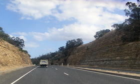
East Derwent Highway
| Eastern Derwent Highway | |||||||||||||||||||||||||||||||
|---|---|---|---|---|---|---|---|---|---|---|---|---|---|---|---|---|---|---|---|---|---|---|---|---|---|---|---|---|---|---|---|

|
|||||||||||||||||||||||||||||||
| Basic data | |||||||||||||||||||||||||||||||
| Operator: | THIS | ||||||||||||||||||||||||||||||
| Start of the street: |
Hobart ( 42 ° 52 ′ S , 147 ° 21 ′ E ) |
||||||||||||||||||||||||||||||
| End of street: |
Bridgewater ( 42 ° 44 ′ S , 147 ° 14 ′ E ) |
||||||||||||||||||||||||||||||
| Overall length: | 22 km | ||||||||||||||||||||||||||||||
|
States : |
|||||||||||||||||||||||||||||||
| East Derwent Highway at Geilston Bay | |||||||||||||||||||||||||||||||
|
Course of the road
|
|||||||||||||||||||||||||||||||
The East Derwent Highway is an urban highway in the south of the Australian state of Tasmania . It connects the Tasman Highway (A3) and the eastern districts of Hobart with Bridgewater and the Midland Highway (N1) on the east bank of the Derwent River . Like the Brooker Highway on the other side of the river, the East Derwent Highway is also used for rush hour traffic .
course
The highway begins at the Lindisfarne junction on the east ramp of the Tasman Bridge and heads north through the suburb of Lindisfarne past historic Risdon Cove . Shortly thereafter, Goodwood Road (B35) branches off , which crosses the Derwent River to Glenorchy on Bowen Bridge . Then the East Derwent Highway follows the river bank, past Mount Direction through the settlements of Otago, Old Beach and Gagebrook . It meets the Midland Highway north of Bridgewater.
Entrances and exits
|
East Derwent Highway |
|||
| Southbound interchanges | Distance from Tasman Highway (km) |
Distance to Midland Highway (km) |
Entrances and exits to the north |
|
End East Derwent Highway to Tasman Highway to Hobart |
0 | 22.3 |
Start East Derwent Highway from Tasman Highway |
|
Sorell Tasman Highway |
Sorell Tasman Highway |
||
| no entrance | 0.2 | 22.1 | Rose Bay Yolla Street |
| Rose Bay Lenna Street (East) |
0.4 | 21.9 | Rose Bay Lenna Street (West) |
| Rose Bay Ronnie Street |
0.6 | 21.7 | Rose Bay Ronnie Street |
| Lindisfarne Sunnyside Road, Ballawinnie Road (East) |
0.9-1.4 | 21.4-20.9 | Lindisfarne Shore Street, Ballawinnie Road (West) |
| Lindisfarne Nietta Road |
1.5 | 20.8 | Lindisfarne Nietta Road |
| no entrance | 1.8 | 20.5 | Lindisfarne Beach Road |
| Lindisfarne, Rosny Park Gordons Hill Road |
1.8 | 20.5 | Lindisfarne, Rosny Park Gordons Hill Road |
| Lindisfarne Boatta Road, Bay Road |
2.0-2.1 | 20.3-20.2 | Lindisfarne Boatta Road, Bay Road |
| Lindisfarne Lincoln Street |
2.2 | 20.1 | Lindisfarne Lincoln Street |
| Lindisfarne Derwent Avenue (East) |
2.4-2.5 | 19.9-19.8 | Lindisfarne Derwent Avenue (West) , Raminea Road (exit only) |
| Lindisfarne Lowanna Road (East) |
2.8 | 19.5 | Lindisfarne Lowanna Road (West) |
| Lindisfarne Lowanna Road (East) |
|||
| Lindisfarne Clunie Close, Broad Street |
2.9-3.0 | 19.4-19.3 | Lindisfarne Clunie Close, Broad Street |
| Geilston Bay Derwent Avenue |
3.2 | 19.1 | Geilston Bay Derwent Avenue |
| Geilston Bay Golf Links Road |
Geilston Bay Golf Links Road |
||
| Geilston Bay Araluen Street |
3.5 | 18.8 | Geilston Bay Araluen Street |
| Geilston Bay Geilston Bay Road |
3.7 | 18.6 | Geilston Bay Geilston Bay Road |
| Geilston Bay Clinton Road |
Geilston Bay Clinton Road |
||
| Risdon Vale Sugarloaf Road |
4.6 | 17.7 | Risdon Vale Sugarloaf Road |
|
Richmond , Risdon Vale Grasstree Hill Road |
6.5 | 15.8 |
Richmond , Risdon Vale Grasstree Hill Road |
| Risdon Saundersons Road |
8.1 | 14.2 | Risdon Saundersons Road |
|
Glenorchy Goodwood Road |
8.8 | 13.5 |
Glenorchy Goodwood Road |
| Otago Bay Direction Drive, Otago Bay Road |
9.5-9.9 | 12.8-12.4 | Otago Bay Direction Drive, Otago Bay Road |
| Otago Bay Otago Bay Road, Kandos Drive |
11.9-12.0 | 10.4-10.3 | Otago Bay Otago Bay Road, Kandos Drive |
| Brighton Baskerville Road |
14.6 | 7.7 | Brighton Baskerville Road |
| Old Beach Fouche Avenue |
15.0 | 7.3 | Old Beach Fouche Avenue |
| Old Beach Clives Avenue |
Old Beach Clives Avenue |
||
| Old Beach Jetty Road, Jetty Road |
15.5-16.2 | 6.8-6.1 | Old Beach Jetty Road, Jetty Road |
| Old Beach, Brighton Old Beach Road |
16.4 | 5.9 | Old Beach, Brighton Old Beach Road |
| Old Beach Compton Road, Riviera Drive, Stanfield Drive |
16.7-17.7 | 5.6-4.6 | Old Beach Compton Road, Riviera Drive, Stanfield Drive |
| Gagebrook Lamprill Circle |
18.6 | 3.7 | Gagebrook Lamprill Circle |
| Gagebrook Gage Road |
Gagebrook Gage Road |
||
| Gagebrook Lamprill Circle (exit only) |
19.5 | 2.8 | Gagebrook Lamprill Circle |
| JORDAN RIVER BRIDGE | |||
| Green Point Scott Road |
21.3 | 1.0 | Green Point Scott Road |
|
Bridgewater Paice Street |
Bridgewater Paice Street |
||
|
Bridgewater Cove Hill Road |
22.0 | 0.3 |
Bridgewater Cove Hill Road |
| Green Point Gunn Street |
22.1 | 0.2 | Green Point Gunn Street |
|
Glenorchy , Hobart Midland Highway |
22.3 | 0 |
Glenorchy , Hobart Midland Highway |
|
Start East Derwent Highway from the Midland Highway |
End of East Derwent Highway to Midland Highway to Brighton, Launceston |
||
Note: some subordinate streets have been omitted.
Web links
source
- Steve Parish: Australian Touring Atlas . Steve Parish Publishing, Archerfield QLD 2007, ISBN 978-1-74193-232-4 , p. 56.
