Midway Point
| Midway Point | |||||||
|---|---|---|---|---|---|---|---|
 Aerial view of Midway Point with the causeway |
|||||||
|
|||||||
|
|||||||
|
|||||||
|
|||||||
|
|
|||||||
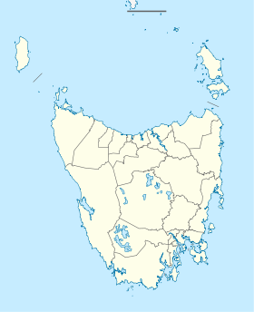
Midway Point is a small town and suburb of Hobart in the southeast of the Australian state of Tasmania , 31 km northeast of Hobart city center. It belongs to the Local Government Area Sorell Municipality and is located on a small peninsula between the bay of Pitt Water in the west and the Orielton Lagoon in the east. In 2016, 2,859 people lived here.
Midway Point forms the middle of the crossing of Pitt Water by the Tasman Highway (A3) over the McGees Bridge and the Sorell Causeway , hence the name. On the McGees Bridge the city by is Hobart International Airport and via the Sorell Causeway with Sorell .
In recent years, Midway Point has become popular as a dormitory town for commuters to Hobart.
Individual evidence
- ↑ a b Australian Bureau of Statistics : Midway Point ( English ) In: 2016 Census QuickStats . June 27, 2017. Retrieved April 29, 2020.
