
Mesurado River
| Mesurado River | ||
.jpg) View of Monrovia with the Mesurado (from right to left) and Stockton Creek (from above) 2013 |
||
| Data | ||
| location |
West Africa Liberia |
|
| River system | Mesurado River | |
| Source height | approx. 30 m | |
| muzzle |
Atlantic Ocean Coordinates: 6 ° 19 ′ 55 " N , 10 ° 48 ′ 27" W 6 ° 19 ′ 55 " N , 10 ° 48 ′ 27" W |
|
| Mouth height | 0 m | |
| Height difference | approx. 30 m | |
| Bottom slope | approx. 1.2 ‰ | |
| length | 25 km | |
| Right tributaries | Stockton Creek | |
| Big cities | Monrovia | |
| Communities | Sinda Town | |
| Residents in the catchment area | 1,010,970 | |
| Navigable | still navigable in the 19th century, old port and shipyard | |
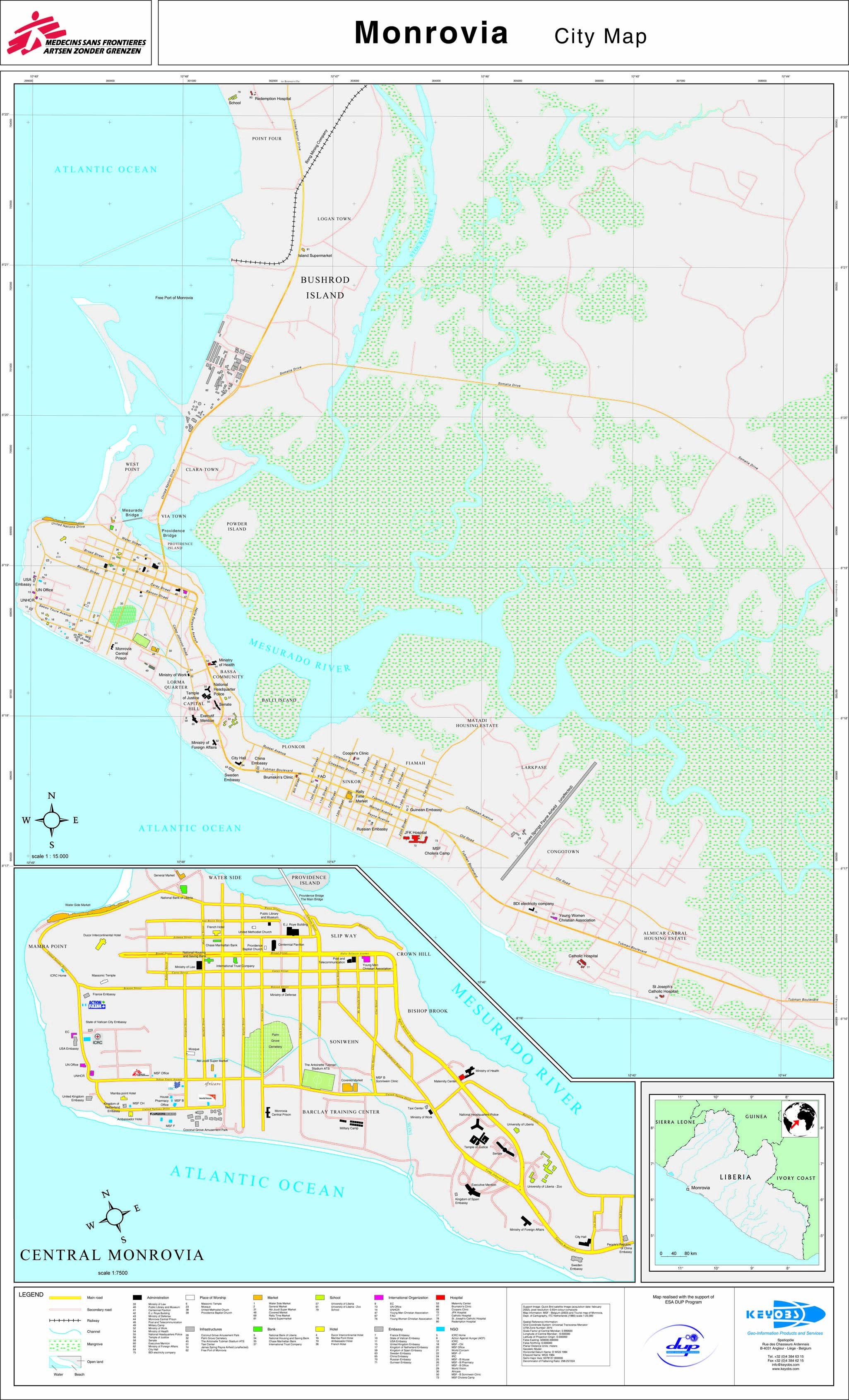
The Mesurado River is a river in the West African Republic of Liberia that flows into the Atlantic Ocean in the western urban area of Monrovia .
course
The headwaters of the Mesurado is located directly east of Monrovia in the Sinda Town area . The lower course of the Mesurado River is under the influence of the tides: at high tide the river is dammed, a large lagoon landscape has formed in this flood plain. When the city of Monrovia was founded, the old port on the Mesurado was an incentive for settlement.
In the Mesurado, in the urban area of Monrovia, there are the islands of Providence Island , Powder Island and Balli Island . According to the results of the last census from 2008, there are already 1,010,970 inhabitants in the urban area of Monrovia.
The now collapsed Mesurado Bridge and the Gabriel Tucker Bridge (old names: Peoples Bridge , Johnson Bridge ) lead across the river to the northern district of Providence Island .
The Stockton Creek is a specialty , it is a right tributary and, strictly speaking, already an estuary of the Saint Paul River .
Nature reserve
On the advice of international nature conservation organizations, parts of the mangrove area , an area of around 6,000 hectares on the lower reaches of the Saint Paul River and the Mesurado, were designated as a nature reserve.
Web links
- Monrovia district (1906) general map
- Two historical views (17th century) (English)
- Walter L. Frey Collection - Photos from Monrovia (1930s)
- City map (approx. 2005)
Individual evidence
- ^ Liberia - Country and Road Detail Maps, sheet NB29–5E. (PDF; 1.5 MB) (No longer available online.) In: The PUREONE Org. Archived from the original on May 18, 2015 ; Retrieved January 20, 2011 . Info: The archive link was inserted automatically and has not yet been checked. Please check the original and archive link according to the instructions and then remove this notice.
- ^ Wetlands in Liberia. (PDF; 296 kB) (No longer available online.) In: RAMSAR database. Formerly in the original ; Retrieved January 20, 2011 . ( Page no longer available , search in web archives ) Info: The link was automatically marked as defective. Please check the link according to the instructions and then remove this notice.