Milejewska Gora
| Milejewska Góra ( butter mountain ) |
||
|---|---|---|
| height | 196.9 m npm | |
| location | Poland , Warmia-Masuria | |
| Mountains | Wysoczyzna Elbląska (Elbinger Höhe) | |
| Coordinates | 54 ° 13 '9 " N , 19 ° 32' 2" E | |
|
|
||
| Type | Ice age moraine | |
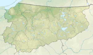
The Milejewska Góra ( German Butterberg ; translated Trunzer Berg ) was long with 197 m npm as the highest mountain of the Wysoczyzna Elbląska (Elbinger Höhe) in northern Poland . It is located in the Warmian-Masurian Voivodeship , about ten kilometers northeast of Elbląg (Elbing) and one kilometer northwest of Milejewo (Trunz) . After this place it got its official name in 1958, it is also known in the Polish translation of Butterberg as Góra Maslana.
The Elbinger Höhe has been part of the Krajobrazowy Wysoczyzny Elbląskiej landscape protection park since 1985 . It is part of the Baltic ridge , which was raised as a moraine from the Scandinavian inland ice south of the Baltic Sea.
More recently, Góra Srebrna, a little to the west, was determined to be the highest point on the hill at 198.5 meters.
See also
- Dylewska Góra (Kernsdorfer Höhe) - the highest mountain in the voivodeship, the second highest (312 m) elevation of the Polish lowlands, Masurian Lake District
literature
- CE Rhode: The Elbinger Kreis in topographical, historical and statistical terms. Kafemann, Danzig 1871. p. 3.
- Meyer's Large Conversation Lexicon : West Prussia . 1905.
Web links
- Gisela Brauer: Paths around the Butterberg .
Individual evidence
- ↑ Document server of the Sejm : Monitor Polski 1958 No. 90, Poz. 502. S. 746. (PDF; Polish)
- ↑ Elbinger Heights . (accessed on February 11, 2019)
- ↑ Weichselwerderring . (accessed on February 11, 2019)
