Mkuranga (District)
| Mkuranga District | |
|---|---|
 Location of the Mkuranga district in Tanzania |
|
| Basic data | |
| Country | Tanzania |
| region | Pwani |
| surface | 2432 km² |
| Residents | 222,921 (2012) |
| density | 92 inhabitants per km² |
| ISO 3166-2 | TZ-19 |
Coordinates: 7 ° 7 ′ S , 39 ° 8 ′ E
Mkuranga is a district of the Pwani region with the administrative center in the city of Mkuranga. The district borders on the Dar es Salaam region in the north, the Indian Ocean in the east, the Rufiji district in the south and the Kisarawe district in the west .
geography
Mkuranga has an area of 2432 square kilometers and 222,921 inhabitants (as of 2012). The Indian Ocean accounts for 447 square kilometers of the area. Topographically, the country can be divided into three zones: the coastal zone, the highlands and the valleys and basins within them. The vegetation includes mangrove forests on the coast, miombo forests and savannah in the highlands and swamps in the lowlands. The drainage takes place via small rivers in the Indian Ocean, the only permanent river is the Kogamimba.
The climate in the district is tropical, Aw according to the effective climate classification . The annual average of 800 to 1000 millimeters of rain falls, mainly in two rainy seasons. Short rain showers fall in the months of November and December, there is extensive rainfall from March to June. The annual average temperature is 28 degrees Celius, the hottest time is from October to March. From May to August is the coolest time with 25 degrees.
history
The district was separated from the Kisarawe district in 1995.
Administrative division
The district is divided into the four divisions Mkamba, Mkuranga, Kisiju and Shungubweni as well as 18 parishes (wards):
- Mkuranga
- Tanmbani
- Vikindu
- Mbezi
- Shungubweni
- Kisiju
- Magawa
- Kitomondo
- Lukanga
- Nyamato
- Kimanzichana
- Mkamba
- Pamzuo
- Bupu
- Mwalusembe
- Vianzi
- Njia nne
- Kiparang'anda
population
Mainly members of the Wazaramo and Wandengereko ethnic groups live in Mkuranga. The population rose from 186,927 in 2002 to 222,921 in 2012, which corresponds to an annual growth of 1.8 percent.
Facilities and services
- Education: In 2017, 107 pre-schools and 124 elementary schools were available.
- Health: There is a hospital, six health centers and 54 pharmacies (as of 2019) for medical care. One of the health centers is run by the Salvatorians .
- Water: 62.5 percent of the population had access to clean and safe water (as of 2017).
Economy and Infrastructure
By far the most important branch of the economy is agriculture, which employs almost seventy percent of the workforce.
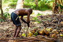
- Agriculture: Over 80 percent of the total area is suitable for cultivation. Mainly maize, cassava, rice, sweet potatoes and pulses are grown for self-sufficiency. Cashews, coconuts and tropical fruits such as oranges, pineapples, mango and melons are planted for sale. Over 95 percent of households in rural areas also keep farm animals, especially poultry (as of 2012).
- Forestry: Over five hundred square kilometers are forest. The four forest reserves Masanganya, Vikindu, Malenda and the mangrove forest cover 8,000 hectares, 43,000 hectares are open forest, which is used for construction timber, firewood and for the production of charcoal.
- Fishing: Fishing is carried out by 1500 fishermen, mainly along the coast.
- Roads: The main road connection is the T7 national road from Dar es Salaam to Lindi and Mtwara , which crosses the district from north to south.
Web links
Individual evidence
- ↑ a b History | Halmashauri ya Wilaya ya Mkuranga. Retrieved February 18, 2020 .
- ^ A b Tanzania Regional Profiles, 06 Pwani Regional Profiles. (PDF) The United Republic of Tanzania, 2016, p. 16 , accessed on February 19, 2020 .
- ↑ a b c Strategic Plan 2013 / 2014–2017 / 2018. (PDF) Mkuranga District Council, pp. 1–2 , accessed on February 19, 2020 .
- ↑ Mkuranga climate: Average Temperature, weather by month, Mkuranga weather averages - Climate-Data.org. Retrieved February 19, 2020 .
- ↑ 2012 Polulation and Housing Census. (PDF) The United Republic of Tanzania, March 2013, p. 69 , accessed on February 18, 2020 .
- ↑ Education | Halmashauri ya Wilaya ya Mkuranga. Retrieved February 19, 2020 (Swahili).
- ↑ Statistics | Halmashauri ya Wilaya ya Mkuranga. Retrieved February 19, 2020 .
- ↑ Tanzania, Mkuranga. January 15, 2020, accessed February 19, 2020 .
- ↑ Water | Halmashauri ya Wilaya ya Mkuranga. Retrieved February 19, 2020 (Swahili).
- ^ Tanzania Regional Profiles, 06 Pwani Regional Profiles. (PDF) The United Republic of Tanzania, 2016, p. 97 , accessed on February 19, 2020 .
- ↑ a b c Strategic Plan 2013 / 2014–2017 / 2018. (PDF) Mkuranga District Council, p. 3 , accessed on February 19, 2020 .
- ^ Tanzania Regional Profiles, 06 Pwani Regional Profiles. (PDF) The United Republic of Tanzania, 2016, pp. 130, 133 , accessed on February 19, 2020 .
- ^ Tanzania Trunk Road Network. Retrieved February 19, 2020 .


