Moate
| Moate an Móta Moate |
||
|---|---|---|
|
|
||
| Coordinates | 53 ° 23 '43 " N , 7 ° 43' 12" W | |
| Basic data | ||
| Country | Ireland | |
| county | County Westmeath | |
| ISO 3166-2 | IE | |
| height | 72 m | |
| surface | 1.9 km² | |
| Residents | 2763 (2016) | |
| density | 1422 Ew. / km² | |
| Telephone code | +353 (0) 90 | |
|
Moate, Main Street (2000)
|
||
Moate ( Irish : An Móta ) is a small town with 2,763 inhabitants (2016 census) in the south-west of County Westmeath in the Republic of Ireland .
history
The Irish term móta means something like "earth wall" and is likely to indicate a type of castle, the so-called moth , which was often built in the area under the Normans .
geography
Location and traffic
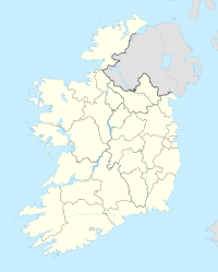
Moate is located in the center of the Irish island in the Central Irish Plain. In a south to east direction the place borders on the County of Offaly . The next larger towns are Athlone , about 14 km west, Tullamore , the capital of Offaly, about 21 km southeast and Mullingar about 29 km northeast. The capital Dublin is around 100 km away.
The regional road R446 runs directly through Moate from west to east. Until the completion of the M6 motorway , which bypasses the city to the south, it corresponded to the national road N6, making it one of the main arteries between Galway and Dublin. However, since the R446 was insufficiently designed for cross-regional traffic, there were regular long traffic jams within the village. With the M6, however, this problem has been alleviated. Junctions 6 and 7 are about three and five kilometers from the town center, respectively.
Until 1987 Moate had a railway connection through the Mullingar - Athlone railway line. The section was part of the Midland Great Western Railway network and opened in 1855. The line was closed to all traffic due to falling passenger numbers. The stretch that had been fallow for decades was reopened to traffic in October 2015 in the form of the 40 km Old Rail Trail cycle path . It is part of the Dublin-Galway Greenway and thus also of the European long- distance cycle route EuroVelo EV2 .
Surroundings
| Ballymore (11 km) |
Castletown Geoghegan (17 km) Mullingar (29 km) |
|
| Athlone (14 km) |

|
Kilbeggan (15 km) |
| Ferbane (15 km) |
Clara (9.5 km) Tullamore (21 km) |
Attractions
- Dún na Sí Amenity & Heritage Park - A park that offers information and activities about Irish culture.
Web links
Individual evidence
- ↑ a b Website of the Central Statistics Office ( English , Irish )
- ↑ a b Project website of the database for Irish place names of the Ministry of Culture - Moate / An Móta ( English , Irish )
- ↑ Moate (Census Town) on citypopulation.de, accessed on June 20, 2018 ( English )
- ↑ Video on the history of the Mullingar - Athlone railway line ( English )
- ↑ Dublin-Galway Greenway website ( English )
- ↑ Information page on the EuroVelo route EV2
- ^ Website of the Dún na Sí Amenity & Heritage Park

