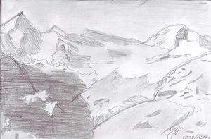
Mont Durand Glacier
| Mont Durand Glacier | ||
|---|---|---|
|
Pencil drawing by Jasmin Nelly Weidmann |
||
| location | Canton of Valais , Switzerland | |
| Mountains | Valais Alps | |
| Type | Valley glacier | |
| length | 5.6 km (2011) | |
| surface | 7.62 km² (1995) | |
| Exposure | Nutrient area east, consumption area northeast | |
| Altitude range | 4280 m above sea level M. - 2340 m above sea level M. (2005) | |
| Tilt | ⌀ 20.4 ° (37%) | |
| Ice volume | 0.47 ± 0.12 km³ (1995) | |
| Coordinates | 591 657 / 85569 | |
|
|
||
| drainage | Dranse de Bagnes , Lac de Mauvoisin , Rhone | |
The Mont Durand Glacier (French Glacier du Mont Durand ) is a valley glacier in the southwestern Valais Alps in the canton of Valais , Switzerland . It is about 5.6 km long and, including its tributary glaciers , took up an area of 7.62 km² in 1995. The exposure of the nutrient area is east, that of the consumption area is northeast.
The Mont Durand glacier has its origin on the southern flank of the Grand Combin at an altitude of 3570 m on the glaciated summit of the Grande Tête de By . The glacier flows to the east, with the Glacier du Croissant joining from the north over a steep slope with a gradient of over 80% , which attaches to the Grand Combin at 4280 m . In its further course, the Mont Durand Glacier is in the north by the Tour de Boussine ( 3833 m above sea level ), a foothill of the Grand Combin, and in the south by the Tête Blanche ( 3418 m above sea level ) and the Mont Avril ( 3347 m above sea level ) flanked. The border between Italy and Switzerland runs across the latter two . The glacier tongue ended in 2005 at about 2340 m above sea level. M. The melt water flows into the Dranse de Bagnes , which in de Lac Mauvoisin is dammed and then the Val de Bagnes for Rhone drained.
The Mont Durand Glacier is one of the few Swiss Alpine glaciers that advanced slightly during the 1990s. After the turn of the millennium, however, this glacier also began to trend backwards.
Web links
- Mont Durand Glacier on the ETHorama platform
- Map section at map.geo.admin.ch
Individual evidence
- ↑ a b c Research Institute for Hydraulic Engineering, Hydrology and Glaciology (VAW) of the ETH Zurich (Ed.): Mont-Durand-Gletscher. In: Swiss Glacier Measurement Network. ( ethz.ch , also as PDF , accessed on January 31, 2014).
- ↑ a b c Daniel Farinotti, Matthias Huss, Andreas Bauder, Martin Funk: An estimate of the glacier ice volume in the Swiss Alps. In: Global and Planetary Change. 68: 225-231, 2009 ( online ; PDF; 756 kB).
- ↑ a b c WGMS: Fluctuations of Glaciers Database. World Glacier Monitoring Service, Zurich 2013 ( DOI: 10.5904 / wgms-fog-2013-11 ), accessed on December 11, 2013
- ↑ Andreas Linsbauer, Frank Paul, Wilfried Haeberli: Modeling glacier thickness distribution and bed topography over entire mountain ranges with GlabTop: Application of a fast and robust approach. In: Journal of Geophysical Research. , Volume 117, F03007, 2012, doi : 10.1029 / 2011JF002313 ( online )

