Moordorf (Steinburg)
|
Moordorf
Westermoor municipality
Coordinates: 53 ° 54 ′ 6 ″ N , 9 ° 37 ′ 0 ″ E
|
||
|---|---|---|
| Height : | 3 m above sea level NN | |
| Area : | 4.74 km² | |
| Incorporation : | March 1, 2008 | |
| Postal code : | 25597 | |
| Area code : | 04828 | |
|
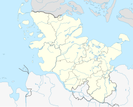
Location of Moordorf in Schleswig-Holstein |
||
Moordorf is a district of the municipality of Westermoor in the Steinburg district in Schleswig-Holstein . Until February 29, 2008 Moordorf was an independent municipality. Meierhaus and Hübek were in the municipality.
Geography and traffic
Moordorf is about 5 km east of Itzehoe . The Große Au flows through the municipality. About 7 km north of the federal highway 206 runs from Itzehoe to Bad Bramstedt , about 5 km southwest of the federal highway 23 from Itzehoe to Hamburg .
The place is on the edge of the Breitenburger Moors .
economy
The local area is predominantly agricultural.
politics
Until the incorporation, the community had a community assembly , instead of a community council , to which all residents of the community belonged. According to Section 54 of the Schleswig-Holstein municipal code, this applies to all municipalities with fewer than 70 inhabitants.
The municipality of Moordorf did not have a coat of arms .
Individual evidence
- ↑ StBA Area: changes from 01.01. until December 31, 2008
- ↑ Schleswig-Holstein topography. Vol. 6: Kronprinzenkoog - Mühlenrade . 1st edition Flying-Kiwi-Verl. Junge, Flensburg 2006, ISBN 978-3-926055-85-9 , pp. 335 ( dnb.de [accessed on July 29, 2020]).

