Moulton Icefalls
| Moulton Icefalls | ||
|---|---|---|
|
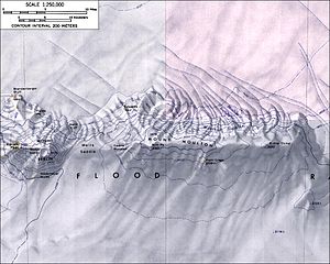
Map of Mount Moulton with the Moulton Icefalls |
||
| location | Marie Byrd Land , West Antarctica | |
| Mountains | Flood range | |
| Coordinates | 76 ° 0 ′ S , 134 ° 35 ′ W | |
|
|
||
The Moulton Icefalls are steep glacier breaks in Marie-Byrd Land in West Antarctica . In the Flood Range they are on the northern slopes of Mount Moulton .
The United States Geological Survey mapped them based on their own measurements and aerial photographs of the United States Navy from 1959 to 1965. The Advisory Committee on Antarctic Names named them in 1974 based on the name of the mountain of the same name. Its namesake is Richard Stanley Moulton (1917-2000), dog sled driver on the so-called West Base of the United States Antarctic Service Expedition (1939-1941).
Web links
- Moulton Icefalls in the Geographic Names Information System of the United States Geological Survey (English)
- Moulton Icefalls on geographic.org (English)

