Mount Humphreys, California
| Mount Humphreys | ||
|---|---|---|
|
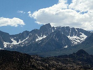
Mount Humphreys as seen from the east |
||
| height | 4265 m | |
| location | California , United States | |
| Mountains | Sierra Nevada | |
| Dominance | 23.65 km → Thunderbolt Peak | |
| Notch height | 781 m | |
| Coordinates | 37 ° 16 '14 " N , 118 ° 40' 23" W | |
|
|
||
| First ascent | 1906 | |
| Normal way | Grade 4 | |
|
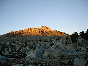
at sunset |
||
The Mount Humphreys is a 4265 m high mountain in the Sierra Nevada in the State of California of the United States . It is on the border of Inyo County and Fresno County in the John Muir Wilderness . The mountain was first climbed in 1906 by Edward and James Hutchinson .
Surroundings
The mountain lies on the eastern edge of the Sierra Nevada. In the west there is a comparatively larger mountain valley with several lakes such as Desolation Lake . East of the mountain, after a few smaller foothills of the Sierra Nevada, the Owens Valley begins with the town of Bishop about 26 km east-northeast. Nearby peaks are Four Gables in the north, Basin Mountain in the northeast, Mount Emerson in the south, Muriel Peak and Mount Goethe in the southwest, and Pilot Knob in the west. The dominance is about 23.65 km, so the mountain is the highest elevation within a 23.65 km radius. It is dominated by Thunderbolt Peak to the southeast .
Web links
- Mount Humphreys, California in the United States Geological Survey's Geographic Names Information System
- Data on the mountain
Individual evidence
- ↑ a b summitpost.org : Mount Humphreys . Accessed March 7, 2019
- ↑ a b peakbagger.com : Mount Humphreys, California . Accessed March 7, 2019


