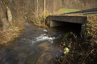
Naifer Bach
|
Naifer Bach Naifer |
||
|
The Naifer spring dammed into a small pond |
||
| Data | ||
| Water code | DE : 2422612 | |
| location | Germany | |
| River system | Rhine | |
| Drain over | Schnaittach → Pegnitz → Regnitz → Main → Rhine → North Sea | |
| source | at Simmelsdorf -Obernaifermühle 49 ° 37 '51 " N , 11 ° 21' 38" O |
|
| Source height | approx. 444 m above sea level NN | |
| confluence | near Simmelsdorf- Diepoltsdorf with the Ittling to Schnaittach Coordinates: 49 ° 36 '49 " N , 11 ° 21' 38" E 49 ° 36 '49 " N , 11 ° 21' 38" E |
|
| Mouth height | approx. 396 m above sea level NN | |
| Height difference | approx. 48 m | |
| Bottom slope | approx. 20 ‰ | |
| length | 2.4 km | |
|
Confluence of the Naiferbach (left) and the Ittlinger Bach to the Schnaittach |
||
The Naifer Bach , locally also called Naifer , is the 2.4 km long right source brook of the Schnaittach .
geography
course
The Naifer rises at the Naifer spring near Simmelsdorf -Obernaifermühle. It flows together with the Ittling to the Schnaittach at Simmelsdorf-Diepoltsdorf .
Pegnitz river system
places
The Naifer flows through the following places:
- Simmelsdorf-Obernaifermühle
- Simmelsdorf-Mittelaifermühle
- Simmelsdorf-Unteraifermühle
- Simmelsdorf-Utzmannsbach
Web links
Commons : Naifer Bach - collection of images, videos and audio files
Individual evidence
- ↑ Map services of the Bavarian State Office for the Environment
- ↑ GeoFachDatenAtlas and water services of the Bavarian State Office for the Environment
- ↑ In TOP 10 Bayern Nord also Naiferbach

