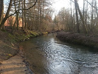
Schnaittach (Pegnitz)
| Schnaittach | ||
| Data | ||
| Water code | DE : 24226 | |
| location | Germany | |
| River system | Rhine | |
| Drain over | Pegnitz → Regnitz → Main → Rhine → North Sea | |
| confluence | of Naifer and Ittling northeast of Simmelsdorf -Diepoltsdorf 49 ° 36 '49 " N , 11 ° 21' 38" O |
|
| Source height | approx. 397 m above sea level NN | |
| muzzle | at the municipal boundary of Ottensoos and Neunkirchen am Sand Coordinates: 49 ° 30 ′ 52 ″ N , 11 ° 19 ′ 21 ″ E 49 ° 30 ′ 52 ″ N , 11 ° 19 ′ 21 ″ E |
|
| Mouth height | approx. 324 m above sea level NN | |
| Height difference | approx. 73 m | |
| Bottom slope | approx. 4.2 ‰ | |
| length | 12.1 km (17.4 km with Naifer Bach ) |
|
| Catchment area | 79.83 km² | |
| Discharge at the Markt Schnaittach A Eo gauge: 62.51 km² |
NNQ MNQ MQ Mq MHQ HHQ (1995) |
115 l / s 296 l / s 764 l / s 12.2 l / (s km²) 9.39 m³ / s 18 m³ / s |
| Left tributaries | Easter Bach, Kersbach | |
| Right tributaries | Grundelbach | |
| Communities | Simmelsdorf , Schnaittach , Neunkirchen am Sand | |
The Schnaittach is an approximately 12 km ( 17.4 km with Naifer Bach ) long, coarse material-rich, carbonate low mountain range in the Central Franconian district of Nürnberger Land in Bavaria , which flows into the Pegnitz at Neunkirchen am Sand from the right .
geography
course
The Schnaittach arises from the confluence of the Naifer Bach and Ittlinger Bach northeast of Simmelsdorf- Diepoltsdorf. Some see Naifer Bach only as a name for the upper reaches of the Schnaittach, which flows into the Pegnitz at the municipal border between Ottensoos and Neunkirchen am Sand .
Tributaries
Listed from source to mouth:
- Naifer , right source stream, 2.4 km
- Ittling , left source stream, 2.6 km
- Stream from the clean pit, from the left
- Stream through Rampertshof, from the left
- Grundelbach, from the right
- Grundbach, from the right
- Osteroher Bach , from the left, 4.3 km
- Dörningbach, from the left
- Kersbach, from the left
- Erlenbachgraben, from the left
- Purified water from the Schnaittachtal sewage treatment plant, from the right
Pegnitz river system
places
The Schnaittach flows through the following places:
- Simmelsdorf-Diepoltsdorf
- Simmelsdorf-Rampertshof
- Simmelsdorf
- Schnaittach-Hedersdorf
- Schnaittach
- Neunkirchen- Rollhofen
- Neunkirchen-Speikern
literature
- Johann Kaspar Bundschuh : Schnaitach . In: Geographical Statistical-Topographical Lexicon of Franconia . tape 5 : S-U . Verlag der Stettinische Buchhandlung, Ulm 1802, DNB 790364328 , OCLC 833753112 , Sp. 158 ( digitized version ).
Individual evidence
- ↑ a b List of brook and river areas in Bavaria - Main river area, page 43 of the Bavarian State Office for the Environment, as of 2016 (PDF; 3.3 MB)
- ↑ Bavarian flood news service (as of September 7, 2011)
- ↑ Backwaters of the Pegnitz from the confluence of the Happurger Bach to the confluence of the Schnaittach (flowing waters - identifier: DE_RW_DEBY_2_F041) , water body profile surface water bodies of the 2nd management plan according to the Water Framework Directive, accessed on March 30, 2018.
