Curonian Spit National Park (Lithuania)
| Curonian Spit National Park Kuršių Nerijos Nacionalinis Parkas |
||
|---|---|---|
| Sand dune near Juodkrantė | ||
|
|
||
| Location: | Lithuania | |
| Next city: | Nida , Klaipeda | |
| Surface: | 264.74 km² | |
| Founding: | 1991 | |
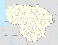
The Curonian Spit National Park ( Lithuanian Kuršių Nerijos Nacionalinis Parkas , KNNP) is a national park in Lithuania . The area was declared a national park after Lithuania gained independence in 1991, after a landscape protection area had existed here since 1961 . On the territory of the Russian Oblast Kaliningrad, the national park continues with the Nazionalny park Kurschskaja kossa .
The national park occupies the entire Lithuanian part of the Curonian Spit , this is 36.9% of the park area.
The park also includes the bordering Baltic Sea (47.2%) and parts of the Curonian Lagoon (15.9%). The total area of the national park is 26,474 ha. The administration is located outside the territory in Klaipėda .
The Curonian Spit is also under protection as a UNESCO World Heritage Site . Together with the Curonian Lagoon and the Memel Delta , which is a protected area under the Ramsar Convention , the national park forms the largest coherent Lithuanian Natura 2000 area.
literature
- Lithuania & Curonian Spit. Travel Guide: Tips for Individual Explorers. Ivanovsky's travel book publisher; ISBN 978-3-933041-29-6 .
Web links
- Official website of the national park (Lithuanian, English or Russian)
- World Database on Protected Areas - Curonian Spit National Park (Lithuania )


