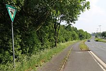
Hofsteder pond
| Hofsteder pond | ||
|---|---|---|

|
||
| Geographical location | Hofstede , Bochum , North Rhine-Westphalia , Germany | |
| Tributaries | none | |
| Drain | none | |
| Data | ||
| Coordinates | 51 ° 30 '55 " N , 7 ° 11' 34" E | |
|
|
||
| Altitude above sea level | 52.3 m | |
| length | 220 m | |
The Hofsteder Weiher is a still water in Bochum-Hofstede not far from the Dorneburg brook . The six hectare area around the pond was declared a nature reserve in 1996 .
See also
Web links
Commons : Hofsteder Weiher Nature Reserve - Collection of images, videos and audio files
- Description on bochum.de
- "Hofsteder Weiher" nature reserve (BO-003) in the specialist information system of the State Office for Nature, Environment and Consumer Protection in North Rhine-Westphalia


