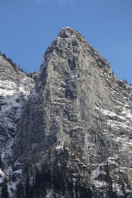
Naunspitze
| Naunspitze | ||
|---|---|---|
|
Naunspitze of Ebbs seen |
||
| height | 1633 m above sea level A. | |
| location | Tyrol , Austria | |
| Mountains | Tame Emperor | |
| Coordinates | 47 ° 36 '0 " N , 12 ° 14' 0" E | |
|
|
||
|
View from Petersköpfl over the Naunspitze, deep down Kiefersfelden in the Inn Valley |
||
The Naunspitze is 1633 m above sea level. A. high summit in the Kaiser Mountains in Austria . The Naunspitze belongs to the area of the Zahmer Kaiser in the north of the Kaisergebirge. Viewed from the west, it is the first independent summit of the main ridge. To the south it falls schrofig from. To the north it breaks off with a steep rock face that overlooks the Inn valley at Ebbs . East of the Naunspitze follows the Petersköpfl ( 1745 m above sea level ) in the ridge , from which the Naunspitze is separated by a small notch.
Approaches
The Naunspitze can be reached easily from the Vorderkaiserfeldenhütte in the south-west in 45 minutes, or from Petersköpfl in 20 minutes. Some alpine climbing routes from the III. Difficulty level according to UIAA .


