Nereta
| Nereta ( German : Nerft) | ||
|---|---|---|
 |
|
|
| Basic data | ||
| State : |
|
|
| Landscape: | Semgallia ( Latvian : Zemgale ) | |
| Administrative district : | Neretas novads | |
| Coordinates : | 56 ° 12 ' N , 25 ° 18' E | |
| Residents : | 1,128 (Jun 3, 2015) | |
| Area : | ||
| Population density : | ||
| Height : | 81 m | |
| Website: | www.neretasnovads.lv | |
| Post Code: | ||
| ISO code: | ||
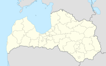
Nereta (German: Nerft ) is a place in southern Latvia , on the border with Lithuania , and is the center of the administrative unit of the same name, Neretas novads .
The place was first mentioned in writing in 1298. In 1711 the place died out due to the plague . Today's town was formed around Gut Nerft. There are extensive moorlands here .
Neretas novads
An administrative community of the municipalities of Nereta, Mazzalvas, Pilskalne and Slave has existed since 2009. (See also: Administrative division of Latvia )
literature
- Hans Feldmann , Heinz von zur Mühlen (Hrsg.): Baltic historical local dictionary, part 2: Latvia (southern Livland and Courland). Böhlau, Cologne 1990, ISBN 3-412-06889-6 , pp. 411-412.
- Astrīda Iltnere (ed.): Latvijas Pagasti, Enciklopēdija. Preses Nams, Riga 2002, ISBN 9984-00-436-8 .
Web links
Commons : Nereta - collection of images, videos and audio files

