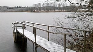
Nussberger pond
| Nussberger pond | ||
|---|---|---|

|
||
| Nussberger pond | ||
| Geographical location | Bavaria , Germany | |
| Drain | Schwabweiher → Seeseitenbach → Starnberger See → Würm → Amper → Isar → Danube → Black Sea | |
| Location close to the shore | Seeshaupt | |
| Data | ||
| Coordinates | 47 ° 50 '30 " N , 11 ° 15' 23" E | |
|
|
||
| Altitude above sea level | 633 m | |
| length | approx. 850 m | |
| width | approx. 700 m | |
The Nussberger Weiher are a series of artificially expanded ponds for fish farming in the Seeshaupt community , Weilheim-Schongau district . Historically, they belonged to the Bernried monastery .
The largest pond is called the Nussberger Weiher. Other ponds are the Schwabweiher , the Neue Weiher , the Hausweiher , the Hapberger Weiher and the Bernrieder Weiher , as well as other smaller, nameless bodies of water that are grouped around the Nussberg homestead . All ponds are located in the immediate vicinity of the hamlet and can be easily reached from there. The Lachenweiher is another pond in the lake group, but it is already in the Bernrieder Filz nature reserve .
The ponds drain via the Seeseitenbach or the Rötlbach to Lake Starnberg . This means they are in the only part of the Eberfinger Drumlinfeld that does not drain to the Ammersee .


