Neukrug (Lychen)
Neukrug was a residential area in the Retzow district of the city of Lychen in the Uckermark district ( Brandenburg ). The small settlement was built in 1772 and abandoned in 1905. The buildings were demolished.
location
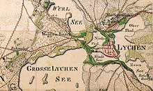
The Neukrug residential area was about 2.5 kilometers as the crow flies west of the old town of Lychen on the L 15 in the direction of Fürstenberg / Havel and approx. 500 meters southwest of today's Bohmshof residential area. He was about 67 m above sea level. NHN .
history
In 1772 the mill master Paetow received lumber from Lychenschen Mühle to build a Büdner double house for two foreign colonists on the road from Lychen to Fürstenberg. The country belonged to the administrative area of the Badingen office and after 1815 to the Zehdenick office . In 1775 two Büdner or granny families lived there. In 1795 the settlement was also called Lychenscher Krug or Krug near Retzow. In 1800 the property burned down but was quickly rebuilt.
In 1830 Neukrug was owned by Johann Friedrich Christian Sctorben, and the Neukrug establishment was publicly auctioned. At that time the property consisted of a house, barn and stables as well as 9 acres and 83 square rods of fields and gardens and 4 acres of meadows. He had the permission to graze in the forest for two cows. He still owned a one acre, 67 square meter property in Rutenberg. The property and the property had been judged to be 599 thalers, 16 groschen and 11.5 pfennigs.
In 1852 the Neukrug establishment belonged to Gut Himmelpfort and thus to the Zehdenick office. In 1860 there was a house and a farm building in Neukrug with 25 residents. In 1867 two families lived in one house; 22 inhabitants are given. In 1905 the Neukrug establishment was canceled.
Communal history
When Neukrug was founded, the estate was an independent establishment . Police power was exercised by the Lychen City Council in 1838. In 1871 Neukrug was still listed as a non-incommunalized residential area . By 1874 Neukrug had been incorporated into the Sähle manor district. With the formation of the administrative districts in the province of Brandenburg in 1874, the manor district of Sähle (with Neukrug and Bohmshof) was assigned to the district of 21 Himmelpfort of the Templin district. The landowner Julius Leopold Eyssenhardt in Ravensbrück (or living in Lichtenberg near Berlin) was appointed head of office, and the landowner and Lieutenant Baer auf Neuthymen as his deputy .
Before 1897 the Sähle manor district (with the Neukrug establishment ) was merged with the Neuthymen forest estate. In 1905 Neukrug was broken off for reasons not known before.
literature
- Lieselott Enders : Historical local dictionary for Brandenburg. Part 8: Uckermark. Böhlau, Weimar 1986, ISBN 3-7400-0042-2 ( publications of the State Archives Potsdam 21) (hereinafter abbreviated to Enders, Historisches Ortslexikon, Uckermark, with corresponding page number).
- Ernst Fidicin: The territories of the Mark Brandenburg or history of the individual counties, cities, manors, foundations and villages in the same, as a continuation of the land book of Emperor Karl IV., Volume 3 (I. District Prenzlau, II. District Templin, III. District Angermünde ). Published by J. Guttentag, Berlin, 1864 Online at Google Books
Individual evidence
- ^ Friedrich Wilhelm August Bratring: Statistical-topographical description of the entire Mark Brandenburg. Second volume: containing the Mittelmark and Ukermark. Maurer, Berlin 1805, online at Google Books , p. 555.
- ^ Official Journal of the Royal Government of Potsdam and the City of Berlin. Extra sheet for the 34th issue of the Official Gazette of August 20, 1830, p. 150, online at Google Books
- ↑ Richard Boeckh: Local statistics of the government district Potsdam with the city of Berlin. Verlag von Dietrich Reimer, Berlin 1861, online at Google Books , pp. 18/19 (under Bohmshof).
- ↑ a b Royal Statistical Bureau: The municipalities and manor districts of the Prussian state and their population. According to the original materials of the general census of December 1, 1871. II. The Province of Brandenburg. Verlag des Königlich Statistischen Bureau, Berlin 1873, online at Google Books , p. 16.
- ↑ Enders, Historisches Ortslexikon, Uckermark, p. 708/09.
- ↑ a b Official Journal of the Royal Government of Potsdam and the City of Berlin. Extra sheet of June 6, 1874, p. 181, online at Google Books
- ↑ F. Mauer: Alphabetical index of all the towns and districts in the Potsdam administrative district, together with a list of the associated chief foresters and district commands. A. Stein's publishing house, Potsdam 1897
Coordinates: 53 ° 12 '26.7 " N , 13 ° 15' 50.2" E
