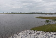
Nieuwe Merwede
The Nieuwe Merwede is an artificially created section between 1861 and 1874 of the southernmost and hydrologically most powerful branch of the Rhine estuary in the Netherlands .
Location and characteristics
The left and by far the largest estuary of the Rhine, the Waal , is called Boven Merwede (“Obere Merwede”) from the former confluence of the Maas . The river forks at Werkendam into the Beneden Merwede ("Untere Merwede") going off to the right and the wider Nieuwe Merwede. After 18.2 kilometers it merges into Hollands Diep , next to the confluence of the Amer , which, originally probably the lower reaches of the Donge , now mainly carries the water of the Bergsche Maas . The Haringvliet is a wide estuary , the water of which flows through the tidal barriers of the Haringvliet dam into the North Sea. The width of the Nieuwe Merwede is between 325 and 695 meters, and its gully is between 3.7 and 5.3 meters deep. In the triangle between Nieuwe Merwede and Amer lies the protected wetland of the Biesbosch . The Nieuwe Merwede forms the border between Zuid-Holland and Noord-Brabant . At Dubbeldam on Dordrecht Island there is a ferry connection to the south bank.
history
Before the Neue Merwede was built, the Obere Merwede branched out into numerous small arms, some of which merged with the Meuse. This variety of channels and sandbanks slowed down the outflow during floods and reduced the force to transport the sediment carried along . This active delta area, located far inland, was created in 1421 when the Elisabethenflut tore apart the river marshland island of Groote Waard, which was diked in the 13th century . This was a step in the gradual relocation of the arms of the Rhine estuary to the southwest into the former Maas estuary area ( see also: Rhine-Maas-Delta ). The Nieuwe Merwede can drain the water much more quickly.
function
The Nieuwe Merwede is the most voluminous estuary of the Waal and the Rhine, but not the most important shipping route; this runs over the Beneden Merwede, the Noord , the Nieuwe Maas and the Nieuwe Waterweg to the North Sea. The water management by means of the barrages is therefore aiming for a flow rate in the Nieuwe Waterweg of around 1500 m³ / s, which corresponds to about two thirds of the mean water flow (MQ) of the Rhine near Emmerich. Any excess runoff is discharged via the Nieuwe Merwede with its many times higher capacity, i.e. especially the peak runoff. Conversely, the discharge of the Nieuwe Merwede can go to zero if the Rhine has little water. If the Rhine level in Lobith near the German border falls below 1100 m³ / s, the flow openings in the tide barrage of the Haringvlietdam are closed. As a result of this slowdown, the combined outflows from Merwede and Maas are pushed northwards via various waterways in the Rhine delta (for example the Dordtsche Kil ), where it finally reaches and strengthens the Nieuwe Waterweg. Depending on the discharge curve of the respective year, the Beneden Merwede can have the larger mean discharge or the Nieuwe Merwede, which at least before the construction of the Haringvliet dam discharged 44% of the total Rhine flow compared to 23% of the Beneden Merwede. Compared to the mean water flow of the Nieuwe Merwede of around 600 to 900 m³ / s, the Meuse flowing in at the lower end is of much less importance: According to various sources, it has between 330 and 350 m³ / s.
Web links
- Nieuwe Merwede Rijkswaterstaat (Dutch)
Individual evidence
- ↑ Brief description of the Maas ( Memento of the original dated August 13, 2013 in the Internet Archive ) Info: The archive link was inserted automatically and has not yet been checked. Please check the original and archive link according to the instructions and then remove this notice. (Dutch)


